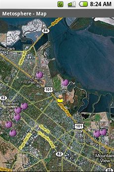
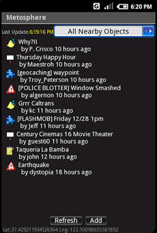
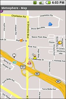
Metosphere Explore and create virtual objects around your physical location like messages, emergency alerts, events, news, reviews, games. View geospatial data from Wikipedia, Eventful, and Upcoming. Start a GeoBlog on your GPS-enabled phone.
This is the core Metosphere Android app. The goal is to follow the Firefox/Eclipse model and provide the ability to create extensions and add-ons like a Geocaching Assistant, Location Messaging Client, Proximity-based KML/GeoRSS Reader, Flash Mob Communicator, Community/Campus Emergency Alert Notifier, or even a Meatspace MUD game.
Like it? Share with your friends!
Supported operating systems:
Google Android 1.0, Google Android 1.5, Google Android 1.6, Google Android 10.x, Google Android 2.0, Google Android 2.1, Google Android 2.2, Google Android 2.3, Google Android 3.0, Google Android 3.1, Google Android 3.2, Google Android 4.0, Google Android 4.1, Google Android 4.2, Google Android 4.3, Google Android 4.4, Google Android 5.x, Google Android 6.x, Google Android 7.x, Google Android 8.x, Google Android 9.x
Similar Software:
Speedometer GPS Speedometer GPS - Speedometer GPS can track your speed,distance,time,location and also can get start time,time elapased,avg speed,max speed,altitude...
Features included
- Save your track info,Record gpx file(it will be saved in "sdcard/SpeedometerGPS/gpx/")..
- Switch between car speedometer and bike cyclometer.
- Switch between mph or km/h mode
Pocket Caddy Pocket Caddy - #1 Golf GPS app: 3D flyover of holes, yardage to greens, shot recording, stats, scorecard, hazard carry or lay up position. Positioning is shot to hole, not cart to hole. Free PC Analytics inc. 3D Google Earth replay with stats, and Free DIY Course Mapping software both available from www.satsportsna
MapMyRun+ for Android MapMyRun+ for Android - MapMyRun is a fitness assistant designed to allow runners, joggers and walkers to track their workouts using their phone's built-in GPS.
With the app you can view your route on a map and record your workout details, including duration, distance, pace, speed, elevation and calories burned
Car Service Finder This is free android app and it have Car dealer, Car rental, Car repair and Car wash place details. you can search any place any time any where without any registration. You can share your location to your friends family and others
Wiot lite Wiot lite -is an application which will track your locations with the help of sattelite monitoring system. The application indicates your current GPS position and sends them to the server. You will always know where your close people are
TomTom U.S. & Canada for Android TomTom U.S. & Canada for Android - TomTom U.S. & Canada is a turn-by-turn GPS navigator for Android devices. The app includes accurate offline maps, so you can find your way anywhere, even without an internet connection
Mobile Tracker Pro Mobile Tracker Pro - Mobile Tracker apps is focused to Android Mobile which can be Tracked after it get lost. When the Android phone get stolen/lost and When the new SIM card is inserted in the mobile, this app begins and automatically sends SMS from the SIM card which is inserted
Mock locations - Fake GPS path Mock locations - is an application which will help you hide your location. With its help you can set 2 certain points and make your device move between these points.When you will view the covered distance on google maps, it will show you not the place you were for real
AndTripLog AndTripLog allows you to record your trip onto your device. The application displays the current GPS position, time and speed. You can export the trip by email and store it onto your sdcard in GPX format
NavTruck for Android NavTruck for Android - NavTruck is a GPS navigation solution created specifically for truck drivers. The app automatically calculates routes taking into account vehicle size, weight, width and load type to avoid restricted roads.
NavTruck uses offline maps, so you don't have to pay for unnecessary internet traffic
Other Software by developer «metosphere.com»:
not found
Comments on Metosphere (Android):
Comments not found
If you noted an error or download link is broken, please, report it via this page or use comments.
Metosphere (Android) is compatible with your device Sharp Android One S3 TD-LTE S3-SH


")
")