Categories: Internet & Communications, Travel & Navigation
Upload date: 5 Nov 11
Developer: Waze
License: Freeware
Downloads: 4814 File Size: 8774 Kb
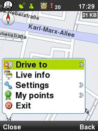
Waze: Community GPS navigation - Waze is a free, 100% user-generated, social navigation app that allows drivers to build and use live maps & real-time traffic updates to improve their daily commute.
In addition to providing turn-by-turn navigation, waze also gives drivers the ability to actively update one other on traffic, police traps, construction, speedcams and more, reflecting a live description of the road at any given moment and because it's user-generated, the more people who use it, the better (and more fun) it gets!
Here is what users are saying about us:
* Im in love already! I don't usually get this excited about things, but I am about waze.
* Coolest navigation app I've seen in a while, hope more people sign up in my area!!
* Waze is an amazing collaborative GPS mapping application!
***
Constantly-updated road map
Real-time traffic updates
Automatic rerouting
Live reports from users on the road
Turn-by turn directions
Road tweets - Twitter integration
Picture sharing from the road
Like it? Share with your friends!
Supported operating systems:
Google Android 1.0, Google Android 1.5, Google Android 1.6, Google Android 10.x, Google Android 2.0, Google Android 2.1, Google Android 2.2, Google Android 2.3, Google Android 3.0, Google Android 3.1, Google Android 3.2, Google Android 4.0, Google Android 4.1, Google Android 4.2, Google Android 4.3, Google Android 4.4, Google Android 5.x, Google Android 6.x, Google Android 7.x, Google Android 8.x, Google Android 9.x
Similar Software:
Smart Tools Smart Tools is a complete package of 6 app sets. I
CoPilot Premium Europe (Android) CoPilot Premium Europe (Android) - CoPilot Premium is a powerful GPS navigation solution for Android smartphones and tablets. The app comes with downloadable maps of more than 40 European countries, which can be used offline, allowing you to find your way even when you don't have an internet connection
Run.GPS Trainer UV Run.GPS Trainer is the perfect tool for sports like running, skiing and walking. It uses the Global Positioning System (GPS) to record all of your training parameters like speed, distance and altitude.
Run.GPS Trainer UV is the successor of of the award-winning Run.GPS Trainer software and has tons of new features
AlpineQuest Lite AlpineQuest Lite - AlpineQuest turns your Android device into an off-road GPS using offline topo maps. It is a complete solution for all outdoor activities and sports, including hiking, running, trailing, hunting, sailing, geocaching and much more
MapMyRIDE GPS Cycling Riding MapMyRIDE GPS Cycling Riding - tracks the route, distance, pace, and more in real-time using GPS.
NEW: iMapMyRIDE+ for Android
iMapMyRIDE+ brings you its mobile app for Android-based devices! Now owners of Android 2
Foursquare Foursquare - helps you explore the world around you. Keep up with friends, get insider tips, and unlock discounts and rewards.
While on the go, you can easily tell friends where you are, share pictures, get their comments ("I'm right around the corner, I'll stop by to say hello"), and get insider tips ("order the Lobster Ravioli; it's the best dish by far
Place Nearby Place Nearby - This application is all about searching for a desire location on map anytime, anywhere or anyplace.
This application just required a high speed internet connection, Network / GPS enabled device to search for your desire location.
This application will show you the live traffic near by your present location
GPS Assistant GPS Assistant - GPS Assistant is a simple and intuitive app which shows location data from the GPS receiver. You can check your coordinates (latitude and longitude) and altitude. Additionally, it includes a speedometer.
What's New in This Release:
· Changed ad network
What's New in 1
NAVIGON Eastern Europe for Android NAVIGON Eastern Europe for Android - NAVIGON turns your mobile device into a fully featured GPS navigation system. The software provides advanced functionality for both drivers and pedestrians, including 2D and 3D maps, route planner, speed assistant, voice directions, local search, and more
OSMTracker for Android OSMTracker stands for OpenStreetMap Tracker. It allows you to track your journey and mark significant way points. Way points can be marked with a tag using a button, with a quick voice record, a text note or by taking a picture. The various button pages and layouts can be customized to suit your OpenStreetMap activities
Other Software by developer «Waze»:
Waze Waze is a free, 100% user-generated, social navigation application that allows drivers to build and use live maps & real-time traffic updates to improve their daily commute
Waze (iPhone/iPad) Waze is a free, 100% user-generated, social navigation application that allows drivers to build and use live maps & real-time traffic updates to improve their daily commute
Waze Waze is a free, 100% user-generated, social navigation application that allows drivers to build and use live maps & real-time traffic updates to improve their daily commute
Waze Waze is a free, 100% user-generated, social navigation application that allows drivers to build and use live maps & real-time traffic updates to improve their daily commute
waze Waze - Waze is a free, 100% user-generated, social navigation application that allows drivers to build and use live maps & real-time traffic updates to improve their daily commute

")


")


")


