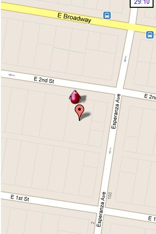
Hunting the Snark - Inspired by Lewis Carrol's poem, The Hunting of the Snark, Hunting the Snark is an action game played on both your GPS-enabled Android device and in the real world. In it, you hunt a Snark (the creature on the map in blue.) If you invade its physical location before the game time has expired, you win. Otherwise, you lose. Also, at random intervals the Snark becomes a Boojum. Your device will vibrate and the creature will turn red, and it will then attack you until a random interval expires, at which time it will become a Snark again. If, as a Boojum, it invades your physical space, you lose.
NOTE: the accuracy of the game is around 3 yards (2.5 meters.) Keep this in mind when you have the map zoomed in close.
Please play responsibly, in areas of low traffic. Adult supervision is recommended.
In the menu, you can pause or stop the game, start a new one, change the screen's orientation, and modify the settings, which include the Snark's speed, the game time, whether the Snark must remain within the region of the map, and the type and zoom-level of the map. Also, you can move the map around with your finger.
This game requires Internet access and an active GPS service, and your device must be facing an open sky. It is also STRONGLY recommended that you turn off other locator services. Though this may be dependent on your particular location and your service provider. The app has been tested on Android 2.2. It may or may not work on other systems.
What's New in This Release:
· Changed character design and animation
· Improved user notifications
· Minor UI improvements
· Replace AdSense with AdMob
Like it? Share with your friends!
Supported operating systems:
Google Android 10.x, Google Android 2.2, Google Android 2.3, Google Android 3.0, Google Android 3.1, Google Android 3.2, Google Android 4.0, Google Android 4.1, Google Android 4.2, Google Android 4.3, Google Android 4.4, Google Android 5.x, Google Android 6.x, Google Android 7.x, Google Android 8.x, Google Android 9.x
Similar Software:
OpenGPSTracker OpenGPSTracker adds the capability to store and review where you and your Android device have been. Basically you press record at the start of your trip and your phone stores the route you take. This route is drawn real-time on the Maps functionality of Android or in the background with an idle device. The route is stored on your phone for review and further use
CopsAlarm No more tickets Show where the hiding police are on Google Map As well as speed cam,red light locations Lite shows police,red lights only
Chennai Everything Chennai Everything - STEPS: 1.Open app 2.Choose Category( ATM , Shopping mall, Cafe , Restaurant Etc, ) 3.choose the place, get details and reviews of the places Features : 1. every places 2. all detail about the place 2. google map support 3. Directions 4. Reviews of the place 5
PhonAlarm PhonAlarm - Start PhonAlarm to make surroundings, friends/family aware of an emergency, and with the GPS location started in your phone, they can immediately locate you. How can PhonAlarm help you and how does it work? If a situation is emerging where you need to be assisted by others, e.g
TomTom Poland for Android TomTom Poland for Android - TomTom Poland is a turn-by-turn GPS navigator for Android devices. The app includes accurate offline maps, so you can find your way anywhere, even without an internet connection
wheredroid wheredroid is a simple application to display your coordinates from the GPS receiver: latitude, longitude, heading, speed, number of satellites used and (it's its peculiarity) altitude and accuracy. It is quite usable as an altimeter and a compass.
What's New in This Release:
· fixes a bug inverting East with West on some displays
What's New in 1.4
Date Me Date Me uses GPS to determine your exact location and instantly connect you with fun friends in your immediate vicinity
Route Monitor Route Monitor - This application helps you to find the driving route between any start and end location which would have been set by you. It is very simple to use. Just search/select your source / destination location and press the submit button! The route between those two locations will be shown on the map. You can view the route in text format too

")