Tracker.py Tracker.py is a GPS mapping application aimed at helping hikers that want to track their position on a digitized map
Mobile GMaps Mobile GMaps is a FREE application that displays maps from various sources like Yahoo! Maps, Windows Live Local, Ask.com and Open Street Map on Symbian and Java J2ME-enabled mobile phones, PDAs and other devices
FON Access Points for Vietnam FON Access Points for Vietnam - FON offers you a new Points of Interest service (POIs). This allows you to download FONspots directly to your navigation device.
What does that mean? You can download a Points of Interest file directly to your navigation device
FON Access Points for Morocco FON Access Points for Morocco - FON offers you a new Points of Interest service (POIs). This allows you to download FONspots directly to your navigation device.
What does that mean? You can download a Points of Interest file directly to your navigation device
Periodic Periodic-Phonelocator periodic is a free service to help you keep tabs on the location of your phone. It runs in the background and can periodically update the phone's location to the Phonelocator server. Updates can also be triggered remotely by sending a text message to the phone that starts with the word 'Update'
GoHome GoHome -On your way home from work or picking up a friend? Stuck in traffic while loved ones are waiting for you? Don’t endanger yourself and others by sending an SMS while driving, GoHome will do it for you! Set an alarm to your destination and GoHome will send a message for you, with or without your arrival time
FON Access Points for Hungary FON Access Points for Hungary - FON offers you a new Points of Interest service (POIs). This allows you to download FONspots directly to your navigation device.
What does that mean? You can download a Points of Interest file directly to your navigation device
Endomondo Sports Tracker Endomondo Sports Tracker is your personal trainer for running, cycling, walking and other sports
OpenGPX OpenGPX is an application for paperless Geocaching for S60 mobiles and optionally on Windows/Linux machines. It's written in Python and uses several additional modules (python-gtk for Win32/Linux and python for S60 for mobiles).
Features:
Simple usage: download GPX files from Geocaching
Trapster Trapster – When you see a trap, report it by pressing a button on your phone, or calling a toll free number. Other user's phones will alert them as they approach the trap. Trapster learns the credibility of traps based on how many users agree. It also learns the credibility of each user, over time
Other Software by developer «VITO Technology»:
VITO Voice2Go Voice2Go is a voice control application for Pocket PC that allows you to manage your Pocket PC with voice commands! Starting and quitting applications, calling contacts, opening system settings, pressing any screen buttons with your voice and launching macros
Map of Slovenia Map of Slovenia - A map of Slovenia. Good for intercity travels with SmartMap.
Layers include:
Towns
Settlements
Airports
Roads
Railroads
Rivers
Inland water
Administrative borders
International borders
Trees
Map scale is 1:1 million.
Good for use with any version of SmartMap. SmartMap can be purchased here
Map of Switzerland Map of Switzerland - A map of Switzerland. Good for intercity travels with SmartMap.
Layers include:
Towns
Settlements
Airports
Roads
Railroads
Rivers
Inland water
Administrative borders
International borders
Trees
Map scale is 1:1 million.
Good for use with any version of SmartMap
Map of Turkey Map of Turkey - A map of Turkey, divided into 67 smaller territories for the ease of use. Good for intercity travels with SmartMap.
Layers include:
Towns
Settlements
Airports
Roads
Railroads
Rivers
Inland water
Administrative borders
International borders
Trees
Map scale is 1:1 million
Map of New Zealand Map of New Zealand - A map of New Zealand.
Good for intercity travels with SmartMap.
Layers include:
Towns
Settlements
Airports
Roads
Railroads
Rivers
Inland water
Administrative borders
International borders
Trees
Map scale is 1:1 million.
Good for use with any version of SmartMap
VITO ThemeEditor UIQ VITO ThemeEditor - FREE for non-commercial use PC-based application that allows you to create your own themes for using on the P900. Start with basic settings, such as defining a default color scheme, then set backgrounds for every screen element, and finish your masterpiece with creating advanced masks and image patterns. Every setting is optional, and you can skip any step
Map of Pakistan Map of Pakistan - A map of Pakistan. Good for intercity travels with SmartMap.
Layers include:
Towns
Settlements
Airports
Roads
Railroads
Rivers
Inland water
Administrative borders
International borders
Trees
Map scale is 1:1 million.
Good for use with any version of SmartMap. SmartMap can be purchased here
Map of Spain Map of Spain - A map of Spain, divided into 8 smaller territories for the ease of use. Good for intercity travels with SmartMap.
Layers include:
Towns
Settlements
Airports
Roads
Railroads
Rivers
Inland water
Administrative borders
International borders
Trees
Map scale is 1:1 million
Map of Ohio (US State) Map of Ohio (US State) - A map of the Ohio by VITO Technology. Good for intercity travels with SmartMap.
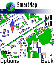
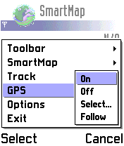
SmartMap is a mobile device application which uses vector and raster maps. It is compatible with any NMEA protocol GPS receiver (Compact Flash socket, serial port, BlueTooth or sleeve)


")