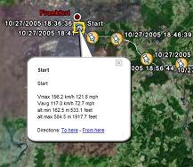
GETrack - Now you can record tracking data from your bluetooth GPS receiver and send the track via bluetooth to your PC for direct use with "Google Earth". For business, holidays and fun.
There's no need for any conversion software on the PC side. The tracking data is ready to be used with "Google Earth". These files can then be sent by email to your friends or put them on your website.
On the PC side you only need a bluetooth dongle and the ability to receive files from your phone.
You can choose a logging interval from 1,3,5,10,20,30,60 and 300 seconds which covers driving speeds by car and bike and is also suitable for hiking tours.
You can choose to send a file in plain Google Earth format, extended Google Earth format including automatic waypoints including altitude, driving speed and time/date , GPX, IGC and CSV (Microsoft Excel or OpenOffice) format.
Compatible with S60 3rd Edition devices.
You need "Goole Earth" Version 3.0 or better, a NMEA compatible bluetooth GPS receiver and you must be able to receive files via bluetooth from your phone.
Like it? Share with your friends!
If you got an error while installing Themes, Software or Games, please, read FAQ.
MapViewGPS II UIQ MapViewGPS II UIQ-navigation and map view solution for UIQ phones.
Main features:
: 100% compatible with OziExplorer maps and data files. Can read and write .plt, .wpt, .map, .names files
: Create and calibrate vector maps using OziExplorer on PC
: Enhanced raster (bitmap) map view
: Unlimited map size, map chunks loading dynamically
Tube 2 Brussels (UIQ) Tube 2 Brussels (UIQ) - This map package for Tube 2 consists of a fully scrollable detailed map of the Brussels tram, metro & bus system.
Plan journeys on these systems, list details of the quickest routes and see a superb animated display of your journey tracking around the system map
Tube 2 Chicago Pro (UIQ3) Tube 2 Chicago Pro (UIQ3) - This map package for Tube 2 consists of a fully scrollable detailed map of the Chicago metro & commuter rail system and linked street maps of central Chicago.
Plan journeys on the metro system, list details of the quickest routes and see a superb animated display of your journey tracking around the system map
PhoneMap Paris PhoneMap Paris- Full map solution for symbian series 60
View map:Display map,select objects,zoom,pan,...
Search: Search street,location,..by name
Shortest path: Show shortest path and total distance.
GPS: Connect to GPS device by bluetooth,go to location on map
Map of Sri Lanka Map of Sri Lanka - A map of Sri Lanka. Good for intercity travels with SmartMap.
Layers include:
Towns
Settlements
Airports
Roads
Railroads
Rivers
Inland water
Administrative borders
International borders
Trees
Map scale is 1:1 million.
Good for use with any version of SmartMap. SmartMap can be purchased here
Tube 2 Rome (UIQ) Tube 2 Rome (UIQ) - This map package for Tube 2 consists of a fully scrollable detailed map of the Rome metro & rail system.
Plan journeys on this system, list details of the quickest routes and see a superb animated display of your journey tracking around the system map
Map of Pennsylvania (US State) Map of Pennsylvania (US State) - A map of the Pennsylvania by VITO Technology. Good for intercity travels with SmartMap.
SmartMap is a mobile device application which uses vector and raster maps. It is compatible with any NMEA protocol GPS receiver (Compact Flash socket, serial port, BlueTooth or sleeve)
A-Z London Street Map 400sqkms UIQ 040020 A-Z London Street Map 400sqkms UIQ 040020 - Comprehensive London street map based on the famous London A-Z maps. This is the highest quality map of London you can buy. Maps are detailed, colourful and clear - exactly the same maps as on the London A-Z. The only difference is that using this application is easier and much faster
Map of Philippines Map of Philippines - A map of Philippines. Good for intercity travels with SmartMap.
Layers include:
Towns
Settlements
Airports
Roads
Railroads
Rivers
Inland water
Administrative borders
International borders
Trees
Map scale is 1:1 million.
Good for use with any version of SmartMap
Other Software by developer «Quentin»:
GETrack for UIQ3 GETrack for UIQ3 - Now you can record tracking data from your bluetooth GPS receiver and send the track via bluetooth to your PC for direct use with "Google Earth". For business, holidays and fun.
There's no need for any conversion software on the PC side. The tracking data is ready to be used with "Google Earth"
TweakME TweakME is used for modifying the security settings of Java midlets on the Nokia 6600 phone.
With TweakME you can set all permissions for a midlet regardless if it's signed or not
GETrack GETrack - Now you can record tracking data from your bluetooth GPS receiver and send the track via bluetooth to your PC for direct use with "Google Earth". For business, holidays and fun.
There's no need for any conversion software on the PC side. The tracking data is ready to be used with "Google Earth"
S60 Screensaver Maker Pro S60 Screensaver Maker Pro - Using this PC application you can create custom screensavers for Nokia S60 2nd Edition devices from a GIF file.
The created screensaver will be automatically packaged into a SIS installer and is ready to be installed on a S60 2nd Edition device. The screensaver turns the backlight on (not on 3230,6260,6600,6620,6670,7610) when it starts
POIXpress POIXpress - Modern location aware applications running on S60 3rd Edition devices like smart2go(TM) aka Nokia Maps use a shared database of POIs (called landmarks).
With POIXpress you can import POI databases in ASC and OV2 format and export landmarks in ASC,GPX and KML format
Series 60 Screensaver Source Code Series 60 Screensaver Source Code - Sourcecode of a Series 60 2nd Edition screensaver plugin. The demoversion only contains the binary SIS installer. Start writing your own screensaver plugins using C++ based on this source code right now. The sourcecode is compatible with the Series 60 SDK 2.0 for Symbian OS


")
")


")

")


