Categories: Internet & Communications, Travel & Navigation
Upload date: 10 Aug 10
Developer: Ulf Arndt
License: Freeware
Downloads: 3651 File Size: 42 Kb
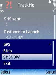
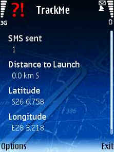
TrackMe (S60)-An application that sends your location at a regular interval via SMS to another cellphone. If it receives a SMS query in a certain format (e.g. from RTMS), will send your location to the predefined number.
Like it? Share with your friends!
If you got an error while installing Themes, Software or Games, please, read FAQ.
LocationRequestor LocationRequestor -Python extension that allows access to the Location Acquisition API (which connects to, for example, an internal and/or external GPS). It supports both blocking calls and callbacks. It is based on the 'lbsreference' example in the Symbian SDK
PhoneLocator Phonelocator is a native S60 realtime GPS tracking application for Nokia S60 phones. It allows you to view the location of your phone and a trail of where it has been using this website
Reperion GPS TrailExplorerReperion GPS TrailExplorer Reperion GPS TrailExplorer is a real-time Java Mobile GPS Tracking application. You can upload your GPS position and others can follow you around in Google Earth.
Use of this application is free. It is an adaptation of TrailExplorer.
Users can upload and view their tracks in real-time using a Java mobile phone and GPS device
3dtracking 3dtracking - With 3dtracking, a GPS (either built-in or Bluetooth) and an S60 v3 smartphone, you can turn your mobile phone into a tracking device. The free 3dtracking service allows you to track your phone live on the internet, as well as record your trips so you can view them at any time
FON Access Points for Portugal FON Access Points for Portugal - FON offers you a new Points of Interest service (POIs). This allows you to download FONspots directly to your navigation device.
What does that mean? You can download a Points of Interest file directly to your navigation device
MapViewGPS II s90 MapViewGPS II is a navigation and map view solution for phones.
Main features:
: 100% compatible with OziExplorer maps and data files. Can read and write .plt, .wpt, .map, .names files
: Create and calibrate vector maps using OziExplorer on PC
: Enhanced raster (bitmap) map view
: Unlimited map size, map chunks loading dynamically
Aspicore GSM Tracker 2 Real-Time GPS Location Tracking with S60 2nd Ed Smartphone and SQL database. Low data costs thanks to GPRS and compact messages. Uses Bluetooth GPS or cell tower ID
FON Access Points for Mexico FON Access Points for Mexico - FON offers you a new Points of Interest service (POIs). This allows you to download FONspots directly to your navigation device.
What does that mean? You can download a Points of Interest file directly to your navigation device
AnchorAlarm AnchorAlarm - Internal or external Bluetooth GPS device is required.
USAGE
Start the application, which will automatically connect to the predefined GPS (see Settings). You will see your latitude/longitude on the main screen after the GPS has calculated the position.
Press 'Start' to pinpoint your anchorage position and start monitoring
MyLocation Script for mShell MyLocation Script for mShell-Use your mobile phone as your location tracker. The software sends an automated reply to anyone who intends to know your location. If your current location cannot be determined, it sends your last recorded known location and its time
Other Software by developer «Ulf Arndt»:
PRS GPS PRS GPS - Uses a built-in GPS of a Nokia Phone and JAVA J2ME based Location based service to SMS your Pilot Status to the Pilot Recovery System. Can be used for the Winelands Paragliding comp. The JAVA J2ME Midlet feeds via SMS the Pilot Recovery status webpage
RTMS RTMS - This JAVA Midlet sends a SMS to a mobile phone that runs the TrackMe code.
It sends an SMS to TrackMe, TrackMe then sends a SMS with the location data to the predefined number.
The predefined number gets set by the enduser when TrackMe gets started.
The code needs a trackmesms.txt file in the Images folder of the cellphone
Pilot Recovery System Pilot Recovery System - A simple J2ME JAVA Midlet that can be used with the Pilot Recovery System. Can be used for the Winelands Paragliding comp. The JAVA J2ME Midlet feeds via SMS the Pilot Recovery status webpage
TrackMeTweet TrackMeTweet - uses the built-in GPS, or a Bluetooth GPS (recommended for cellphone battery life) to send regular tweets of your location to Twitter.
The Tweet info contains your identifier, distance from take-off in km, coordinates in degrees and decimal minutes, altitude in meters above sea level, speed in km/h, direction you are heading at that specific moment


")
")


_23460small.jpg "Aspicore GSM Tracker 2")


