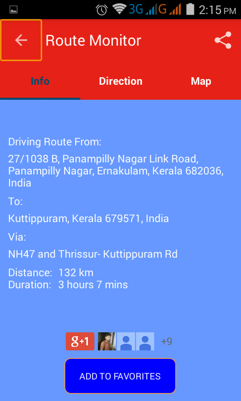
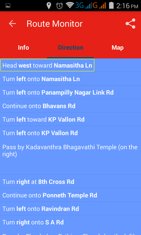
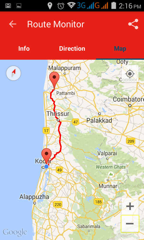
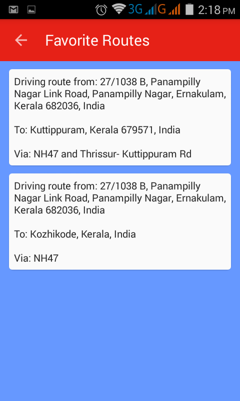
Route Monitor - This application helps you to find the driving route between any start and end location which would have been set by you. It is very simple to use. Just search/select your source / destination location and press the submit button! The route between those two locations will be shown on the map. You can view the route in text format too. In addition to the route, you can view your traveling duration and travel distance. You can save the route to favorites list and show anytime without internet connection. Also share the route with friends and family! Features: * Travel Modes: Shows the route for driving mode and for walking mode. * Duration and Distance: It gives very accurate driving/walking duration and distance. * Alternative Route: you will get alternative routes if available. * Route on the map: you can see the route on the map. * Route in text format: you will get the route in text format, useful for our visually challenged community.
Like it? Share with your friends!
Supported operating systems:
Google Android 3.0, Google Android 3.1, Google Android 3.2, Google Android 4.0, Google Android 4.1, Google Android 4.2, Google Android 4.3, Google Android 4.4
Similar Software:
Android Photo GeoTag Android Photo GeoTag - Take pictures with your mobile phone and incorporate the data of the geographical location. The application allows you to include in the photographs, data from the GPS receiver, along with a brief note. If you know the coordinates, not having the GPS receiver, you can also handwrite geographic data
Polaris Navigation System Polaris Navigation System - The Polaris Navigation System is a powerful navigation software for Android. It includes all the standard GPS functionality, including an odometer, altimeter, speedometer and directional compasses.
The app also allows you to record trails and view them on a map
GPS Tweet GPS Tweet - Share your location with a Tweet, it's easy... download and install this app, after opening it, write a message, press the Twitter logo for sharing your position on Twitter, your friend sees a link, when he clicks the link he sees your position and your message on Google Maps
My.POI 3 000 000 POIs from Shturmann® database on your Android phone
TomTom Western Europe for Android TomTom Western Europe for Android - TomTom Western Europe is a turn-by-turn GPS navigator for Android devices. The app includes accurate offline maps, so you can find your way anywhere, even without an internet connection
DroidTracker DroidTracker allows Android device users to share their exact location (using readable address and google map link) using SMS, Mail and Twitter.
· Contacts send a request SMS to your phone and receive your location back (once or periodically)
AugSatNav Walk AugSatNav is an augmented reality navigation system which overlays walking directions upon a live video feed of the path or road ahead.
With AugSatNav there is no need to follow instructions or interpret maps - you can simply find your way by walking along the route highlighted by a bright white line
BeBack Light BeBack Light - A GPS tracking and voice navigation utility economizing the battery charge.Suitable for hunters, fishers or other adventure finders: allows to walk straight to the target point with free hands according to the voice pointers, having your PDA in a pocket with the switched off screen and saving the battery charge on the way
Art Places Art Places is a software application for the Android mobile operating system.
The application gets our position through the GPS in the mobile device and shows us our current location in the maps application. of maps
Comments on Route Monitor:
Comments not found
If you noted an error or download link is broken, please, report it via this page or use comments.
Route Monitor is compatible with your device T-Mobile LG V909 G-Slate