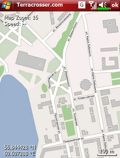
Terracrosser is a free GPS navigation software for Windows Mobile Pocket PC.
· Terracrosser works in Map and Photo modes
· Terracrosser uses zoomable maps
· Terracrosser is completely compatible with Google Maps service. With included Mapper module you can download maps from the Internet. All maps are automatically calibrated (geo-referenced)
What's New in This Release:
Terracrosser:
· POI system
· enhanced scrolling
· multiple options in settings menu
· maps correction to improve default maps calibration
Mapper:
· limited region to download non-square part of map
Like it? Share with your friends!
If you got an error while installing Themes, Software or Games, please, read FAQ.
Supported operating systems:
Windows Mobile 5.0, Windows Mobile 5.0 Smartphone, Windows Mobile 6 Classic, Windows Mobile 6 Professional, Windows Mobile 6 Standard, Windows Mobile 6.1 Classic, Windows Mobile 6.1 Professional, Windows Mobile 6.1 Standard, Windows Mobile 6.5 Professional, Windows Mobile 6.5 Standard
Map of Madrid / Spain for City Advisor Madrid / Spain map for City Advisor.
1. Download the map (zip file)
2. Extract the files in /CityAdvisor/maps
3. Open CityAdvisor -> Maps icon -> Menu -> Refresh
4
Map of Pennsylvania (US State) Map of Pennsylvania (US State) - A map of the Pennsylvania by VITO Technology. Good for intercity travels with SmartMap.
SmartMap is a mobile device application which uses vector and raster maps. It is compatible with any NMEA protocol GPS receiver (Compact Flash socket, serial port, BlueTooth or sleeve)
Travel Hawaii Travel Hawaii an illustrated travel guide, phrasebook, and maps. Indulge Yourself with a personal tour guide on Your PDA. FREE General Information, basic phrasebook, and a map in the trial version.
Features
Fully illustrated.
City attractions.
Historical overviews.
Interesting facts.
Street Maps, Phrasebook, and more
Rough Guides Map Washington DC Rough Guides Map Washington DC... These guides are a series of fantastic interactive maps.
Produced in conjunction with the premier travel publisher Rough Guides.
Discover and explore Washington DC using full colour interactive linked maps, in this simple to use PDA version of The Rough Guides Washington DC
TextMapperer TextMapperer - TextMapperer allows you to create named text based GPS maps. When you get a GPS lock then you can create a new map and enter text for the area. When you save the text the map is downloaded and the text and GPS is appended to the end of the map with current GPS
RoadMap RoadMap - RoadMap is a car navigation system. RoadMap displays a map of the streets, tracks the position provided by a NMEA-compliant GPS receiver, identifies the street matching this GPS position and announces the name of the crossing street at the next intersection
MapsAligner MapsAligner - MapsAligner allows you to download large maps based on your GPS or with custom latitude and longitude points that you enter. You can use this to compose maps for your GPS applications. The program uses the Google.com maps server for the maps.
This program requires that you have both the 'BeanDLL
Bristol Pocket A-Z Map Bristol Pocket A-Z Map - This publication has been designed for a Windows® Mobile-based Pocket PC (version 2002 or later) and The Pocket A-Z Viewer
Other Software by developer «Nitisara»:
not found
Comments on Terracrosser:
Comments not found
If you noted an error or download link is broken, please, report it via this page or use comments.
Terracrosser is compatible with your device T-Mobile MDA Pro


")


