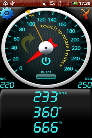
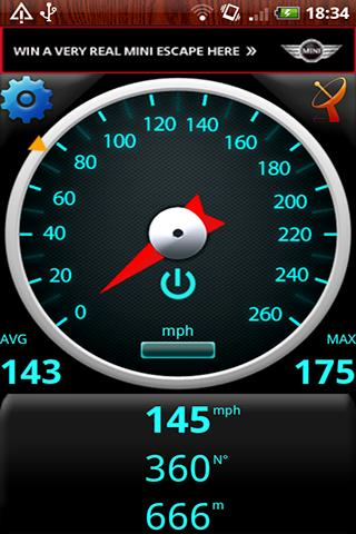
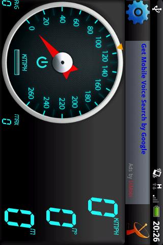
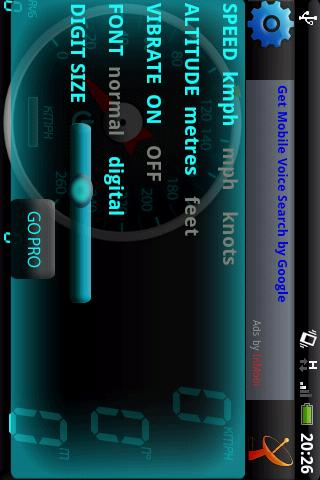
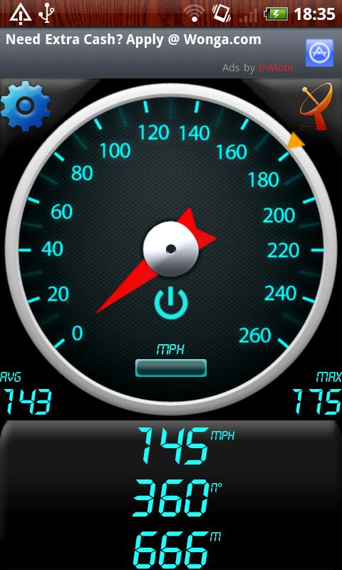
GPS Speedometer - Find out your speed by GPS Speedometer, another one application utilizing Android GPS capabilities.
Like it? Share with your friends!
Supported operating systems:
Google Android 1.0, Google Android 1.5, Google Android 1.6, Google Android 10.x, Google Android 2.0, Google Android 2.1, Google Android 2.2, Google Android 2.3, Google Android 3.0, Google Android 3.1, Google Android 3.2, Google Android 4.0, Google Android 4.1, Google Android 4.2, Google Android 4.3, Google Android 4.4, Google Android 5.x, Google Android 6.x, Google Android 7.x, Google Android 8.x, Google Android 9.x
Similar Software:
ParkLeitSystem ParkLeitSystem is a car-park-routing system. It shows you, according to your GPS position, the nearest city with a car-park-routing system and gives you a list with all available car-parkings and shows how many free places there are. With a click on the parking it switches to google maps and shows you the position of the parking
AlpineQuest Lite AlpineQuest Lite - AlpineQuest turns your Android device into an off-road GPS using offline topo maps. It is a complete solution for all outdoor activities and sports, including hiking, running, trailing, hunting, sailing, geocaching and much more
CoPilot Live UK + Ireland (Android) CoPilot Live UK + Ireland (Android) - CoPilot Live is full-featured voice-guided GPS navigation with street maps of 1 European region stored on your Android phone. Includes 3D guidance, lane assist, speed limit warnings, safety camera alerts, planning mode.
Download maps via WiFi after purchase. Unlimited use after 10 days once Google order verified
ViewRanger GPS ViewRanger is a unique mapping, navigation, tracking, and information tool for mobile phones that provides fully featured outdoor gps and trail navigation through a natural and intuitive display. ViewRanger transforms a Nokia or other Symbian S60 smartphone into a fully featured trail navigation system
GoPenS GoPenS is an OpenSource GPS application for Android phones, based on OpenStreetMap (OSM). OpenStreetMap is a collaborative map of the world. Therefore, one of the main functions of the application is to be able to record a trace and send it as a GPX to the OSM servers, and so edit the OSM Map
DEWA (Android) DEWA - Welcome to the Mobile World of DEWA
AndNav2 (Android) AndNav2 is a navigation system for Android-powered phones. AndNav2 is based on free mapdata by OpenStreetMap.org. AndNav2 will provide full audible turn-by-turn realtime route-guidance. AndNav2 has unique features, like Text-2-Speech, an accessibility-study (aka 'Where can I get in 30 minutes') or avoiding customizable areas, i.e
Mileage (Android) Mileage is a mileage tracker for an Android-powered phones. Allows importing and exporting of data in various formats, so it is easy to sync with your existing logs. Supports GPS recording
Locate My Family Locate My Family - Why do you need Locate My Family application?
1. Locate My Family tracks, monitors and manages an individual or group of people for operational and safety security reasons.
How to start?
1. Install the application on your Android phone.
2. Create your account by providing your email id, phone number of the device, name, country and submit it.
3
Other Software by developer «Bakhtiyor Khodjayev»:
Froggy Tic-Tac-Toe (Android) Froggy Tic-Tac-Toe - Amphibians, especially frogs and toads, are ecological indicators, and in recent decades there has been a dramatic decline in amphibian populations around the globe. Many species are now threatened or extinct.
This application is a Tic-Tac-Toe game with frogs and minimax algorithm
Plumb-Bob (Android) A plumb-bob is a weight, with a pointed tip on the bottom, that is suspended from a string and used as a vertical reference line

")
")
")


")


")
")
")

")
")

")
")
")
")
")
")
")