GeoRecorder - The ONLY GPS logger app you'll ever need on the Android platform!
· Automatically log your location when you use Google Map, Foursquare or any other app that uses GPS information
· Save logged data in KML, GPX or CSV format
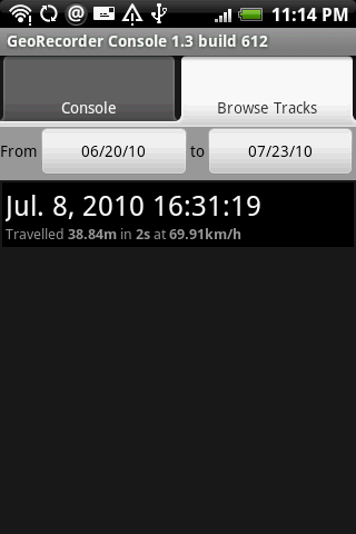
· View logged tracks in built-in map view
Like it? Share with your friends!
Supported operating systems:
Google Android 1.5, Google Android 1.6, Google Android 10.x, Google Android 2.0, Google Android 2.1, Google Android 2.2, Google Android 2.3, Google Android 3.0, Google Android 3.1, Google Android 3.2, Google Android 4.0, Google Android 4.1, Google Android 4.2, Google Android 4.3, Google Android 4.4, Google Android 5.x, Google Android 6.x, Google Android 7.x, Google Android 8.x, Google Android 9.x
Similar Software:
PinPoint UPDATE - Google maps link sent with email A simple way to send someone your current location. - Finds your current location and displays a map with your address - Send via email, SMS or MMS
OakLogAndroid OakLogAndroid Logger application for your Android device. Records GPS and sensor information on your phone.
The log files (*.olg) can later be loaded into TrackView.NET and viewed in all their 3D-glory.
· Logs GPS position, altitude, speed, etc
amAze (Android) AmAze is a first of its kind free navigation and local search service. It is free to download and use and it contains wide coverage of maps including aerial photo in Europe, North America, Australia and parts of Asia and Africa
Redpin The aim of the Redpin project is to create an open source system that allows indoor positioning up to room-level description using mobile phones
WAY - Where are you? WAY - Where are you? - Share you location and find your friends easily.
Wanna find your friends?
Wanna share your location with friends?
Congratulations: YOU FOUND THE APPLICATION WHICH ALLOWS YOU THAT AND EVEN MORE.
"WAY - Where are you?" allows you to find your friends' locations in real time and/or send them free messages
GPS Status GPS Status is an application which displays the information received from the phone's GPS receiver. In addition to the basic location information it can extract and display the state and location of each visible GPS satellite which is displayed on a simple sky view. The outer circle represents the horizon while the center corresponds to the zenith right above your head
DEWA (Android) DEWA - Welcome to the Mobile World of DEWA
Location Tracker Why do you need Location Tracker application? 1. Track, monitor and manage an individual or group of people for operational and safety security reasons. 2. Send an instant alert in emergency situation by pressing the Panic button
iMapMyWALK+ iMapMyWALK+ - tracks the route, distance, pace, and more in real-time using GPS.
Free new version!
iMapMyWALK+ brings you its mobile app for Android-based devices! Now owners of Android 2.1 or higher devices can track the route, time, distance, speed, pace and calories in real-time for their fitness activities using their GPS enabled mobile device
GeoSense GeoSense - Ever wondered how you would know if you have reached a destination you've never been before? GPS is great .
Other Software by developer «Idea Matters»:
MemoDroid MemoDroid - Memory training tool for Android. Utilizes "spaced repetition" theory to manage intervals for every item based on your responses in previous repetitions in order to boost the efficiency of your learning.
Import SuperMemo data including learning progress
Surveyor Surveyor - Measure distances with a single click on your Android phone!
All you need to do is point your phone to the object you want to measure, and select the point where it touches ground from the screen.
What's New in This Release:
· Use gyroscope to improve accuracy and smoothness of Augmented Reality result
Sensor List Sensor List lists all sensors available on the device along with their current values and a plot to display their changes over time.
Including accelerometer, magnetic field, orientation, temperature, light...
Can be a handy tool for development or hardware testing purpose

")


")


")


