Locus Fast and useful Online/Offline map viewer for Android.
· This is also My Maps editor so Google Account permission is needed
· Contacts permission is for getting contact address on various places in app (adding point into database by contact address, etc...)
· If anything not work, send email
· If app crash, send log from logcat or Locus/logs directory
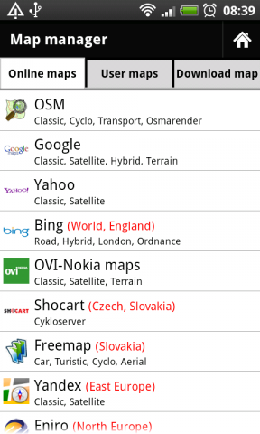
· Online maps (OSM, Google, Yahoo, Bing, OVI/Nokia, ... actually 37 types)
· Offline maps (SQLiteDB format, updated TrekBuddy TARed format)
· direct download Online -> Offline (defined area - rectangle, path, state).
· Google My Maps Viewer, Google My Maps editor (BETA)!
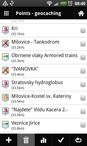
· POI handling => POI import into separated categories, viewing on map, basic guiding.
· support for Groundspeak PocketQuery
· Google Street View
· support for Bluetooth GPS
· work with c:geo, GPS Status
· quick and clean GUI
· and more
What's New in This Release:
· fixed some language troubles (import/export)
· full support for zipped files import
· better support for GPX files
· faster data importing
What's New in 0.9.21:
· fixed problem with adding categories
· rewrote a little start of app
What's New in 0.9.15:
· distance on screen during path creating
· improved handling with track styles. Now define style for import and record separately
· bug fixes
Like it? Share with your friends!
Supported operating systems:
Google Android 1.6, Google Android 10.x, Google Android 2.0, Google Android 2.1, Google Android 2.2, Google Android 2.3, Google Android 3.0, Google Android 3.1, Google Android 3.2, Google Android 4.0, Google Android 4.1, Google Android 4.2, Google Android 4.3, Google Android 4.4, Google Android 5.x, Google Android 6.x, Google Android 7.x, Google Android 8.x, Google Android 9.x
Similar Software:
OpenStreetMapViewer OpenStreetMapViewer provides Tools / Views to interact with OpenStreetMap-Data
amAze (Android) AmAze is a first of its kind free navigation and local search service. It is free to download and use and it contains wide coverage of maps including aerial photo in Europe, North America, Australia and parts of Asia and Africa
Gowalla Gowalla is the easiest way to share places you go with friends. Download the app to discover eateries, coffeehouses, hotspots, hangouts, shops, landmarks, parks, museums and more. Share your experiences through Gowalla with friends on Facebook and Twitter, then stamp your passport to earn rewards at the places you visit
Naver Maps Naver Maps - Smarter than ever! Experience Naver Map for Android. You can find the shortest way to get to your destination, using public transportation even it is far away. You can also search the information on the area around you easily and check whether you are heading to your destination correctly with GPS and compass
OSM Android Android program that renders OpenStreetMap maps and calculates routes
Outdoor Offline Maps for Android Outdoor Offline Maps for Android - The Outdoor Navigation software is your best friend through your adventures in the wild.
Go into the outdoors with confidence and enjoy your activities without worrying about the tools to help you navigate. Your Outdoor Navigation app is made by the people who have been developing this software since 2003 across multiple platforms
yozi yozi is a navigation software for the Android platform. It uses digital topographic maps in well-known Ozi Explorer formats for navigation and doesn't require network access like built-in Maps application on Android
OS Map OS Map is a tool to turn your Android phone into a handy Ordnance Survey map, with your GPS position pinpointed on it!
· Nearly all OS Map scales available (including 250,000 and 50,000).
· Touch-scrolling - simply use your finger to drag the map around.
· Fast resume from standby and fast position updates
ClapCard ClapCard is a free social network for creating and sharing animated cards directly from Android based phones
NavStarter NavStarter is a little app that can be used for the Google Navigation Hack to navigate to an address without first creating a shortcut
Other Software by developer «menion»:
Locus Free Locus Free - Fast and useful Online/Offline map viewer for Android.
· This is also My Maps editor so Google Account permission is needed
· Contacts permission is for getting contact address on various places in app (adding point into database by contact address, etc..


")
_13333small.png "Gowalla")


