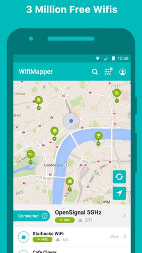
WifiMapper - is a global map of free of charge Wifi access points all over the world. This application will help you find the nearby access points as well as type of facility (coffee houses, pubs, cinemas and so on). Besides, the list of access points has daily updates.
Game features:
Big map of networks
Handy interface
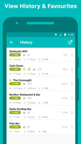
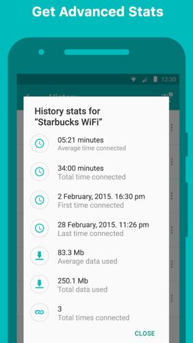
History of your Wi-Fi access points
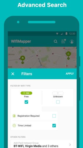
Filters
Like it? Share with your friends!
Supported operating systems:
Google Android 10.x, Google Android 4.1, Google Android 4.2, Google Android 4.3, Google Android 4.4, Google Android 5.x, Google Android 6.x, Google Android 7.x, Google Android 8.x, Google Android 9.x
Similar Software:
JTrip JTrip - Create your own trip in Thailand. JTrip recommends attractions and directions that you need. Let's get to know Thailand together.
· select places.
· select hotel.
· show map location.
· route path form src to dest.
· taxi, time remaining.
· suggest bus number
Trapster Trapster- Your mobile phone alerts you as you approach police speed traps, red light and speed cameras, via spoken warnings in fun voices! Join world''s largest driver''s social network, 5 million users and growing! Drivers helping drivers! New for 1.6
amAze (Samsung) AmAze is a first of its kind free navigation and local search service. It is free to download and use and it contains wide coverage of maps including aerial photo in Europe, North America, Australia and parts of Asia and Africa
yozi yozi is a navigation software for the Android platform. It uses digital topographic maps in well-known Ozi Explorer formats for navigation and doesn't require network access like built-in Maps application on Android
Yandex. Metro Yandex. Metro - is a useful application for those who often goes by subway. The application will make exact calculation of time, offer the best route and give the switch points. Select the destination and departure stations according to the scheme and easily plan your subway trips
MapsWithMe Pro for Android MapsWithMe Pro for Android - MapsWithMe allows you to access maps of all the countries in the world while on the go. The maps are based on OpenStreetMap data and work completely offline, without requiring an internet connection
amAze GPS light edition amAze GPS light edition provides access to worldwide street maps, full topographic map coverage of the USA and satellite imagery for 200 major cities around the world. It allows you to search in a worldwide rich POI database and you can upgrade to the full version that includes turn-by-turn voice guided navigation from within the application
Walk And Run Keeper Walk And Run Keeper - Lets you measure how far you ran/walked, track your walking distance, speed, time, and calories burned and store a record of your daily workouts to stay fit.
This is the best way to maintain walking schedules. Use this app and measure your walking route and calculate your burned calories per session
Cell Phone Coverage Map Cell Phone Coverage Map - Test your mobile service for yourself and compare results to other carriers using RootMetrics. Coverage information in the market today is incomplete and gathered infrequently - often no more than once a year - resulting in soft advertising claims of network reliability. RootMetrics is different


_13470small.png "Trapster")
")


")