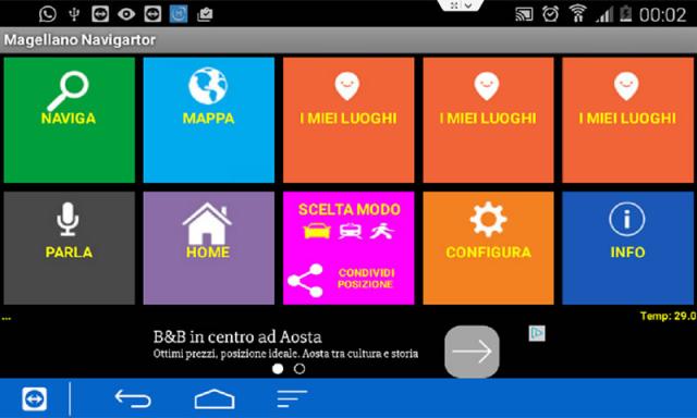
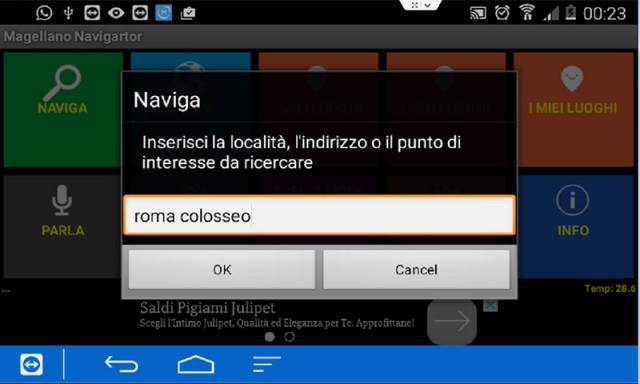
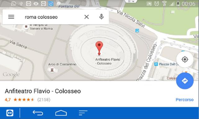
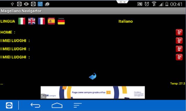
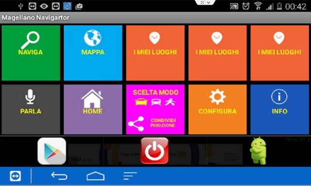
Magellano Navigator GPS - Magellan will lead you to your destination using the GPS of the smartphone and the engine of Google Maps (registered trademark from the rightful owner) or other application of road maps. You can set the destination by typing in the box or by speaking after activating the voice mode. Maps will be started at the end ready to take you to your destination. Magellan has a simple interface, instant and intuitive, with the convenient voice dictation allows use in cars without distractions. With Magellan Free becomes easy to store your home address, and three bookmarks, making them available to be reached with a simple touch on the screen. If we do not remember where we parked the car, just add the place to favorites and you're done. If we saw a beautiful monument, a good pizza or a place that we want to share with a friend, just press the button with the symbol of the share and then choose one of the tools that will be proposed and send e coordinates.
Like it? Share with your friends!
Supported operating systems:
Google Android 10.x, Google Android 3.0, Google Android 3.1, Google Android 3.2, Google Android 4.0, Google Android 4.1, Google Android 4.2, Google Android 4.3, Google Android 4.4, Google Android 5.x, Google Android 6.x, Google Android 7.x, Google Android 8.x, Google Android 9.x
Similar Software:
GPSbySMS (Android) GPSbySMS is an application that reads navigation data from GPS and sends it to any user via SMS or email.
Purpose:
1) Read navigation data from GPS and send it to any user via SMS or email.
2) View current position on Maps (need Internet connection).
3) Save navigation data in database using data transfer via GPRS Internet.
4) Alarm Function
AnyLocation AnyLocation - AnyLocation is the most professional app for mobile location mock, which can perfectly mock GPS location on LBS app, for example facebook, wechat, momo and so on. The most powerful ability of AnyLocation is: 1 It can mock without the system setting "allow mock locations" enabled(root required). 2 It can block cell-ID location
Connector - Track & Dispatch (Android) Connector - Track & Dispatch (Android) is a cloud-based, Google Apps integrated track and dispatch service.
The service supports a wide range of location-aware devices including smart phones, wireless routers and other GPS devices. It is suitable for businesses and organizations of all sizes as well as for individuals
yozi yozi is a navigation software for the Android platform. It uses digital topographic maps in well-known Ozi Explorer formats for navigation and doesn't require network access like built-in Maps application on Android
wayg wayg - Create your trip, record your route, share your position. WhereAreYouGoing is able to record position, speed, altitude and time of your routes on your device. WhereAreYouGoing allow to share your route on the most important social network (Google+, Twitter, Facebook...), create file Kml for Google Maps or file GPX (OpenStreetMap)
MapMyRIDE GPS Cycling Riding MapMyRIDE GPS Cycling Riding - tracks the route, distance, pace, and more in real-time using GPS.
NEW: iMapMyRIDE+ for Android
iMapMyRIDE+ brings you its mobile app for Android-based devices! Now owners of Android 2
OpenGPSTracker OpenGPSTracker adds the capability to store and review where you and your Android device have been. Basically you press record at the start of your trip and your phone stores the route you take. This route is drawn real-time on the Maps functionality of Android or in the background with an idle device. The route is stored on your phone for review and further use
Current Location Finder Current Location Finder - Current Location finder which can be used to locate your location with the aid of a live satellite map you can dynamically (real time) determine ... Use the live satellite maps
BlueGPS4Droid BlueGPS4Droid is an application for using an external Bluetooth GPS on Android devices.
The application starts a service, then connects to a Bluetooth device (NMEA GPS) and creates a mock GPS provider which can be used to replace the internal GPS.
It's also possible to log the external GPS NMEA data in a file on the device
Digital Dashboard GPS Digital Dashboard GPS - Features included
- Save your track info,Record gpx file(it will be saved in "sdcard/DigitalDashboardGPS/gpx/")..
- Switch between car speedometer and bike cyclometer.
- Switch between mph or km/h mode.
- Display satellites status.
- Speed chart.
- Map integration,get your location.
……
Facebook:https://www.facebook
Comments on Magellano Navigator GPS:
Comments not found
If you noted an error or download link is broken, please, report it via this page or use comments.
Magellano Navigator GPS is compatible with your device TCL Hero N3 TD (TCL Y910T)

")


")

")


