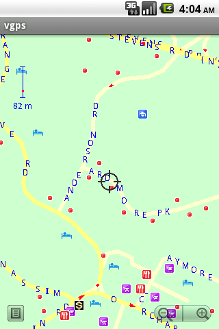
VGPS was designed to use city street map on your ordinary mobile phone without the need of having GPS receiver or internet connection. VGPS does not require internal or external GPS receiver. However, if you have internal GPS receiver or external bluetooth GPS receiver, VGPS can work with your GPS receiver as well. VGPS does not require internet connection so you no need to worry about connection charge.
· Offline map (totally offline application. VGPS only uses internet to validate your purchase when you activate demo version become full version. Other than that the application will never use internet)
· Map data from Garmin and OpenStreetMap
· Zoom in/Zoom out/Pan
· Search point by name,type,distance or mix type+name, type+distance
· Can touch any object on the map
· GPS real-time tracking
· Routing point to point
· Rotate map so the driving direction (heading) is always up
· Voice guidance (turn left/turn right)
Like it? Share with your friends!
Supported operating systems:
Google Android 1.5, Google Android 1.6, Google Android 10.x, Google Android 2.0, Google Android 2.1, Google Android 2.2, Google Android 2.3, Google Android 3.0, Google Android 3.1, Google Android 3.2, Google Android 4.0, Google Android 4.1, Google Android 4.2, Google Android 4.3, Google Android 4.4, Google Android 5.x, Google Android 6.x, Google Android 7.x, Google Android 8.x, Google Android 9.x
Similar Software:
Glympse Glympse - Safely share your location in real-time via email, SMS, Facebook, or Twitter.
"Glympse: The Coolest Thing Your Smartphone Can Do"
-FastCompany
Glympse is the easy way to safely share your location in realtime. No sign-up needed. No social network to manage. Just send a Glympse to anyone via email, SMS, Facebook, or Twitter
TomTom Australia for Android TomTom Australia for Android - TomTom Australia is a turn-by-turn GPS navigator for Android devices. The app includes accurate offline maps, so you can find your way anywhere, even without an internet connection
NAVIGON MobileNavigator NAVIGON MobileNavigator - Turn your Android phone into a mobile navigation device with lots of useful functions that will delight you! The pocket navigation device will show you the right way with functions such as Reality View Pro and Lane Assistant Pro
RMaps RMaps is a navigation tool. You can use RMaps as an online map viewer for some popular maps. And as an offline map viewer for your own maps created on the PC.
· Auto rotate map in driving direction.
· Auto rotate map in the northern direction.
· Compass on the map.
· Auto-follow function.
· Online search.
· Full screen mode
wheredroid wheredroid is a simple application to display your coordinates from the GPS receiver: latitude, longitude, heading, speed, number of satellites used and (it's its peculiarity) altitude and accuracy. It is quite usable as an altimeter and a compass.
What's New in This Release:
· fixes a bug inverting East with West on some displays
What's New in 1.4
Place Nearby Place Nearby - This application is all about searching for a desire location on map anytime, anywhere or anyplace.
This application just required a high speed internet connection, Network / GPS enabled device to search for your desire location.
This application will show you the live traffic near by your present location
Family Safety Family Safety - Active and Passive - Managed Family Safety & Security System!
★ Your Family Safety and Security by location aware real time notifications.
★ Create location aware multiple geo-fence’s to get automatic security alerts when person is not within the specified zone
Tricorder Tricorder - A simple tricorder simulator for Android powered phones, using real sensors to detect magnetic fields, gravity, etc. See the passing gravity wave from a distant collapsar on your phone screen (actual device sensitivity may be insufficient to detect gravity waves). Detect buried powerful magnets! Be a mega-geek! Etc
GPS2OpenGTS Free GPS2OpenGTS will send your GPS data to an OpenGTS tracking system.
Latest version now supports UDP.
Also added is a Test function/screen to help with server configuration.
Send a NMEA GPRMC strings with the following data.
(accountID, deviceID, Latitude, Longitude, Speed, Heading and Altitude
GPS Status GPS Status is an application which displays the information received from the phone's GPS receiver. In addition to the basic location information it can extract and display the state and location of each visible GPS satellite which is displayed on a simple sky view. The outer circle represents the horizon while the center corresponds to the zenith right above your head
Other Software by developer «Vietnamese GPS»:
VGPS (Vietnamese GPS) VGPS (Vietnamese GPS) - was designed to use city street map on your ordinary mobile phone without the need of having GPS receiver or internet connection. VGPS does not require internal or external GPS receiver. However, if you have internal GPS receiver or external bluetooth GPS receiver, VGPS can work with your GPS receiver as well
VGPS (Vietnamese GPS) for Android VGPS (Vietnamese GPS) for Android was designed to use city street map on your ordinary mobile phone without the need of having GPS receiver or internet connection. VGPS does not require internal or external GPS receiver. However, if you have internal GPS receiver or external bluetooth GPS receiver, VGPS can work with your GPS receiver as well

")
 for Android")
 for Android")


")
 for Android")