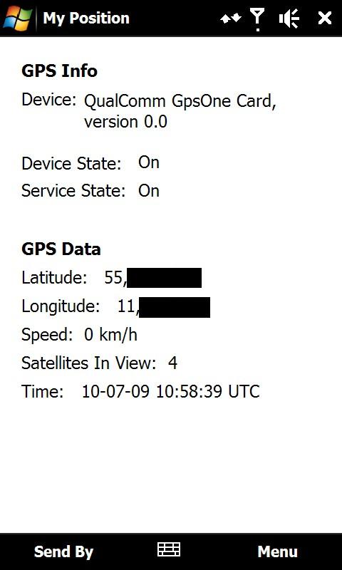
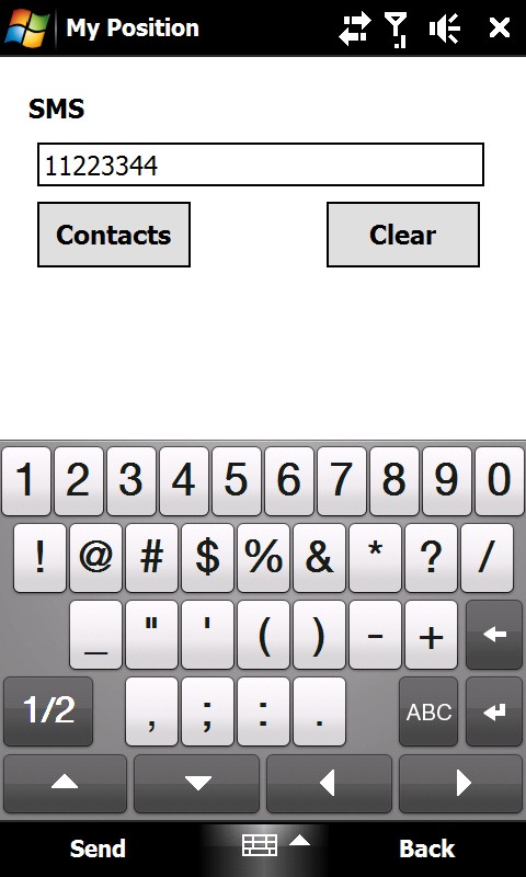
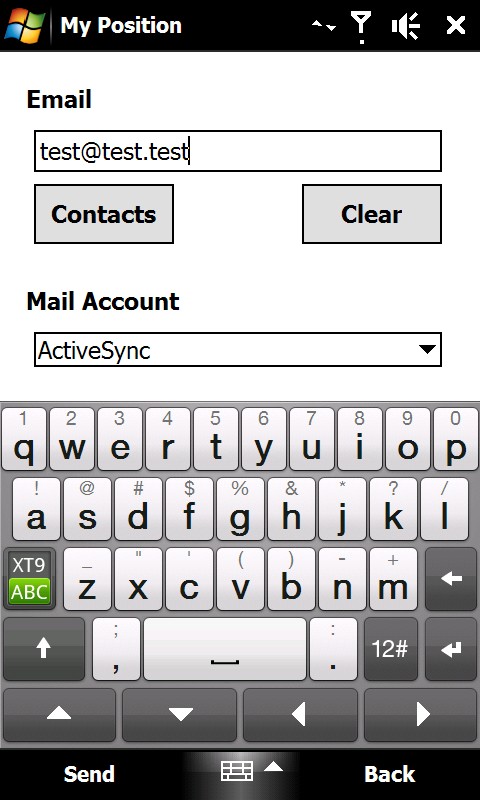
My Position - With My Position it is possible to see actual GPS information via the phone's built in GPS and send the position to others via sms or email.
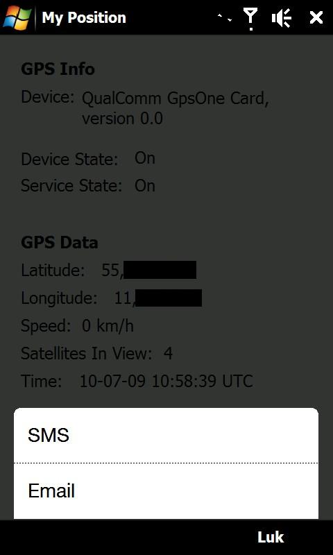
When sending the position via sms or email it is possible to enter a telephone number or email address. It is also possible to select a contact from the contact list.
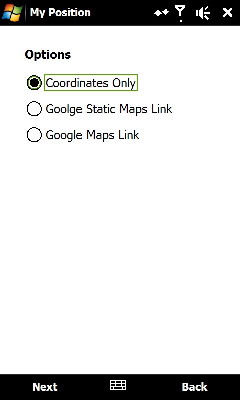
Sending the position is possible in three different ways:
1) As coordinates which can be inserted directly in Google Earth or Google Maps.
2) As a link to Google Static Maps. When the receiver opens the link the phones default web browser connects to the internet and shows the position on a map in 400x400 pixel resolution.
3) As a link to Google Maps. This option is mostly suitable when sending the position via email.
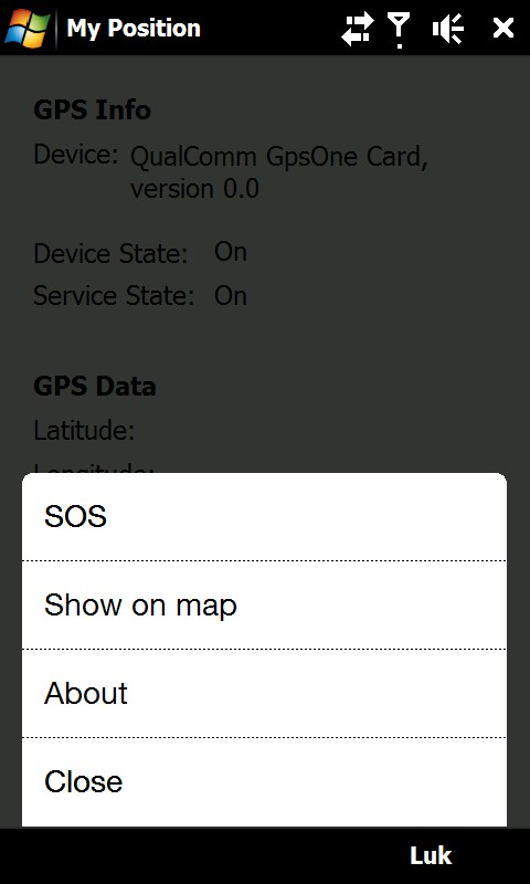
It is also possible to see ones own position on a map where Google Static Map is being used. The phones default web browser will open and connect to the internet and shows the position on a map in 400x400 pixel resolution.
This is a very good function when you are in a big city with many streets.
There is also a sos function which sends the position and a message of help. Again it is possible to send via sms or email.
Like it? Share with your friends!
If you got an error while installing Themes, Software or Games, please, read FAQ.
Supported operating systems:
Windows Mobile 6 Classic, Windows Mobile 6 Professional, Windows Mobile 6.1 Classic, Windows Mobile 6.1 Professional, Windows Mobile 6.5 Professional
Similar Software:
CalculatorGPSed CalculatorGPSed - CalculatorGPSed is a GPS distance calculator and location finder. You can use the GPS or custom entry on your PocketPC to view and download GPS marked satellite camera pictures and calculates distance between two points specified by the latitude/longitude using "The Vincenty inverse formula for ellipsoids" (accuracy to within 0.5mm, or 0
GPS Tuner Essentials Full Version with Canada Basic Map Content GPS Tuner Essentials Full Version with Canada Basic Map Content is designed specifically for off-road use: its large buttons, selectable tool window size, multiple Compass views and the built-in Tele Atlas map makes it extremely user-friendly and reliable
GPSWM65Indicator GPSWM65Indicator uses GPS to find your current coordinates and displays your latitude/longitude on the upper right of your display
Pocket PC Geocaching Tools Pocket PC Geocaching Tools - Many tools in one program to help you while you are geocaching.
What's included?
* Open GSAK databases directly
* HTML view
* Field Notes
* Hint decoder and decryption
* Several coordinate functions
* Solver
* Transformer (Text to Digits, etc
PoliceSpeeders PoliceSpeeders - PoliceSpeeders can be used by a police officer for an informal police speed trap. Enter the distance between the two points in settings and metric/imperial and tap the button or joypad when a car hits the start line and then again at the end line. The program calculates the estimated speeds into a log file
FON Access Points for China FON Access Points for China - FON offers you a new Points of Interest service (POIs). This allows you to download FONspots directly to your navigation device.
What does that mean? You can download a Points of Interest file directly to your navigation device
TimeGPSs TimeGPSs - This program allows you to enter two sets of GPS points and a speed reading in Miles or KM/H. Then the program displays the distance between the two points and the amount of time to travel from each point.
This program requires that you have both the 'BeanDLL.dll' file ** and ** the runtime files for Visual Basic on your PocketPC computer
amAze (Motorola) AmAze is a first of its kind free navigation and local search service. It is free to download and use and it contains wide coverage of maps including aerial photo in Europe, North America, Australia and parts of Asia and Africa
DiaryGPS DiaryGPS - DiaryGPS can be used to make text diary notes based on your GPS. For each day the program creates a subfolder under the current storage folder with the text notes. You can view the notes via distance. Tap on the diary entry to view.
This program requires that you have both the 'BeanDLL
FON Access Points for Palestinian Territory FON Access Points for Palestinian Territory - FON offers you a new Points of Interest service (POIs). This allows you to download FONspots directly to your navigation device.
What does that mean? You can download a Points of Interest file directly to your navigation device
Other Software by developer «ULJ»:
Backlight Control A small and simple application to control the backlight

")


")


