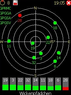
NaviPOWM is a car navigation system capable of running on a variety of operating systems. Only OSM based map data is supported. Realtime routing engine is planned in a later version. Geocaching and city guide functionality are also planned. other:
· more POI types
· more way types
· support more targets at once
· switch between targets by clicking on target display
· coastlines bugfixing
What's New in This Release:
fixed bugs:
· crash under Windows XP when displaying areas with holes
· areas with holes not drawn properly on Windows mobile
implemented feature requests:
· Support for gpsd
What's New in 0.2.5:
fixed bugs:
· TrackLog must show real GPSCoor
implemented feature requests:
· No aygshell.dll on PNA systems
· Show oneway arrow on streets
· Visibility of speed-pos box adjustable
· Save received data also as GPX file
other:
· area display (sea) speedup
· reorganized directories
· support for CMake
Like it? Share with your friends!
If you got an error while installing Themes, Software or Games, please, read FAQ.
Supported operating systems:
Windows Mobile 2003, Windows Mobile 5.0, Windows Mobile 6 Classic, Windows Mobile 6 Professional, Windows Mobile 6.1 Classic, Windows Mobile 6.1 Professional, Windows Mobile 6.5 Professional
Similar Software:
MyMotion MyMotion - GPS route recording and playback with customizable spoken feedback of speed, distance and time. Uses a moving map to show progress as well as textual output. Maps can be generated from Google Earth installed on a PC using a map creation tool. Allows user to record a route then load it up as a reference for live comparison the next time it is traversed
OS GPS Convertor OS GPS Convertor converts positions between WGS84 latitude & longitude and Ordnance Survey (OS) British & Irish or Universal Transverse Mercator (UTM) worldwide grid references. It displays positions in multiple formats.
It can be used with:
* TomTom Navigator - to create a Point of Interest (POI) or Itinerary file ... then show on map, navigate to, etc
e-Mobile GPS Traffic e-Mobile GPS Traffic
Receive real-time traffic information from your hand. Get all you need to know about the traffic condition around town.
Live traffic flow and traffic incidents report.
Get directions and traffic conditions to a point of interest with detailed map
FON Access Points for USA FON Access Points for USA - FON offers you a new Points of Interest service (POIs). This allows you to download FONspots directly to your navigation device.
What does that mean? You can download a Points of Interest file directly to your navigation device
BoatOdometers BoatOdometers - BoatOdometers uses the GPS on your PocketPC to measure your boat's speed and displays it in real time in Knots/hr, KM/hr and Miles/hr. The program also displays your latitude and longitude.
This program requires that you have both the 'BeanDLL.dll' file ** and ** the runtime files for Visual Basic on your PocketPC computer
FileGPSed FileGPSed - FileGPSed allows browse and view GPS tagged Excel, Word, Note, Voice, Text and Picture/Video files. You can browse the folders of the PocketPC for GPS tagged files and view them via GPS distance from your current location. Tap on the file to open it in the associated application.
This program requires that you have both the 'BeanDLL
FON Access Points for Slovenia FON Access Points for Slovenia - FON offers you a new Points of Interest service (POIs). This allows you to download FONspots directly to your navigation device.
What does that mean? You can download a Points of Interest file directly to your navigation device
GPSPicturer GPSPicture allows you to create GPS stamped JPEG files and displays them in an easy to use explorer interface. When you get a GPS lock the program will display the JPEG files in order of distance to your current GPS. To view the image file simply tap on it. The map service is provided by Google
quoox|TRACKER quoox|TRACKER - quoox gps tracker is a free service to live-track any kind of things using gps technology. The only thing needed is a device, which uploads its current gps data to quoox tracker service periodically.
This service is completely free for private use and easy to use. Just register a tracker id, simple as that
GPS Tuner Essentials Full Version with Balkans Basic Map Content GPS Tuner Essentials Full Version with Balkans Basic Map Content is designed specifically for off-road use: its large buttons, selectable tool window size, multiple Compass views and the built-in Tele Atlas map makes it extremely user-friendly and reliable
Other Software by developer «Julian Bugariu»:
not found
Comments on NaviPOWM:
Comments not found
If you noted an error or download link is broken, please, report it via this page or use comments.
NaviPOWM is compatible with your device Telstra HTC HD2 T9193 (HTC Leo)

")