OpenMobileMaps - An application similar to Google Maps, but relying on OpenStreetMap
· showing map in fullscreen
· finger friendly user interface
· map tiles are automatically downloaded if internet connection is available
· map tiles are stored locally for offline use
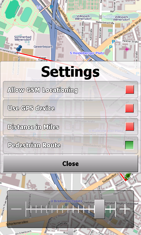
· GPS support and GSM triangulation
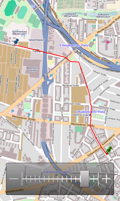
· show actual position on map
· follow-mode to automatically scroll the map
· search addresses
What's New in This Release:
· just a few bugfixes to prevent instabilities on certain phones
What's New in 1.4.3816.9028:
· WebServices updated to match the new OpenMobileMaps website.
Like it? Share with your friends!
If you got an error while installing Themes, Software or Games, please, read FAQ.
Supported operating systems:
Windows Mobile 5.0, Windows Mobile 6 Classic, Windows Mobile 6 Professional, Windows Mobile 6.1 Classic, Windows Mobile 6.1 Professional, Windows Mobile 6.5 Professional
Similar Software:
PocketGIS PocketGIS is a powerful mobile Geographical Information System (GIS) for field data capture which can display and edit map geometry and attributes. PocketGIS brings real GIS functionality to highly portable handheld devices which are lightweight, convenient and have a long battery life
TravelFTPs TravelFTPs - TravelFTPs can be used when you travel. You can set a FTP server to send a 'picture blog' of your trip. The program creates the HTML page and sends the page and pictures to the FTP server.
This program requires that you have both the 'BeanDLL.dll' file ** and ** the runtime files for Visual Basic on your PocketPC computer
GPSRulerer GPSRulerer uses GPS to find two points and uses the "The Vincenty inverse formula for ellipsoids." (accuracy to within 0.5mm, or 0.000015"). Select 'Start GPS' to start the GPS and when you get a lock you can view your current GPS. Tap the button to save it and measure your distance. The map service is provided by Google
FON Access Points for Japan FON Access Points for Japan - FON offers you a new Points of Interest service (POIs). This allows you to download FONspots directly to your navigation device.
What does that mean? You can download a Points of Interest file directly to your navigation device
FON Access Points for Philippines FON Access Points for Philippines - FON offers you a new Points of Interest service (POIs). This allows you to download FONspots directly to your navigation device.
What does that mean? You can download a Points of Interest file directly to your navigation device
GParkS The other day I was at a football game where I had to park on a golf course far from the stadium and ended up wandering around for 20 minutes trying to locate the car afterward
BikeDashboard BikeDashboard- This application provides training assistance (through graphs and stats) + navigation help (with moving maps and GPX file import & export) for mountainbike and roadbike enthusiasts.
BikeDashboard Features:
* Keep a track of their achievements:
o Where they have been.
o How long.
o How fast
chtiGPS chtiGPS is intended to the sportsmen and to hikers, for their training (bicycle, rollers, ski...), but also to locate itself by knowing the distance and the direction from the closest cities. Geolocalization finally makes it possible to reassure its close relations at the time of great exits..
Geo Track Geo Track- basically a software to emulate GPS, by using your nearest cell towers. It allows you to tag your location by providing you with the option for storing one or more descriptions of a location in terms of text and/or pictures.After this, your device will display these textual or image desciptions every time you visit these locations. Visit http://som4tress.blogspot
Other Software by developer «Cipher»:
not found
Comments on OpenMobileMaps:
vitor:
good
Date: 2 Mar 11
If you noted an error or download link is broken, please, report it via this page or use comments.
OpenMobileMaps is compatible with your device TORQ N100