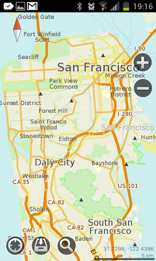
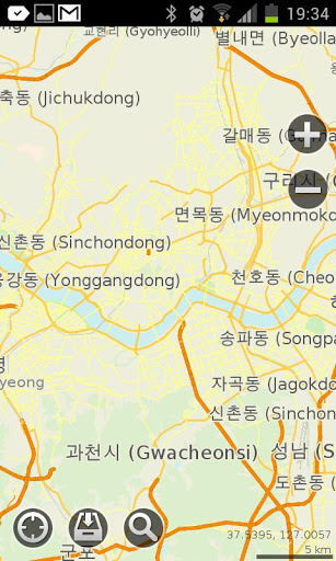
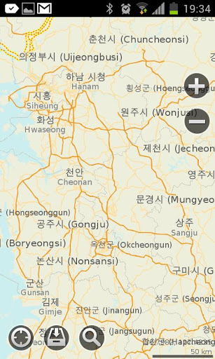
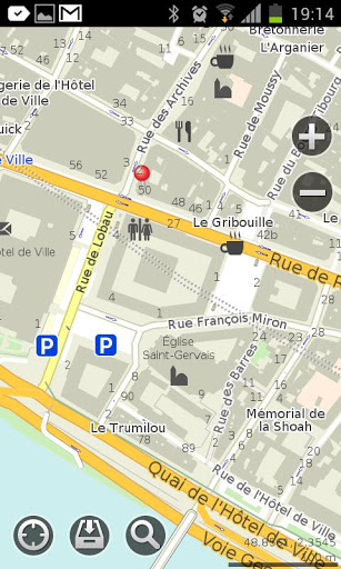
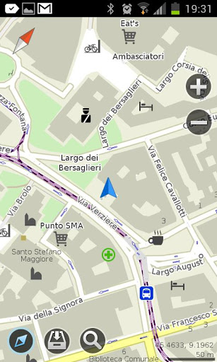
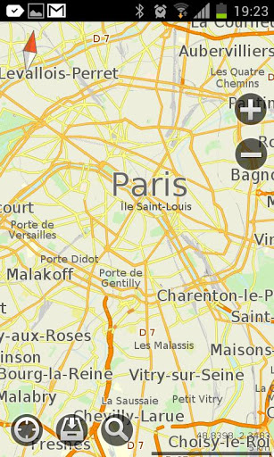
MapsWithMe Pro for Android - MapsWithMe allows you to access maps of all the countries in the world while on the go. The maps are based on OpenStreetMap data and work completely offline, without requiring an internet connection.
With MapsWithMe installed on your iOS device, you can find out your current location using GPS, search for points of interest, bookmark favorite spots, and more. MapsWithMe Pro for Android features:
· All countries, all cities covered
· High level of detail
· Offline search, auto-suggestion feature
· Thousands of POI
· Bookmarks
· GPS positioning and compass
· Map rotation and auto-follow mode
· Vector maps
· Innovative map data compression method
· English, Russian, Spanish, German, Czech, Dutch, Japanese, Korean supported
What's New in This Release:
· Fixed bug on Samsung Galaxy S4 GT-I9500
What's New in 2.5.0:
· Paths/lines/tracks import from KML. Finally you can display and use the lines from other apps in MapsWithMe. Import KML file to MapsWithMe and view the projected route on the map. Further improvements are coming soon.
· Map data updated
· Bug fixes
What's New in 2.4.6:
· Map updates notification. You do not need to check whether new map details are available or not any more. Now the app informs you which maps need to be updated
· Travel guides availability notification. To help you make your travel more enjoyable, we provide reliable country information. Once you've downloaded the map, free travel guide GuideWithMe app can be offered for your destination
· Android 4.3 support
· Map data updated
· Bug fixes
What's New in 2.4.4:
· New option is available: get and copy precise coordinates of any point on the map. Coordinates info is displayed on the POI information screen
· Fresh OpenStreetMap data
· Bug fixes
What's New in 2.3.5:
· We made maps faster!
· Added Poland and Ukraine translations: the option of searching by keywords in native language is enabled for you.
· Optimized for new devices' screens
· Changed UI color theme to white
· Fixed installation issue on some Android devices
What's New in 2.3.4:
· optimized the map brightness and contrast
· changed the map fonts
· fixed the bugs
What's New in 2.3.3:
· Meet a brand new feature - location sharing! It enables you to send a pin to any place on the map via e-mail or sms.
· Traditional Chinese, Korean, Japanese, Dutch, Ukrainian languages added
· API for external apps via geo url scheme added
· Map data updated
· Smoother map handling
What's New in 2.3.2:
· IMPORT/EXPORT OF BOOKMARKS. Share your favorite places with friends via email or add bookmarks from other maps to MapsWithMe. KML/KMZ files are supported.
· "My position" arrow problem fixed
· Map data updated
· Smoother map handling
What's New in 2.3.0:
· Bookmarks feature! Now you are able to mark and save your favorite locations, POI and destinations. The option of creating a group of bookmarks is added
· Improved search: more detailed categories; an option to choose the location where to search is available
· Compass and GPS issues fixed
· Map data updated
What's New in 2.2.1:
· There are lots of improvements and bug fixes in the new version.
Like it? Share with your friends!
Supported operating systems:
Google Android 10.x, Google Android 2.1, Google Android 2.2, Google Android 2.3, Google Android 3.0, Google Android 3.1, Google Android 3.2, Google Android 4.0, Google Android 4.1, Google Android 4.2, Google Android 4.3, Google Android 4.4, Google Android 5.x, Google Android 6.x, Google Android 7.x, Google Android 8.x, Google Android 9.x
AugSatNav Walk AugSatNav is an augmented reality navigation system which overlays walking directions upon a live video feed of the path or road ahead.
With AugSatNav there is no need to follow instructions or interpret maps - you can simply find your way by walking along the route highlighted by a bright white line
Waze Waze is a free, 100% user-generated, social navigation application that allows drivers to build and use live maps & real-time traffic updates to improve their daily commute
UMichBusMap An Android application which shows the live positions of University of Michigan buses overlayed on Google Maps
Latitude Launcher Latitude isn't enabled in the UK, and some other countries, on the T-Mobile G1, however it is enabled on many other phones e.g. Nokia N95. This is frustrating, a Google phone without Google Latitude.
Latitude Launcher can enable Latitude for you if you have 'Rooted' your phone
OSMTracker for Android OSMTracker stands for OpenStreetMap Tracker. It allows you to track your journey and mark significant way points. Way points can be marked with a tag using a button, with a quick voice record, a text note or by taking a picture. The various button pages and layouts can be customized to suit your OpenStreetMap activities
BostonBusMap BostonBusMap is an application for Android phones. It uses GPS data provided by the MBTA to plot the real-time location of buses on a map.
What's New in This Release:
· GPS now turns on when you start the app to allow quicker location lookup times
yozi yozi is a navigation software for the Android platform. It uses digital topographic maps in well-known Ozi Explorer formats for navigation and doesn't require network access like built-in Maps application on Android
amAze GPS light edition amAze GPS light edition provides access to worldwide street maps, full topographic map coverage of the USA and satellite imagery for 200 major cities around the world. It allows you to search in a worldwide rich POI database and you can upgrade to the full version that includes turn-by-turn voice guided navigation from within the application
Other Software by developer «MapsWithMe»:
MAPS.ME Lite for iPhone/iPad 3. MAPS.ME Lite for iPhone/iPad 3. - MapsWithMe allows you to access maps of all the countries in the world while on the go. The maps are based on OpenStreetMap data and work completely offline, without requiring an internet connection
MAPS.ME for iPhone/iPad 3. MAPS.ME for iPhone/iPad 3. - MapsWithMe allows you to access maps of all the countries in the world while on the go. The maps are based on OpenStreetMap data and work completely offline, without requiring an internet connection
MapsWithMe Pro for iPhone/iPad MapsWithMe Pro for iPhone/iPad - MapsWithMe allows you to access maps of all the countries in the world while on the go. The maps are based on OpenStreetMap data and work completely offline, without requiring an internet connection
MAPS.ME for Android MAPS.ME for Android - MapsWithMe allows you to access maps of all the countries in the world while on the go. The maps are based on OpenStreetMap data and work completely offline, without requiring an internet connection
MapsWithMe Lite for iPhone/iPad MapsWithMe Lite for iPhone/iPad - MapsWithMe allows you to access maps of all the countries in the world while on the go. The maps are based on OpenStreetMap data and work completely offline, without requiring an internet connection