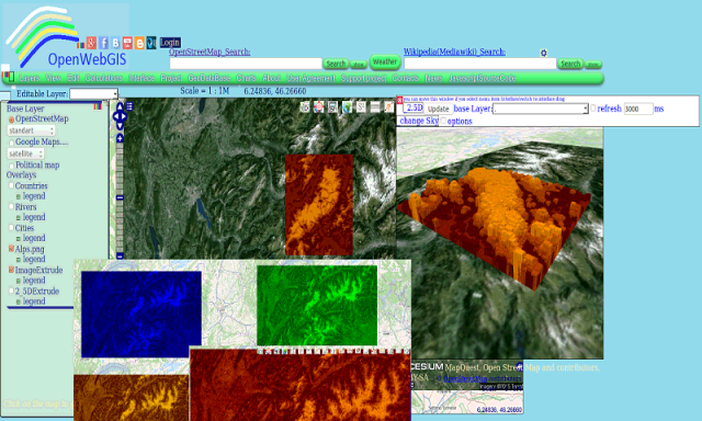
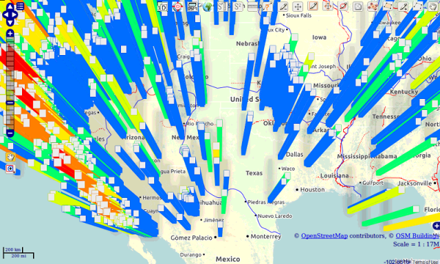
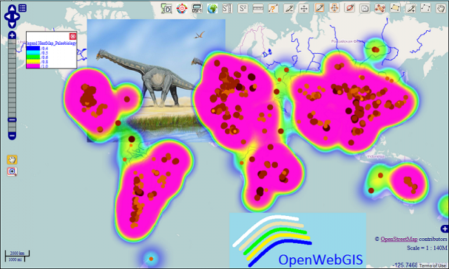
OpenWebGIS - OpenWebGIS is created for everyone who wishes to see and use a new free&open Geographic Information System(GIS). Please make your comments and suggestions. In this GIS you can use the extensive mathematical functionality to calculate and analyze your data. Using OpenWebGIS you will get a GIS at your disposal, it may be similar in functionality to some desktop GIS. Please support this project. The OpenWebGIS for Android has online and local version. In local version, you can use OpenWebGIS without having to connect to the server of OpenWebGIS and even without Internet connection. In local version, some functions do not work, but in future there will be the modification of these functions for the local version. The OpenWebGIS blog (http://openwebgisystem.blogspot.com/) provide a lot of information about possibilities for users' data operating. Full list of articles about OpenWebGIS: http://openwebgisystem.blogspot.com/2015/08/list-of-articles-about-openwebgis-in.html
Like it? Share with your friends!
Supported operating systems:
Google Android 10.x, Google Android 3.0, Google Android 3.1, Google Android 3.2, Google Android 4.0, Google Android 4.1, Google Android 4.2, Google Android 4.3, Google Android 4.4, Google Android 5.x, Google Android 6.x, Google Android 7.x, Google Android 8.x, Google Android 9.x
Similar Software:
learn Ember JS learn Ember JS - This tutorial is designed for software programmers who wants to learn the basics of BackboneJS and its programming concepts in simple and easy ways. This tutorial will give you enough understanding on components of EmberJS with suitable examples
SEO Webpage Analysis SEO Webpage Analysis - Key Features:
- Provides a report of all the on-page SEO factors from your website including meta tag information, web page content, links on the page, image alt tags and anchor text.
- Provides recommendations on how on-page SEO factors on your website can be improved to help your ranking in natural search results
Learn XSLT Learn XSLT will teach you basics of XSLT
Learn LTE Learn LTE - LTE stands for Long Term Evolution and it was started as a project in 2004 by telecommunication body known as the Third Generation Partnership Project (3GPP). LTE evolved from an earlier 3GPP system known as the Universal Mobile Telecommunication System (UMTS), which in turn evolved from the Global System for Mobile Communications (GSM)
Learn LISP Learn LISP - This reference has been prepared for the beginners to help them understand the basic to advanced concepts related to LISP Programming language. Lisp is the second-oldest high-level programming language after Fortran and has changed a great deal since its early days, and a number of dialects have existed over its history
UnicodeMidlet UnicodeMidlet provides a user interface for browsing all of the unicode characters on Java ME phones
Learn JSF Learn JSF - This tutorial has been prepared for the beginners to help them understand basic JSF programming. After completing this tutorial you will find yourself at a moderate level of expertise in JSF programming from where you can take yourself to next levels
Learn JFreeChart Learn JFreeChart - This tutorial describes various ways to incorporate JFreeChart in Java based standalone and web based applications. It will give you a quick start with JFreeChart and make you comfortable with JFreeChart programming with Java applications
Comments on OpenWebGIS:
Comments not found
If you noted an error or download link is broken, please, report it via this page or use comments.
OpenWebGIS is compatible with your device Uniscope U558D