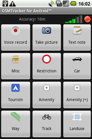
OSMTracker stands for OpenStreetMap Tracker. It allows you to track your journey and mark significant way points. Way points can be marked with a tag using a button, with a quick voice record, a text note or by taking a picture. The various button pages and layouts can be customized to suit your OpenStreetMap activities. You can view your current track on top of an OpenStreetMap background.
The track is then exported in GPX format, ready to use in OSM tools like JOSM.
This project has been mainly inspired by the great OSMTracker for Windows Mobile devices.
· Fix OSM upload on Android 3 and more.
· Fix issue with non-ASCII characters in OSM upload.
· Retain original filename when uploading.
· Updated translations.
What's New in 0.6.2:
· Fixed menu not appearing on Android 3+ devices.
· Various changes for Transifex compatibility.
What's New in 0.6.0:
· Upload tracks to OpenStreetMap.
· Mass GPX-export of tracks.
· Fix issue with GPX files invisible on some phones (Galaxy Nexus).
What's New in 0.5.8:
· Way points are now displayed on the map.
· Minor bug fixes in GPX export.
· Updated translations: IT, IW, FR, RU, NN, NB.
What's New in 0.5.8:
· Now requires Android 2.1.
· Fix for background tracking unexpectedly stopping and parts of track lost for Android 2.x and after.
· Track list now shows the most recent first.
· Access way points list from track details screen.
· Minor layout fixes and improvements.
· Minor OSM background map improvements.
· Ensure GPX files are XML schema-compliant
· Updated translations: NO, PL, RU, JA, FR.
What's New in 0.5.6:
· Fixed bug when using internal memory for storage
· Added menu to delete all tracks at once
· Various minor improvements
· Updated translations: SK, NN
What's New in 0.5.5:
· Fixed Market packaging issue
What's New in 0.5.3:
· Fixed screen rotation issues when entering a note.
· Fixed GPS logging interval handling.
· Fixed notification problems.
· Screen can now automatically be turned off.
· Ability to pause and resume tracking.
· Ability to stop tracking from the track list.
· Performance improvements on track list.
· New/updated translations: Slovak, Italian, German, Brazilian Pt.
What's New in 0.5.1:
· Various bug fixes.
· Updated DE translation.
· Ability to display a previous track from the track list.
Like it? Share with your friends!
Supported operating systems:
Google Android 1.5, Google Android 1.6, Google Android 10.x, Google Android 2.0, Google Android 2.1, Google Android 2.2, Google Android 2.3, Google Android 3.0, Google Android 3.1, Google Android 3.2, Google Android 4.0, Google Android 4.1, Google Android 4.2, Google Android 4.3, Google Android 4.4, Google Android 5.x, Google Android 6.x, Google Android 7.x, Google Android 8.x, Google Android 9.x
Similar Software:
BigTinCan Speed Proof Speed Proof logs your current speed, location and so on to a GPX file as fast as the GPS chip updates the system
AugSatNav Walk AugSatNav is an augmented reality navigation system which overlays walking directions upon a live video feed of the path or road ahead.
With AugSatNav there is no need to follow instructions or interpret maps - you can simply find your way by walking along the route highlighted by a bright white line
GPS OnOff Simple GPS toggle widget (1×1) for Android.
Allows you to toggle On/Off your GPS state with only 1 click instead of 4
Hunting the Snark Hunting the Snark - Inspired by Lewis Carrol's poem, The Hunting of the Snark, Hunting the Snark is an action game played on both your GPS-enabled Android device and in the real world. In it, you hunt a Snark (the creature on the map in blue.) If you invade its physical location before the game time has expired, you win. Otherwise, you lose
TomTom Mexico for Android TomTom Mexico for Android - TomTom Mexico is a turn-by-turn GPS navigator for Android devices. The app includes accurate offline maps, so you can find your way anywhere, even without an internet connection
GPSbySMS (Android) GPSbySMS is an application that reads navigation data from GPS and sends it to any user via SMS or email.
Purpose:
1) Read navigation data from GPS and send it to any user via SMS or email.
2) View current position on Maps (need Internet connection).
3) Save navigation data in database using data transfer via GPRS Internet.
4) Alarm Function
Local Local - Local is your best application to find any place you are looking for near you. Local offers you so easy and customized search with best filtered results, show you places as per user ratings. You can see complete details of a local place like opening and closing timings, map, Google+ profile, users reviews, price range
TomTom Poland for Android TomTom Poland for Android - TomTom Poland is a turn-by-turn GPS navigator for Android devices. The app includes accurate offline maps, so you can find your way anywhere, even without an internet connection
GoPenS GoPenS is an OpenSource GPS application for Android phones, based on OpenStreetMap (OSM). OpenStreetMap is a collaborative map of the world. Therefore, one of the main functions of the application is to be able to record a trace and send it as a GPX to the OSM servers, and so edit the OSM Map
GPS Map Search Compass & Track An app for all the purpose so what you're waiting for....!!! Yes.... creatiosoft proudly introduced an awesome GPS Toolbox where you can do anything whatever you desired. Lets track all the locations of yourself via GPS where you are expedition
Other Software by developer «Nicolas Guillaumin»:
not found
Comments on OSMTracker for Android:
Comments not found
If you noted an error or download link is broken, please, report it via this page or use comments.
OSMTracker for Android is compatible with your device Vertu Aster VM-01 LTE-A