GPS Speedometer & Flashlight - GPS Speedometer & Flashlight is a free app for Android devices with built-in GPS receiver. It functions as a normal speed gauge found in every car, displaying the velocity of the vehicle.
In addition, the software includes an easy to use flashlight. Simply tap the green button in the upper right corner of the screen to switch it on or off.
GPS Speedometer & Flashlight features:
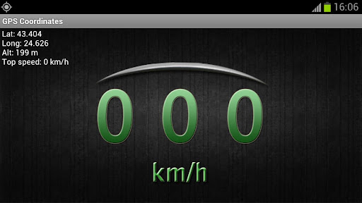
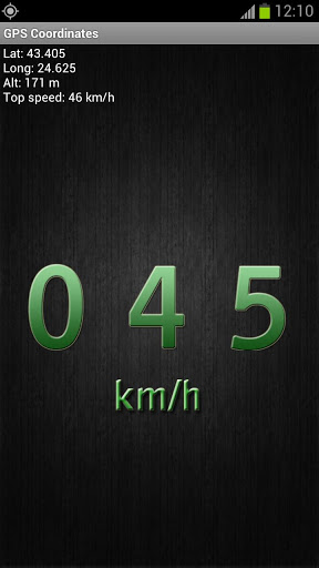
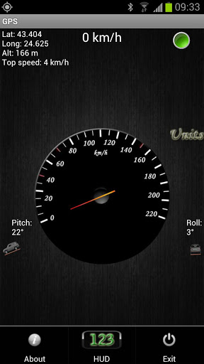
· GPS coordinates - shows longitude, latitude and altitude, as well as top speed
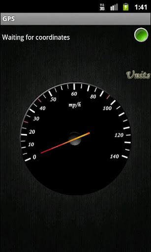
· GPS speed - shows current speed and maximum velocity
· Vehicle position - shows the pitch and roll of the car
· Units - the analog speedometer dial can be either in miles or kilometers per hour
· HUD (heads-up display) - shows velocity with large green numbers
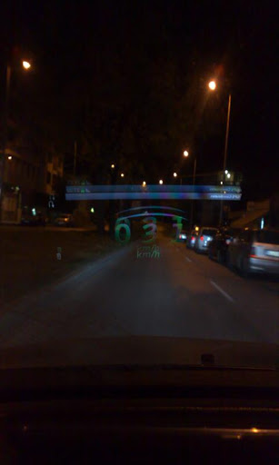
· Mirror HUD mode - a mirror view of the digits allowing speed readings to be reflected from the windshield at night
What's New in This Release:
· Added flashlight, using the LED on your device
· Choose between Imperial or Metric units for the GPS
· Added max speed for current trip
· Added Altitude for the GPS
· Added Pitch and Roll with an SUV visualization
· Added HUD element
Like it? Share with your friends!
Supported operating systems:
Google Android 1.0, Google Android 1.5, Google Android 1.6, Google Android 10.x, Google Android 2.0, Google Android 2.1, Google Android 2.2, Google Android 2.3, Google Android 3.0, Google Android 3.1, Google Android 3.2, Google Android 4.0, Google Android 4.1, Google Android 4.2, Google Android 4.3, Google Android 4.4, Google Android 5.x, Google Android 6.x, Google Android 7.x, Google Android 8.x, Google Android 9.x
Similar Software:
VGPS (Vietnamese GPS) for Android VGPS was designed to use city street map on your ordinary mobile phone without the need of having GPS receiver or internet connection. VGPS does not require internal or external GPS receiver. However, if you have internal GPS receiver or external bluetooth GPS receiver, VGPS can work with your GPS receiver as well
Navitel Navigator Android “Navitel Navigator” is a unique and accurate navigation system. Detailed Russia map. Free traffic jams information service. SPEEDCAMs. The most detailed map of Russia: more than 118 000 cities and towns, 1500 of them contain address search information. The most detailed Moscow and Saint-Petersburg map
AndNav2 (Android) AndNav2 is a navigation system for Android-powered phones. AndNav2 is based on free mapdata by OpenStreetMap.org. AndNav2 will provide full audible turn-by-turn realtime route-guidance. AndNav2 has unique features, like Text-2-Speech, an accessibility-study (aka 'Where can I get in 30 minutes') or avoiding customizable areas, i.e
PhonAlarm PhonAlarm - Start PhonAlarm to make surroundings, friends/family aware of an emergency, and with the GPS location started in your phone, they can immediately locate you. How can PhonAlarm help you and how does it work? If a situation is emerging where you need to be assisted by others, e.g
amAze (LG) AmAze is a first of its kind free navigation and local search service. It is free to download and use and it contains wide coverage of maps including aerial photo in Europe, North America, Australia and parts of Asia and Africa
AugSatNav Walk AugSatNav is an augmented reality navigation system which overlays walking directions upon a live video feed of the path or road ahead.
With AugSatNav there is no need to follow instructions or interpret maps - you can simply find your way by walking along the route highlighted by a bright white line
NAVIGON MobileNavigator NAVIGON MobileNavigator - Turn your Android phone into a mobile navigation device with lots of useful functions that will delight you! The pocket navigation device will show you the right way with functions such as Reality View Pro and Lane Assistant Pro
Redpin The aim of the Redpin project is to create an open source system that allows indoor positioning up to room-level description using mobile phones
amAze (Android) AmAze is a first of its kind free navigation and local search service. It is free to download and use and it contains wide coverage of maps including aerial photo in Europe, North America, Australia and parts of Asia and Africa
Mobbyway Mobbyway based on both internet mobile technologies and GPS, Mobbyway allows you to know easily, at any time, your relatives’ exact position on a map if they have accepted it and if they are connected to the network.Mobbyway is also a help on the road network with a local alert system of a dangerous zone which is carried out with the network of members
Other Software by developer «Kaloyan Beshev»:
not found
Comments on GPS Speedometer & Flashlight:
Comments not found
If you noted an error or download link is broken, please, report it via this page or use comments.
GPS Speedometer & Flashlight is compatible with your device WellcoM A66


 for Android")

")

")


")
