GPS Essentials - Turn your phone into a fully-featured GPS receiver!
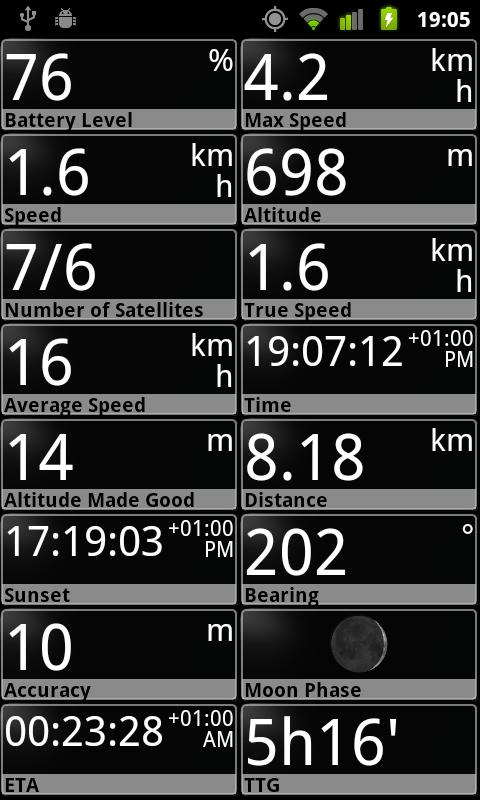
★★★ Dashboard ★★★
Shows navigation values such as: Accuracy, Altitude, Speed, Battery, Bearing, Climb, Course, Date, Declination, Distance, ETA, Latitude, Longitude, Max Speed, Min Speed, Actual Speed, True Speed, Sunrise, Sunset, Moonset, Moonrise, Moon Phase, Target, Time, TTG, Turn.
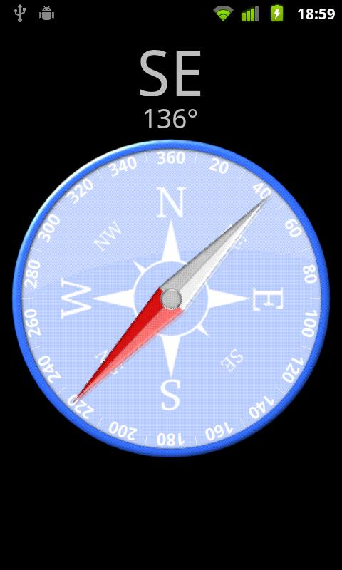
★★★ Compass ★★★
Show the orientation of the earth's magnetic field, shows an arbitrary tracking angle and the current target.
★★★ Camera ★★★
A camera HUD (heads-up display) view to show your waypoints.
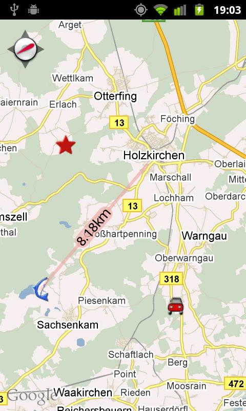
★★★ Map ★★★
A map to show your waypoints. Convert mail addresses of your contacts to waypoint so that they can be used within the app.
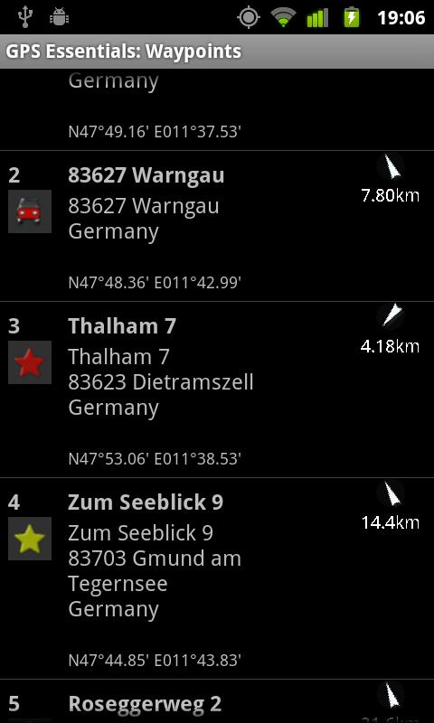
★★★ Waypoints ★★★
A list of all your waypoints with export and import (KML-format).
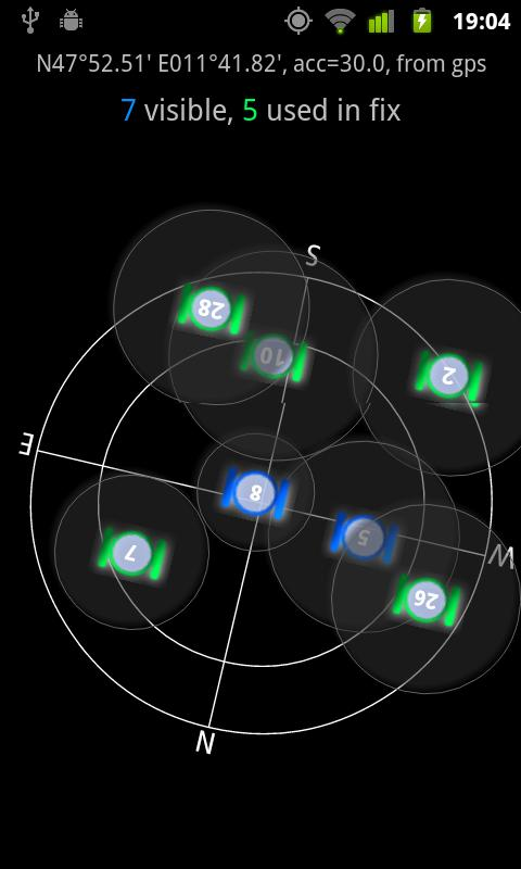
★★★ Satellites ★★★
A sky view of the current positions that shows satellites in view.
Please open the web page below for more info, send me emails for support. I CANNOT HELP IF YOU SIMPLY PLACE A COMMENT HERE.
Purchase the "GPS Essentials Donation Plugin" on Android Market if you want to support development.
Like it? Share with your friends!
Supported operating systems:
Google Android 1.5, Google Android 1.6, Google Android 10.x, Google Android 2.0, Google Android 2.1, Google Android 2.2, Google Android 2.3, Google Android 3.0, Google Android 3.1, Google Android 3.2, Google Android 4.0, Google Android 4.1, Google Android 4.2, Google Android 4.3, Google Android 4.4, Google Android 5.x, Google Android 6.x, Google Android 7.x, Google Android 8.x, Google Android 9.x
Similar Software:
Mobile Spy Track EVERY move your child or employee makes using our POWERFUL cell phone monitoring technology to expose the TRUTH!Mobile Spy is a hybrid software/service which allows you to monitor our child or employee's smartphone in real time
Share Path Share Path - Although e-maps and GPS can provide accurate navigation, we are confined on the basis of the existing database. Many times we may go to a place which cannot be found on the e-map. For example, go to a club with friends; on a vacation to the countryside near the lake where we have never been to
amAze (LG) AmAze is a first of its kind free navigation and local search service. It is free to download and use and it contains wide coverage of maps including aerial photo in Europe, North America, Australia and parts of Asia and Africa
gOmniTracker (Android) GOmniTracker wonder where was your teenager spending time last night? or when did they leave school, home, or tennis-practice? Or maybe its granny you are concerned about whether she got back home from the park yet? gOmniTracker can answer these questions, and more, right from your Mobile Device
WRU? Wondering where your children are, or what your elderly parents are doing? Have them install WRU? on their phone, and you can find out their location at any time using SMS.recipient with WRU installed
MyCar Locator Free MyCar Locator Free - Use MyCar Locator to remember where you park and guide you back to your car!
MyCar Locator free is the easiest to use car locator on the market, with all essential information displayed at all times
PhonAlarm PhonAlarm - Start PhonAlarm to make surroundings, friends/family aware of an emergency, and with the GPS location started in your phone, they can immediately locate you. How can PhonAlarm help you and how does it work? If a situation is emerging where you need to be assisted by others, e.g
NearMe NearMe application gives you a fast and easy way to find places near you. In addition, you can set the area (in Km) where to search. With every found place you have some useful options:
* Call
* Add To Contacts
* Open In Maps
* Get Directions
And other option is History: it keeps for you all places you have searched for
Mileage (Android) Mileage is a mileage tracker for an Android-powered phones. Allows importing and exporting of data in various formats, so it is easy to sync with your existing logs. Supports GPS recording
Nöbetçi Eczaneler Ankara Nöbetçi Eczaneler Ankara - Ankara Eczacı Odası'ndan günlük olarak alınan bilgiler doğrultusunda, uygulamamızda ilçenizi seçerek, bölgedeki nöbetçi eczanelerin bilgilerine ulaşabilirsiniz
Other Software by developer «mictale»:
not found
Comments on GPS Essentials:
Anton:
Free download gps essentials how?
Date: 30 Mar 13
If you noted an error or download link is broken, please, report it via this page or use comments.
GPS Essentials is compatible with your device WellcoM A69


")


")
