Categories: Internet & Communications, Travel & Navigation
Upload date: 5 Nov 11
Developer: Waze
License: Freeware
Downloads: 4814 File Size: 8774 Kb
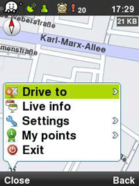
Waze: Community GPS navigation - Waze is a free, 100% user-generated, social navigation app that allows drivers to build and use live maps & real-time traffic updates to improve their daily commute.
In addition to providing turn-by-turn navigation, waze also gives drivers the ability to actively update one other on traffic, police traps, construction, speedcams and more, reflecting a live description of the road at any given moment and because it's user-generated, the more people who use it, the better (and more fun) it gets!
Here is what users are saying about us:
* Im in love already! I don't usually get this excited about things, but I am about waze.
* Coolest navigation app I've seen in a while, hope more people sign up in my area!!
* Waze is an amazing collaborative GPS mapping application!
***
Constantly-updated road map
Real-time traffic updates
Automatic rerouting
Live reports from users on the road
Turn-by turn directions
Road tweets - Twitter integration
Picture sharing from the road
Like it? Share with your friends!
Supported operating systems:
Google Android 1.0, Google Android 1.5, Google Android 1.6, Google Android 10.x, Google Android 2.0, Google Android 2.1, Google Android 2.2, Google Android 2.3, Google Android 3.0, Google Android 3.1, Google Android 3.2, Google Android 4.0, Google Android 4.1, Google Android 4.2, Google Android 4.3, Google Android 4.4, Google Android 5.x, Google Android 6.x, Google Android 7.x, Google Android 8.x, Google Android 9.x
Similar Software:
Twitter Twitter - Discover what’s happening right now, anywhere in the world with the official Twitter for Android app. Realtime search, trending topics and maps show whats happening now everywhere and nearby. Tweet, send DMs, share photos, videos and links to your friends and the world
Simply Facebook Simply Facebook is a light, simple, extensible Java library for accessing and modifying data available through the Facebook API. This is a useful tool on the Android platform, as the SDK does not ship with any means for accessing the Facebook API.
This library uses the Desktop mode approach for authentication
FB Album Small error in process of fixing. When open a gallery scroll then it will work Access Facebook(tm) Albums in a user friendly way! Simply scroll through your list of friends and click their name. The best facebook photo viewer available
Ashley Madison Dating Ashley Madison Dating - Are you .... Looking? Ashley Madison is the place for Dating & Affairs.....Shhhhhhhhh
Feeling neglected and in need of some excitement? You came to the right place
Let's Coffee (Android) Let's Coffee - The main objective of the project Let's Coffee is mood! It tries to create a real-time social network using the most advanced technologies. Probably everyone always had the desire to simply go to a cafe and have coffee with friends. But we closed our eyes and passed by, because drinking coffee alone is boring and not interesting
HootSuite (Twitter & Facebook) HootSuite for Android: Manage Twitter, Facebook, and Foursquare from one place. Manage multiple social networks on the go with HootSuite for Android. Now supports multiple Twitter, Facebook, and Foursquare accounts
Goojet (Android) Having Goojet on your mobile phone instantly gives you access to a real-time feed of news, blogs, videos, user-generated posts, etc... from all across the mobile Web, tailored to your preferences and filtered out by the community
1337pwn.com XBOX Live Friends 1337pwn.com XBOX Live Friends - XBOX Live Friends with notifications - Official XBOX Community Developer
XBOX Live Friends List for the Android platform from the team at
1337pwn.com
. Now you can check in on your XBOX 360 friends while you're on the go. The application even generates notifications when gamertags come online
ANDRICO ANDRICO is an Android application which enables users to synchronize data from FaceBook, such as friends contacts, events information and so on
Swift Twitter Swift Twitter - Fast, small, simple and powerful Twitter client for Android.
What's New in This Release:
· Conversation Threads
· Img
Other Software by developer «Waze»:
waze Waze - Waze is a free, 100% user-generated, social navigation application that allows drivers to build and use live maps & real-time traffic updates to improve their daily commute
Waze Waze is a free, 100% user-generated, social navigation application that allows drivers to build and use live maps & real-time traffic updates to improve their daily commute
Waze Waze is a free, 100% user-generated, social navigation application that allows drivers to build and use live maps & real-time traffic updates to improve their daily commute
Waze (iPhone/iPad) Waze is a free, 100% user-generated, social navigation application that allows drivers to build and use live maps & real-time traffic updates to improve their daily commute
Waze Waze is a free, 100% user-generated, social navigation application that allows drivers to build and use live maps & real-time traffic updates to improve their daily commute


")
")
")


")
