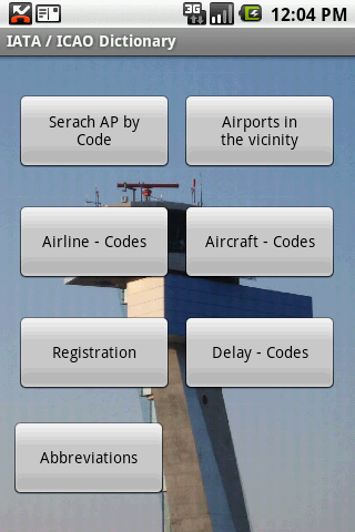
IATA / ICAO Dictionary -This application is an offline database for IATA / ICAO airport, airline, aircraft, delay codes and aircraft registration codes.
The airport database provides:
- Name
- Elevation
- Latitude and Longitude coordinates,
- timezone,
- runway and communication information (not every airport)
- Metar / TAF reports (not every airport)
- google map (not every airport)
- sunrise / set calculation
- find other airport in the vicinity of the selected airport or from your present position (GPS required)
- calculate the distance to the selected airport (GPS required)
The airline database provides:
- Name
- Country
- Callsign
- picture of the airline with airliners.net
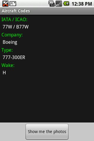
The aircraft database provides:
- Company
- Type
- wake category
- picture of the aircraft with airliners.net
Other functions are:
AC registrations; selection by
- country - registration
- registration - country
Delay codes
general aviation abbreviations
Like it? Share with your friends!
Supported operating systems:
Google Android 1.5, Google Android 1.6, Google Android 10.x, Google Android 2.0, Google Android 2.1, Google Android 2.2, Google Android 2.3, Google Android 3.0, Google Android 3.1, Google Android 3.2, Google Android 4.0, Google Android 4.1, Google Android 4.2, Google Android 4.3, Google Android 4.4, Google Android 5.x, Google Android 6.x, Google Android 7.x, Google Android 8.x, Google Android 9.x
Similar Software:
Avtobuser Avtobuser - are you waiting for a bus too long? You will not have to waste your time thanks to this application anymore. Choose the type of vehicle and get the information on its arrival. The application determines your location and can find the nearest stops even if you don't know the exact name
Hotels.com: Hotel reservation Hotels.com: Hotel reservation - is a big catalogue of hotels of different classes and price range. You can book a hotel in any part of the planet with the help of this application. You can choose a hotel by the category of stars as well as according to the comments of real guests
SBS Transit iris SBS Transit iris - iris is the acronym for "Intelligent Route Information System" which provides bus travel information to enhance commuters' travel experience with SBS Transit. iris offers two applications to help the commuters better plan their journeys: a) iris NextBus and b) iris Journey Planner
Hotels.com - Book hotels Hotels.com - Book hotels - Book your choice of over 20,000 last minute deals
SG Buses SG Buses - SG Buses is a Bus Guide for Singapore Android users with estimated arrival time
Features:
- load arrival time for SBS and some SMRT buses
- show nearby bus stops
- show bus routes
- show bus stops in map
- search buses, roads, bus stops and bus stop no
- bookmark buses and bus stops
For bugs report,
twitter
aMetro aMetro - shows the maps of transit systems all over the world - subways, metro, buses, trains, and other. You can find the right route between stations and estimate travel time.
What's New in This Release:
· Spanish translation
Sabka Traffic Sabka Traffic is India's first real time premier mobile and internet based traffic reporting system. Traffic is collected and intelligently aggregated into our models using various algorithms and techniques
Bucharest metro This app grants you fast acces to the last Bucharest metro map, no internet connection needed once it has been installed. Full zoom controls. Fast, light and simple
MBTA Transit MBTA Transit - Get real time departure information and vehicle tracking for MBTA Transit.
Program Features:
-----------------
1) Track real time departures for MBTA Transit agency.
2) Set up reminders for the earliest next departure for any stop, any route.
3) Save locations of your favorite stops and set up proximity alerts to fire when you approach near them
Sydney Metro This app grants you fast acces to the last Sydney metro map, no internet connection needed once it has been installed. Full zoom controls. Fast, light and simple
Other Software by developer «Steve Dexter»:
Aviation Weather with Decoder Aviation Weather with Decoder - An easy way to receive metar and TAF reports from NOAA
Snowtam Decoder Snowtam Decoder - You have a snowtam in the metar report, you want to decode. Snowtam Decoder does it for you.
· Decoding of a snowtam in metar format
· Explanation of the items (A ,B , C, ..
Guess the X Guess the X - With this game you can guess a flag, a capital, a land and boundaries.
There are four input methods available to enter the answer: an autocomplete editbox, via a listview, multiple choice and a tap mode.
There are also options to change the color, size and font