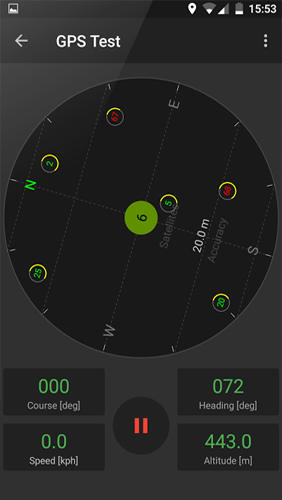
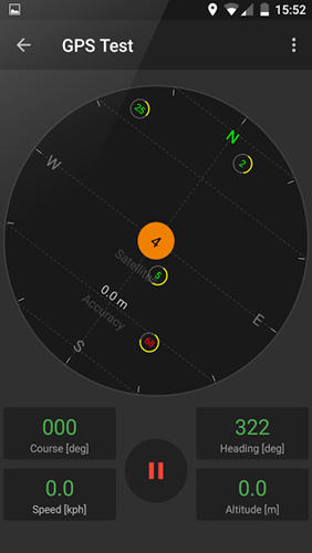
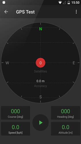
GPS Tools - is an application for calibration of a satellite module of your smartphone. The utility uses a magnetic compass, makes changes to the route, speed and accuracy of the displayed data. As soon as the calibration is completed you can track your location with maximum accuracy.
Game features:
Magnetic compass
Commercial free
Fast calibration
Big number of satellites
Like it? Share with your friends!
Supported operating systems:
Google Android 10.x, Google Android 4.4, Google Android 5.x, Google Android 6.x, Google Android 7.x, Google Android 8.x, Google Android 9.x
Similar Software:
Mobile PocketFinder® tm - G1 Mobile PocketFinder® tm - G1 - allows family or friends to see the location of your BlackBerry® phone worldwide from any computer or phone using www.pocketfinder.com. Information like speed, heading, address and altitude can be viewed instantly
TripComputer TripComputer is a personal off-road GPS navigation utility software for Android phones, that has been created for active people, who love travel by hike or bike.
The application does not use Internet connection or Google Maps for navigation or track recording, but you can share your data to others, or store your data on server
My Fleet Geofence My Fleet Geofence - Why do you need My Fleet Geofence application?
1. With My Fleet Geofence, you can create a specific "safe zone" or "unauthorized zone" on a map and get an E-mail Alert if the phone leaves the area.
2. Receive an instant alert in case of breach of specific zone.
How to start?
1. Install the application on your Android phone.
2
Navitel Navigator Android “Navitel Navigator” is a unique and accurate navigation system. Detailed Russia map. Free traffic jams information service. SPEEDCAMs. The most detailed map of Russia: more than 118 000 cities and towns, 1500 of them contain address search information. The most detailed Moscow and Saint-Petersburg map
My Family Geofence 1. With My Family Geofence, you can create a specific "safe zone" or "unauthorized zone" on a map and get an E-mail Alert if the phone leaves the area.
2. Receive an instant alert in case of breach of specific zone
Satsports Log Satsports Log is your general sport app. Ideal for running, cycling, mountain biking, hiking and walking. It also has some fun visual features such as maps and graphs of your elevation, speed and pace. Real time Statistics: Satsports-log has all the stats you could wish
OpenSatNav OpenSatNav brings open-source satellite navigation to Android handsets.
· All code is open source.
· Global maps and navigation based on OpenStreetMap data
· Navigation by car, bicycle or by foot
MapMyHike+ for Android MapMyHike+ for Android - MapMyHike is a mobile assistant designed to allow hikers to track their activities using their phone's built-in GPS.
With the app you can view your route on a map and record your trip details, including duration, distance, pace, speed and elevation.
You can also share the details of your activity with friends via Facebook, Twitter or email
Quovady for Android Quovady is a service that allows you to ask your friends, your family or coworkers "where are you?", let them know of your whereabouts or track their location if they gave you permission to do so
GPS Tracker GPS Tracker is used to monitor activity of android GPS device and send data to the server
Comments on GPS Tools:
Comments not found
If you noted an error or download link is broken, please, report it via this page or use comments.
GPS Tools is compatible with your device Xiaomi Redmi Note 8 Pro Standard Edition Dual SIM TD-LTE CN 64GB M1906G7E (Xiaomi Begonia)

")