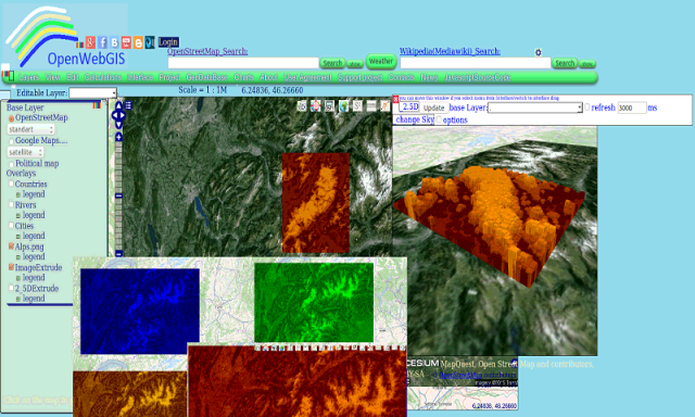
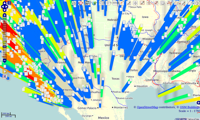
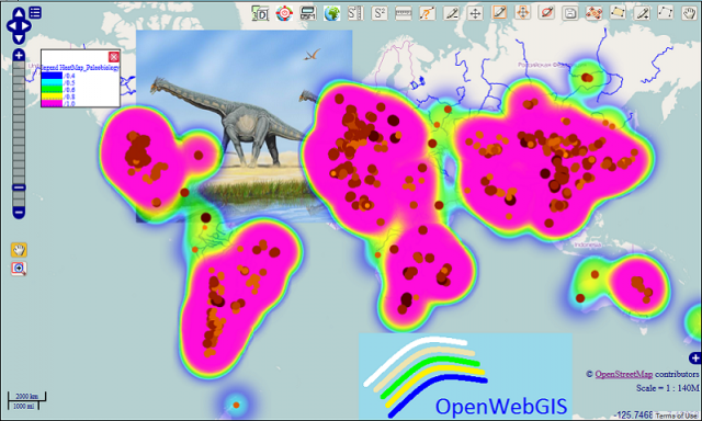
OpenWebGIS - OpenWebGIS is created for everyone who wishes to see and use a new free&open Geographic Information System(GIS). Please make your comments and suggestions. In this GIS you can use the extensive mathematical functionality to calculate and analyze your data. Using OpenWebGIS you will get a GIS at your disposal, it may be similar in functionality to some desktop GIS. Please support this project. The OpenWebGIS for Android has online and local version. In local version, you can use OpenWebGIS without having to connect to the server of OpenWebGIS and even without Internet connection. In local version, some functions do not work, but in future there will be the modification of these functions for the local version. The OpenWebGIS blog (http://openwebgisystem.blogspot.com/) provide a lot of information about possibilities for users' data operating. Full list of articles about OpenWebGIS: http://openwebgisystem.blogspot.com/2015/08/list-of-articles-about-openwebgis-in.html
Like it? Share with your friends!
Supported operating systems:
Google Android 10.x, Google Android 3.0, Google Android 3.1, Google Android 3.2, Google Android 4.0, Google Android 4.1, Google Android 4.2, Google Android 4.3, Google Android 4.4, Google Android 5.x, Google Android 6.x, Google Android 7.x, Google Android 8.x, Google Android 9.x
Similar Software:
Learn Mahout Learn Mahout - Apache Mahout is an open source project that is primarily used in producing scalable machine learning algorithms . This brief tutorial provides a quick introduction to Apache Mahout and explains how it can be applied to make recommendations and organize documents in more useable clusters
Aptoide Uploader Aptoide Uploader is an Android application that allows one to upload his Android applications to his own Bazzar repository (bazaarandroid.com), taking advantage of Bazaar's new webservices API
Icon Computer Computer Education, Software Download, Movie Download and lots of fun at the one place
SEO Webpage Analysis SEO Webpage Analysis - Key Features:
- Provides a report of all the on-page SEO factors from your website including meta tag information, web page content, links on the page, image alt tags and anchor text.
- Provides recommendations on how on-page SEO factors on your website can be improved to help your ranking in natural search results
Learn LinQ Learn LinQ - The aim of this tutorial is to offer an easy understanding of LINQ to the beginners who are keen to learn the same. The acronym LINQ is for Language Integrated Query. Microsoft’s query language is fully integrated and offers easy data access from in-memory objects, databases, XML documents and many more
ColorCalculator Calculate as many solid plain stepwise fading hexadecimal color tone values as you like in between two entered colors
Learn XSLT Learn XSLT will teach you basics of XSLT
Learn JSON v2 Learn JSON v2 - JSON or JavaScript Object Notation is a lightweight and text-based open standard designed for human-readable data interchange. The JSON format was originally specified by Douglas Crockford, and is described in RFC 4627. The official Internet media type for JSON is application/json. The JSON filename extension is .json
Comments on OpenWebGIS:
Comments not found
If you noted an error or download link is broken, please, report it via this page or use comments.
OpenWebGIS is compatible with your device Xplore Ranger X