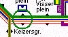
Visitor Guide Metro+ Amsterdam is a route planner for the Metro, Tram and local National Rail network of Amsterdam. It consists of two maps:
The Metro and local National Rail network of Amsterdam
The Tram of Amsterdam.
Other Cities available.
Visitor Guide Great Features:
Visitor Guide allows you to load one or more maps, find any location on these maps, plan a trip from one location to another (which doesn't have to be on the same map), and calculate the shortest route between these locations.
The route can be displayed as a list of travel directions or graphically as an animated display combined with travel directions.
The route animation can be shown in a forward and backward direction
The route animation can be shown step-by-step, or as a fluid movement
During route animation the travel directions for the current location are displayed
You can block locations and lines.
Visitor Guide will exclude blocked locations and lines from the calculated route.
With one Click Visitor Guide can calculate the reverse route.
You can force Visitor Guide to go via a certain location.
Visitor Guide uses a split window. The top window displays the map; the bottom window displays textual information like travel directions.
Select the location with the stylus in the top window and information about this location is immediately displayed in the bottom window. Using the toolbar you can easily select a selected location as departure or destination.
When Visitor Guide is started it reserves 2/3 of the screen for the map and 1/3 for text. You can change this ratio by dragging the split window border with the stylus.
When Visitor Guide is started it detects the maps that are present. If there is only one map it will load this map automatically. If there is more than one map Visitor Guide will display the available maps allowing you to select one or more maps to load.
Find any location on the maps using the Find Location by Type function or the Find Location by Network function.
Visitor Guide offers extended Help.
Like it? Share with your friends!
If you got an error while installing Themes, Software or Games, please, read FAQ.
Supported operating systems:
Pocket PC 2002, WinCE.Net 3.0, WinCE.Net 4.0, WinCE.Net 5.0, WinCE.Net 6.0, Windows Mobile 2003, Windows Mobile 5.0, Windows Mobile 6 Classic, Windows Mobile 6 Professional, Windows Mobile 6.1 Classic, Windows Mobile 6.1 Professional, Windows Mobile 6.5 Professional
Similar Software:
MetrO (PPC) MetrO (PPC) helps you find your way in the public transport systems (subway, bus, trams, ...) in more than 4000 cities around the world. FREE, FAST & ACCURATE. Simply enter you start and end stops, hit the "Go" button and the program finds the fastest route
Bus Guide Bus Guide - A comprehensive guide for public buses in Singapore. Covering both SBS and TIBS buses with route searching function. This is a lite version of Transport Guide which does not contain MRT information. Features:
Route searching and detail itinerary
Star Alliance on PocketPC Star Alliance on PocketPC - The Pocket PC version of the Star Alliance Timetable offers the convenience of the Star Alliance's schedules on your PDA using the Pocket PC Operating System 2000, 2002 and 2003 with the StrongArm Processor. Pocket PC Timetable Benefits - Check flight schedules any time. - Create customized flight itineraries
BusSched for Pocket PC BusSched is an open source application for Pocket PC designed to give you easy access to Dublin Bus timetables. Several timetable databases can be stored on your device and selected dynamically
SMSAirports SMSAirports allows you to get updates of 3,592 airports worldwide via SMS. Start typing the city name to display a list of airports. Tap on the airport name to view the current status for the airport via the FlightStats.com service. This service is provided by Google
Metro Metro helps you find your way in the public transport systems (subway, bus, trams, ...) in more than 400 cities around the world. FREE, FAST & ACCURATE. Simply enter you start and end stops, hit the "Go" button and the program finds the fastest route
RestaurantZIPs RestaurantZIPs finds local restaurants based on your postal code. Enter your postal code and tap the button to view the list of restaurant listings from the Google.com service. You can also export the list into Text or CSV. This service is provided by Google
Visitor Guide City Centre Amsterdam Visitor Guide City Centre Amsterdam is an application that helps you find your way in cities, public transport systems, museums, zoo's, exhibitions and many other places. Visitor Guide combines the functionality of a route planner and an information guide
City Centre Amsterdam is a route planner and Tourist Guide for the City Centre of Amsterdam
Alaska Airlines on PocketPC Alaska Airlines on PocketPC - The Pocket PC version of the Alaska Timetable offers the convenience of Alaska's schedules on your PDA using the Pocket PC Operating System 2000, 2002 and 2003 with the StrongArm Processor. Pocket PC Timetable Benefits - Check flight schedules any time. - Create customized flight itineraries
Travel Mate 3.0 (Desktop Edition)
Today's fast moving world has minimized the circumference of our world, which enables us to travel for long distance in no time. No matter whether it is our business meeting or your holiday plan, all we wish at the start of the travel is to make it a successful and an unforgettable one
Other Software by developer «3LoByte»:
Visitor Guide Metro Istanbul Visitor Guide Metro Istanbul is an easy to use tourist guide and route planner for the metro, tram, funicular railway and light rail systems of Istanbul.
The full version comes with picture galaries of the majour tourist attractions
Visitor Guide Subway New York (Weekend) Visitor Guide Subway New York is an application that helps you find your way in cities, public transport systems, museums, zoo's, exhibitions and many other places. Visitor Guide combines the functionality of a route planner and an information guide
Visitor Guide Subway New York is a great, easy to use, animated route planner for the complex subway system of New York
Visitor Guide Tube + London The ultimate animated Route Planner for the Public Transport System of London. Covers the Tube, Tram, DLR, River and Silverlink Services of London. Other cities available
Visitor Guide City Centre London Visitor Guide City Centre London is an application that helps you find your way in cities, public transport systems, museums, zoo's, exhibitions and many other places. Visitor Guide combines the functionality of a route planner and a city guide
City Centre London is a route planner and Tourist Guide for the City Centre of London
Visitor Guide Istanbul (Blue Mosque) Visitor Guide Istanbul is an illustrated tourist guide for Istanbul.
This free guide contains photos and descriptions of the Blue Mosque
Visitor Guide City Centre Amsterdam Visitor Guide City Centre Amsterdam is an application that helps you find your way in cities, public transport systems, museums, zoo's, exhibitions and many other places. Visitor Guide combines the functionality of a route planner and an information guide
City Centre Amsterdam is a route planner and Tourist Guide for the City Centre of Amsterdam
Visitor Guide Istanbul (Beyoglu Distr) Visitor Guide Istanbul (Beyoglu Distr) - Visitor Guide Istanbul is an illustrated tourist guide for Istanbul.
This free guide contains photos and descriptions of the Beyoglu District, Grand Bazaar and Basilica Cistern
Visitor Guide Amsterdam 3 in 1 Visitor Guide Amsterdam 3 in 1 is an application that helps you find your way in cities, public transport systems, museums, zoo's, exhibitions and many other places
Visitor Guide Istanbul(Eminonu Distr.) Visitor Guide Istanbul(Eminonu Distr.) - Visitor Guide Istanbul is an illustrated tourist guide for Istanbul.
This free guide contains photos and descriptions of the Eminonu District


")


")

")


")
")

")