Categories: Internet & Communications, Travel & Navigation
Upload date: 15 Aug 11
Developer: DotVision
License: Freeware
Downloads: 56
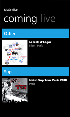
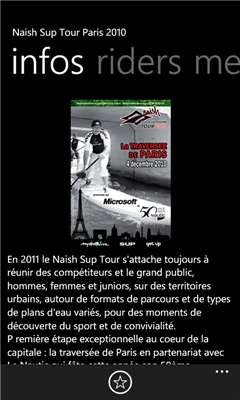
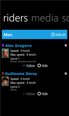
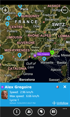
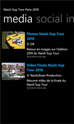
MyGeolive is the ultimate application for outdoor sport fans. Follow live events on the go or start a personnal live tracking session. Share it with your friends on Facebook (they will be able to follow you live on a map with data such as max speed, total distance, routes, running time...), upload pictures, videos of your journey, all your sessions are stored online so they can be shared and replayed at anytime.
Features
- Live Event: GPS live tracking of the competitors, mapview, newsfeed, pictures, videos, social network feed
- Personnal Tracking: personnal or shared GPS live tracking session, mapview, newsfeed, pictures, videos, share your session on social network
Like it? Share with your friends!
If you got an error while installing Themes, Software or Games, please, read FAQ.
Supported operating systems:
Windows 10 Mobile, Windows Phone 7, Windows Phone 8
Geotagged List Geotagged List allows you to "tag" your current location and add photo, a short description, and position. You can keep a list of these items so you can navigate your way back to these places. The
Reach That Point Reach That Point - With this application you can navigate from your current location to one of your favourite locations by following the on-screen compass information
A-to-B A-to-B is a Turn-by-Turn application built to demonstrate some of the capabilities of the ArcGIS API for Windows Phone.
Warning: The application is meant for demonstration purposes only! Do not rely solely on the suggested routes or instructions given by this application.
Features:
- Turn-by-turn routing. Sound notification when a turn is coming up
Gps info Simple program to show your current Position on a map with location data latitude, longitude, course, speed, altitude
GPS & GPX Logger GPS & GPX Logger - GPS logger with GPX export and Dropbox integration.
Reads phone location as fast as possible (about once every second) and keeps track of where you've been. Does not use or need data connection while logging, it only requires internet access to upload log files (which only happens when you choose Upload on the logs page)
My_Geo_App My_Geo_App - By using this app you can locate theirself in the map.
This app consists lot of things and some of them are:
1. Horizontal accuracy
2. Vertical accuracy
My app will contain the following specifications:
1. My Location Details
2. My Location View
3. Road view/ Arial view
4. U can urself on map
5. Zoom in/zoom out
6. Stop services a
Mobile Speedo Mobile Speedo - Mobile Speedo uses your mobile phone's GPS to accurately display your current location, direction and speed. You can also record, share and review this information.
Features:-
Display current speed, average speed, distance travelled, top speed and compass heading
Back Track Free Back Track Free allows you to easily view your current location and save your position. The saved location can be retrieved at a later time when you may need to find your way back. In addition, Back Track offers directions to help direct you back to the saved location along with a visual route and your current position
JaefreyGPS lite JaefreyGPS lite - This app enables you to view your current position and course. Futhermore you can record a track while walking or driving and upload this track as kml-file to your Dropbox account.
If you have any questions or suggestions, please feel free to contact us
Other Software by developer «DotVision»:
not found
Comments on MyGeolive:
Comments not found
If you noted an error or download link is broken, please, report it via this page or use comments.
MyGeolive is compatible with your device Yamada Denki EveryPhone LTE