Categories: Business & Profession, Travel & Navigation
Upload date: 3 Nov 11
Developer: Code Sector
License: Freeware
Downloads: 2894 File Size: 2551 Kb
SpeedView - An advanced speedometer application that offers lots of useful features.
SpeedView uses the phone's built-in GPS system to show your current, maximum and average speed, as well as direction, total distance and time traveled. Suitable for running, car driving, biking or hiking.
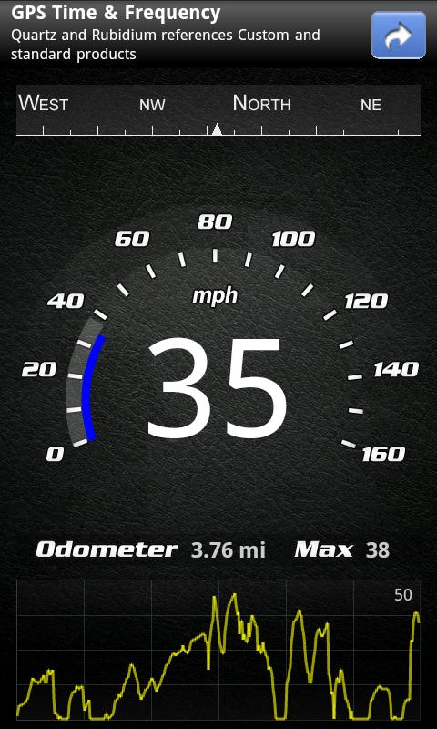
* High accuracy
GPS-based speedometer that is more accurate than the one in your car.
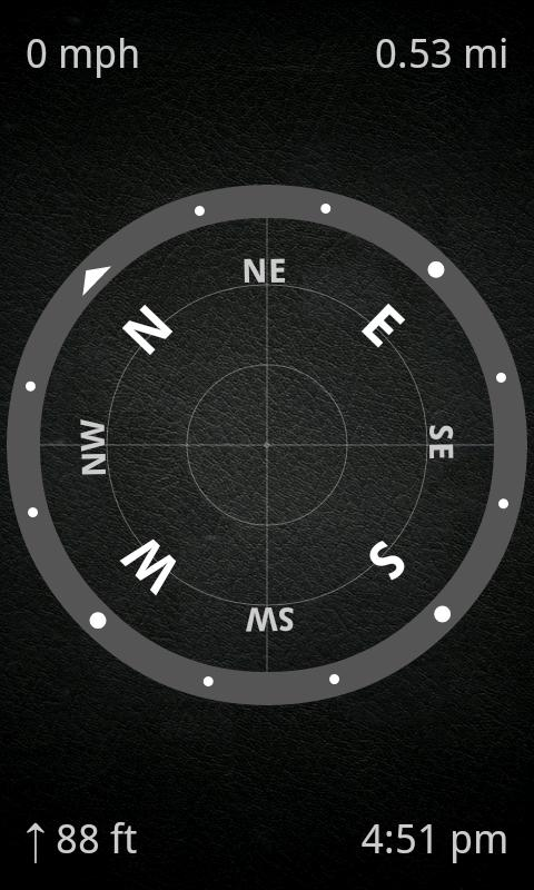
* Linear compass
Shows your direction of travel. Compass mode is also available.
* HUD mode
Mirrors the numbers so you can place the phone under your car's windshield and see the speed reflected on it in the dark.
* Speed graph
Displays a graph chart covering the last several minutes.
* Speed warning
You can set speed limits for three different types of roads, so when you go over a visual alert or sound will notify you.
* Display units
Supports units such as miles, kilometers and nautical miles.
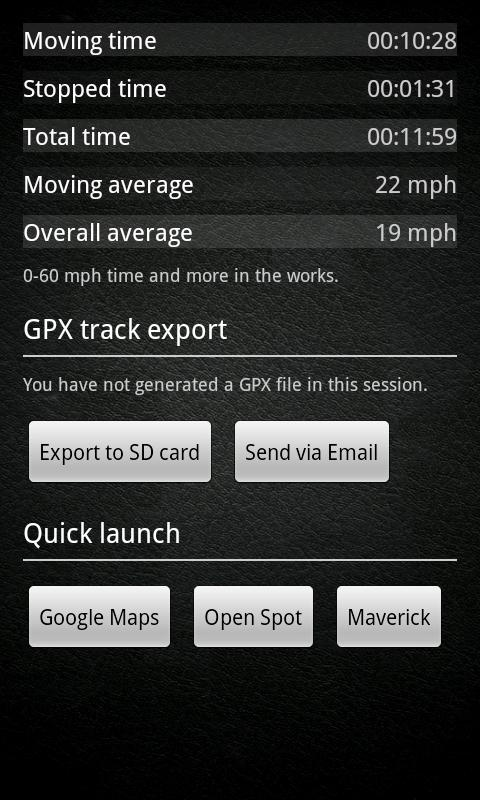
* GPX track export
Enables you to save your current track to SD card or email it to someone. GPX format is supported by many applications.
* Background mode
You can minimize the program and keep it running in background. It will work as usual and even notify you when you exceed the speed limit!
Please note that the accuracy depends on your GPS reception quality. If you have any questions or comments, feel free to post them on our blog.
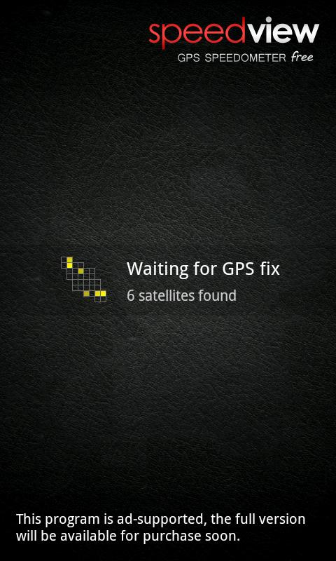
NOTE: Contains ads. A paid version is also available.
Like it? Share with your friends!
Supported operating systems:
Google Android 1.0, Google Android 1.5, Google Android 1.6, Google Android 10.x, Google Android 2.0, Google Android 2.1, Google Android 2.2, Google Android 2.3, Google Android 3.0, Google Android 3.1, Google Android 3.2, Google Android 4.0, Google Android 4.1, Google Android 4.2, Google Android 4.3, Google Android 4.4, Google Android 5.x, Google Android 6.x, Google Android 7.x, Google Android 8.x, Google Android 9.x
Similar Software:
Earth Geo Magnetic Field Calculator 3D Earth Geo Magnetic Field Calculator 3D - Earth Geo Magnetic Calculator 3D used to estimate magnetic field at a given point on Earth, and in particular, to compute the magnetic declination from true north
Compass3D Compass3D - This augmented reality application adds a 3D compass to the live camera view in real-time.
What's New in This Release:
· Support APP2SD
What's New in 4.0:
· minor fix
What's New in 3.7:
· code optimization
What's New in 3.7:
· minor bugfixes
What's New in 3
Speedometer Speedometer - GPS speedometer for Android phones.
· Measures: speed, elapsed time, all distance, peak and average speed.
· Acceleration 0-60-100-150 km/h
· The fastest distance(100m, 1/4 mile, 500m and 1km).
· Draws charts for speed and altitude.
· Speed, all distance, peak and average values, compass.
· Speed alerts
Multi Tool Dragon Multi Tool Application : Is an combination of 14 tools which gives you easy access to the Daily usefull tools on your Finger tip, Multi Tool Comes with
Marine Compass Key Unlock features for the Marine Compass. *** IMPORTANT : Please note that this application cannot be directly opened and will not appear in the home screen. It's purpose is only to unlock Marine Compass advanced features. Please install Marine Compass first (free)
BigTinCan Speed Proof Speed Proof logs your current speed, location and so on to a GPX file as fast as the GPS chip updates the system
GPSTest GPSTest - Program to show off the GPS capabilities of your Android device. Displays Satellite positions and signal strengths as well as speed, bearing and altitude values. It includes a world map with the day/night terminator overlayed as well as your current location and the suns position
Smart Measure - rangefinder You can measure the distance and height of an object. Smart Measure Lite is the part 2. of Smart Tools series. (distance, height) This range-finder measures the Distance and the Height of an object by trigonometry
GeoLog GeoLog saves the sensors data (gps, accelerometer, magnetometer data, etc.) of your device to a log file and calculates the coverage of the site. The coverage is a ratio of the track covering area to the area of the site (expressed in percents)
eGPS Elevation EGPS Elevation has greatly improved altitude and elevation readings. In a typical Android GPS, altitude readings are notoriously inaccurate. eGPS Elevation will even show how deep is the nearest water area
Other Software by developer «Code Sector»:
Maverick Off-road GPS navigator with offline maps support, compass and track recording. Use offline maps and GPS even without an internet connection. This app is great for hiking, boating, geocaching and other outdoor activities
SpeedView: GPS Speedometer SpeedView: GPS Speedometer - An advanced speedometer application that offers lots of useful features.
SpeedView uses the phone's built-in GPS system to show your current, maximum and average speed, as well as direction, total distance and time traveled. Suitable for running, car driving, biking or hiking