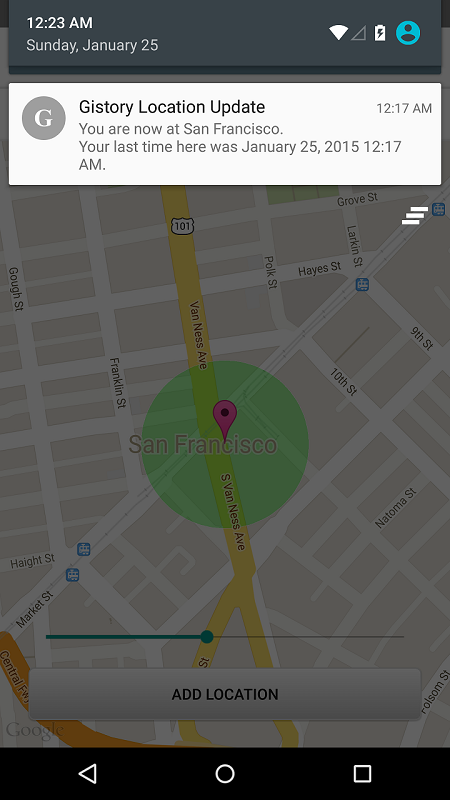
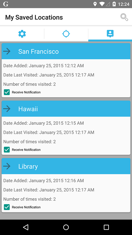
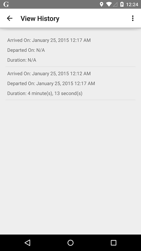
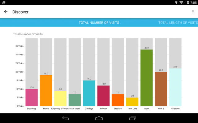
Gistory Analytics - Gistory is a powerful app that allows you to record the places you have been. In addition, you can also use the built-in analytics tool to allow you to discover how often and where you spend your time the most. Just save your current location in the app, and Gistory will take care of the rest. The next time you come back to this place, Gistory will let you know when the last time you were here and how long you stayed. In addition, Gistory will also allow you to take pictures and tag it to the place so you can remember exactly where you took them. Gistory can help answer questions like… - When was the last time I went to Hawaii? - How long do I spend at the gym every week? - Where was this picture taken? - Did I spend more time at work or at home last month? - How often did I go shopping two months ago?
Like it? Share with your friends!
Supported operating systems:
Google Android 10.x, Google Android 3.0, Google Android 3.1, Google Android 3.2, Google Android 4.0, Google Android 4.1, Google Android 4.2, Google Android 4.3, Google Android 4.4, Google Android 5.x, Google Android 6.x, Google Android 7.x, Google Android 8.x, Google Android 9.x
Similar Software:
OsmAnd new OsmAnd new - Another excellent project among navigation devices - the application OsmAnd. It is quite resistant to compete with many well-known companies navigators. It can be used in offline mode. OsmAnd allows you to: - View maps that have been loaded previously from a mobile device or PC. - Identify where the vehicle at the current time
Automatic Location Track Track friends or gadgets everywhere to anticipate the alertness and spy on the nearest person
ViewRanger GPS ViewRanger is a unique mapping, navigation, tracking, and information tool for mobile phones that provides fully featured outdoor gps and trail navigation through a natural and intuitive display. ViewRanger transforms a Nokia or other Symbian S60 smartphone into a fully featured trail navigation system
EV Speedo EV Speedo is a GPS based speedometer with gadgets to provide g-force and other GPS information.
A built in map is also provided and any of the gauges provided can be overlayed upon the map, for example use the map to show your location with a speedometer to show your current speed
GoPenS GoPenS is an OpenSource GPS application for Android phones, based on OpenStreetMap (OSM). OpenStreetMap is a collaborative map of the world. Therefore, one of the main functions of the application is to be able to record a trace and send it as a GPX to the OSM servers, and so edit the OSM Map
My Tracks My Tracks - Use My Tracks while you run, bike, hike, or do anything else outdoors, and it will use the GPS sensor in your Android phone to record the path you took. It will also gather useful statistics such as time, speed, distance, and elevation. You can review all of this data live, or you can save it for use later
Back Country Navigator Back Country Navigator - is a handy navigator which will help you find way in any location. The application has embedded storage so you can download the needed data and use maps without Internet connection. All you need to do is to activate a satellite navigation to see your location
Digital Dashboard GPS Digital Dashboard GPS - Features included
- Save your track info,Record gpx file(it will be saved in "sdcard/DigitalDashboardGPS/gpx/")..
- Switch between car speedometer and bike cyclometer.
- Switch between mph or km/h mode.
- Display satellites status.
- Speed chart.
- Map integration,get your location.
……
Facebook:https://www.facebook
GPS Widget GPS Widget - This widget simply shows your current location in numbers. Latitude and Longitude are received from the GPS location provider or from the network location provider if GPS is not available.
The altitude is queried from open MapQuest API which yields in a more accurate result than receiving the altitude by GPS
Run.GPS Trainer UV Run.GPS Trainer is the perfect tool for sports like running, skiing and walking. It uses the Global Positioning System (GPS) to record all of your training parameters like speed, distance and altitude.
Run.GPS Trainer UV is the successor of of the award-winning Run.GPS Trainer software and has tons of new features
Comments on Gistory Analytics:
Comments not found
If you noted an error or download link is broken, please, report it via this page or use comments.
Gistory Analytics is compatible with your device ZTE Geek