US Terrain Intelligence for Android - The Outdoor Navigation software is your best friend through your adventures in the wild.
Go into the outdoors with confidence and enjoy your activities without worrying about the tools to help you navigate. Your Outdoor Navigation app is made by the people who have been developing this software since 2003 across multiple platforms. Be sure that you will stay ahead of the rest with continuous updates and relevant tools.
It is an excellent tool for biking, jogging, skiing, hiking, geocaching, boating, flying and many other sporting activities.
United States Terrain Intelligence will give you access to the most sophisticated Ground Guidance technology and allow you to take advantage of services that have only been available to military personal until now.
Terrain Intelligence takes into account a multitude of variables, including elevation, land cover and aerial aspects to calculate the best possible route.
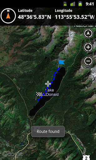
To plan your your off road activities:
· Select Terrain Intelligence as Routing Type in Options
· Route Settings
· Tap on the map to select start and end off road points
· Route will be calculated using Terrain Intelligence service
This plugin works only in the USA.
Installation instructions:
Outdoor US Terrain Intelligence is an add-on for the free Outdoor Navigation application. You need to have your Outdoor Navigation installed to be able to use Outdoor US Terrain Intelligence.
Download and install Outdoor US Terrain Intelligence on your Android device. Start the Outdoor US Terrain Intelligence plugin to complete the license checking: when activation will be completed then the icon will be removed (you need to restart your device to hide the icon) and the plugin will be used inside Outdoor Navigation application
What's New in This Release:
· Bug fixing
Like it? Share with your friends!
Supported operating systems:
Google Android 10.x, Google Android 2.1, Google Android 2.2, Google Android 2.3, Google Android 3.0, Google Android 3.1, Google Android 3.2, Google Android 4.0, Google Android 4.1, Google Android 4.2, Google Android 4.3, Google Android 4.4, Google Android 5.x, Google Android 6.x, Google Android 7.x, Google Android 8.x, Google Android 9.x
Similar Software:
Location Info It gives you many interesting information about you location
TravelLog TravelLog is a one-click-app to log your business trips making accounting very easy
Rio Carnival Photos Get in the mood for the biggest party in the world - The Carnaval in Rio de Janeiro - with this picture gallery. Rio Carnival is as considered the biggest carnival in the world and as locals describe it "the greatest show on Earth"
Greenbridge Laksa Greenbridge Laksa - Qing Qiao Laksa:
-------------------------------------
Welcome to Green Bridge Laksa! Green Bridge
Laksa is a hawker store situated at China
Town, Singapore. Green Bridge Laksa provides
a traditional taste of the 1960s for the famous
Singaporean noodle dish, Laksa
BusStopAlarm BusStopAlarm - This application will let users to set a location based alarm on their mobile phone that will go off when they get close to the bus stop they want to get off at. This project is being written for the Software Engineering course, CSE 403, at the University of Washington, Winter 2010
Wristband Wristband - Wristband uses the SongKick and Bandcamp APIs to search for local shows, gives you a playlist of music in your area, and gives you directions to the show. Looking for something to do tonight? Wristband helps you discover new local music. Support your scene.
What's New in This Release:
· Improved performance of coverflow
Fesmekan Hangi mekanda hangi yiyecek, icecekleri bulabilirsiniz! Mekana gitmeden orada neler bulundugunu bu uygulama ile ogrenebilirsiniz
Elevation Profile Elevation Profile - This application shows the elevation profile of the path.
Create the path by tapping the map. Different modes of path creating are available: direct, driving, walking and bicycling. Direct mode draws straight lines between points. Driving, walking and bicycling modes are able to find and follow roads between points
Intersection Explorer (Android) Intersection Explorer (Android) - Intersection Explorer provides a virtual map to help blind users explore their neighborhood.
Use touch to move along the current road and hear available directions at any given point.
What's New in This Release:
· Fixed issues that caused a crash on launch on some versions of Android.
What's New in 1.2
Emergency Manager Trial Emergency Manager Trial - Trial version
What all can you do with Emergency Manager?
Emergency Services Dialer:
Users can dial the emergency service numbers (Police, Fire and Medical) which appears on the application main screen based on the country the user is in presently; it supports emergency service contacts for over 200 countries
Other Software by developer «GPS Tuner»:
GPS Tuner Essentials Full Version with Baltic Basic Map Content GPS Tuner Essentials Full Version with Baltic Basic Map Content - is designed specifically for off-road use: its large buttons, selectable tool window size, multiple Compass views and the built-in Tele Atlas map makes it extremely user-friendly and reliable
GPS Tuner Essentials Full Version with Brazil Basic Map Content GPS Tuner Essentials Full Version with Brazil Basic Map Content is designed specifically for off-road use: its large buttons, selectable tool window size, multiple Compass views and the built-in Tele Atlas map makes it extremely user-friendly and reliable
GPS Tuner Atlas Full Version with Full Europe Basic Map Content GPS Tuner Atlas Full Version with Full Europe Basic Map Content is designed specifically for off-road use: its large buttons, selectable tool window size, 6 different types of Compass views and the built-in Tele Atlas map makes it extremely user-friendly and reliable
GPS Tuner Essentials Full Version with BENELUX Basic Map Content GPS Tuner Essentials Full Version with BENELUX Basic Map Content is designed specifically for off-road use: its large buttons, selectable tool window size, multiple Compass views and the built-in Tele Atlas map makes it extremely user-friendly and reliable
GPS Tuner Essentials Full Version with United States Basic Map Content GPS Tuner Essentials Full Version with United States Basic Map Content is designed specifically for off-road use: its large buttons, selectable tool window size, multiple Compass views and the built-in Tele Atlas map makes it extremely user-friendly and reliable
GPS Tuner Essentials Full Version with Nordic Countries Basic Map Content GPS Tuner Essentials Full Version with Nordic Countries Basic Map Content is designed specifically for off-road use: its large buttons, selectable tool window size, multiple Compass views and the built-in Tele Atlas map makes it extremely user-friendly and reliable
Outdoor Speedometer for Android Outdoor Speedometer for Android - The Outdoor Navigation software is your best friend through your adventures in the wild.
Go into the outdoors with confidence and enjoy your activities without worrying about the tools to help you navigate. Your Outdoor Navigation app is made by the people who have been developing this software since 2003 across multiple platforms
Outdoor Navigation Pro for Android Outdoor Navigation Pro for Android - The Outdoor Navigation software is your best friend through your adventures in the wild.
Go into the outdoors with confidence and enjoy your activities without worrying about the tools to help you navigate. Your Outdoor Navigation app is made by the people who have been developing this software since 2003 across multiple platforms
Outdoor SOS for Android Outdoor SOS for Android - The Outdoor Navigation software is your best friend through your adventures in the wild.
Go into the outdoors with confidence and enjoy your activities without worrying about the tools to help you navigate. Your Outdoor Navigation app is made by the people who have been developing this software since 2003 across multiple platforms


")


