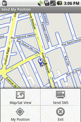
Send My Position isan application which shows your current location using GPS and allows you to send the coordinates using SMS as Google Maps links.
· Shows your current location using GPS
· Allows you to send your location coordinates to anyone using SMS
· Google Maps link send using SMS (Android, iPhone...)
· Map/satellite View of your position
Like it? Share with your friends!
Supported operating systems:
Google Android 1.0, Google Android 1.5, Google Android 1.6, Google Android 10.x, Google Android 2.0, Google Android 2.1, Google Android 2.2, Google Android 2.3, Google Android 3.0, Google Android 3.1, Google Android 3.2, Google Android 4.0, Google Android 4.1, Google Android 4.2, Google Android 4.3, Google Android 4.4, Google Android 5.x, Google Android 6.x, Google Android 7.x, Google Android 8.x, Google Android 9.x
Similar Software:
AntipodalPoint AntipodalPoint retrieves you position from the network provider or GPS and calculates and shows you antipodal point - the place exact opposite of you on Earth.
AntipodalPoint Pro enables you to browse the entire world and find antipodal points
RMaps RMaps is a navigation tool. You can use RMaps as an online map viewer for some popular maps. And as an offline map viewer for your own maps created on the PC.
· Auto rotate map in driving direction.
· Auto rotate map in the northern direction.
· Compass on the map.
· Auto-follow function.
· Online search.
· Full screen mode
PhonAlarm PhonAlarm - Start PhonAlarm to make surroundings, friends/family aware of an emergency, and with the GPS location started in your phone, they can immediately locate you. How can PhonAlarm help you and how does it work? If a situation is emerging where you need to be assisted by others, e.g
BeOnMyMap (Android) BeOnMyMap The Android mobile device application for the BeOnMyMap.Com service. BeOnMyMap is a location based socialisation application, consisting of the BeOnMyMap.com website, a mobile website for use on your mobile phone (BeOnMyMap.mobi) and integrated applications for mobile devices
Boundary Reminder Boundary Reminder - This application is a reminder tool which works with your location. A boundary is registered in drawing a circle on the map, you get a notification when you pass over the boundary.(The application works in background as Service.) Your location data is NOT send to a server
CompassNavi Compass / Navigation Activity, mainly for OpenGPX, but can be used from any application
iMapMyFITNESS+ Fitness App iMapMyFITNESS+ Fitness App - tracks the route, distance, pace, and more in real-time using GPS.
Free new version!
iMapMyFITNESS brings you its mobile app for Android-based devices! Now owners of Android 2.1 or higher devices can track the route, time, distance, speed, pace and calories in real-time for their fitness activities using their GPS enabled mobile device
MileageLedger 2.0 MileageLedger 2.0 - New features include resume trip, filtered reports, auto data export, data export via e-mail or SD card, improved GUI, increased reliability & accuracy, fault tolerance, & trip categories
Mileage Ledger is a GPS powered mileage logging application designed for Android enabled smart phones
GPS Location Lite GPS Location Lite - Use your Android phone as a professional GPS logging device.
Record different tracks and export gpx-files to sdcard.
View Distance, Time, Speed, Altitude, Latitude and Longitude.
In the GPS Location Lite settings you could choose gps or network provider. GPS interval (5-60 seconds) and some other preferences are adjustable
Mileage (Android) Mileage is a mileage tracker for an Android-powered phones. Allows importing and exporting of data in various formats, so it is easy to sync with your existing logs. Supports GPS recording
Other Software by developer «Dragan Stankovski»:
not found
Comments on Send My Position:
ramgol:
very good
Date: 3 Jan 11
If you noted an error or download link is broken, please, report it via this page or use comments.
Send My Position is compatible with your device ZTE Smooth


")


")