Navitel Navigator for Android - Navitel Navigator is a GPS travel assistant for Android. The app turns your phone into a personal navigation system.
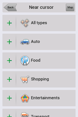
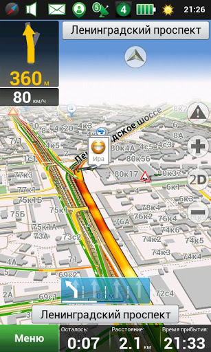
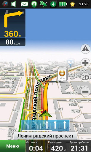
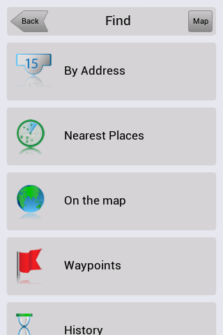
Navitel Navigator comes with detailed maps and other useful features, including traffic jams, speedcams, 3D roads and intersections, instant routing and a comprehensive database with points of interest.
· 30 days trial
What's New in This Release:
· map subscription available;
· vibration of the navigation device in response to use of the keyboard;
· bugs occurring at POI search along the route are fixed;
· traffic jams are rendered quicker in maps.
What's New in 8.0.0.267:
· To Menu - Settings - Navitel.Friends added new option - "Hide irrelevant".
· While installing the minimum values of map detail, buildings are displayed as single-storey.
· Display of textures through the translucent building was fixed.
· Rendering of colors and lighting of 3D models was improved.
· Display of the houses' numbers in 3D mode was fixed.
· Incorrect work of the program on devices Prestigio GeoVision 5500 was fixed.
What's New in 8.0.0.192:
· Option of map scale selection for 3D buildings display was added to the settings.
· As you zoom in more than 3 km, function "Track Up", when following a route, changes to the orientation "North".
· To Menu - My Navitel was added information about version number and size of available update.
· Errors, when drawing some polylines in 3D, were fixed.
· Accuracy of the voice guidance on roundabouts was improved.
· Android 1.5 is no longer supported.
What's New in 8.0.0.0:
· Hardware-accelerated rendering is implemented (OpenGL)
· New 3D maps with number of storeys support and textures
· New 3D models of attractions
· Brand POI
· Traffic jams sensitivity setting
· More detailed description of friends' location on the map is implemented.
· Zoom buttons bugs in "My Route" window were fixed.
· Also other numerous minor fixes, enhancing the stability and reliability of the program, were made
What's New in 7.5.0.2131:
· Automatic SPEEDCAM update from the program menu.
· Personal settings, history, waypoints storing after update installation.
· Dashboard selection on the map while driving on the route.
· Profile switching without having to restart the application.
· Automatic renaming of exported files (routes, waypoints) in order to avoid existing data rewriting.
· Objects naming display is improved during map scrolling.
What's New in 7.5.0.1342:
· Кeyboard for Armenian, Georgian and Azerbaijani languages was added.
· Information of the program's and maps' version was included in menu My Navitel.
· Display of owner's devices on the map attached to the service Navitel.Friends was realized.
· Search by the POI on the route was improved.
What's New in 7.0.0.176:
· View mode and edit mode of "Navitel.Friends" privacy settings are implemented.
· New icons of road infrastructure and weather on the map are added.
· License agreement (Public offer) is updated .
· Multi-touch operation in search result is fixed.
· Bug that caused program hang, during intersections search, was fixed.
· Program zoom is improved on very small and very large scales.
Like it? Share with your friends!
Supported operating systems:
Google Android 1.5, Google Android 1.6, Google Android 10.x, Google Android 2.0, Google Android 2.1, Google Android 2.2, Google Android 2.3, Google Android 3.0, Google Android 3.1, Google Android 3.2, Google Android 4.0, Google Android 4.1, Google Android 4.2, Google Android 4.3, Google Android 4.4, Google Android 5.x, Google Android 6.x, Google Android 7.x, Google Android 8.x, Google Android 9.x
Similar Software:
Android FindMyCar Android FindMyCar - Innovative software for Android devices that uses the GPS signal to show signs that allow to reach a geographic location.
Suitable for various uses (eg. find car parked in a parking area or in an unknown city, finding a person (who has sent their coordinates) in a lovely beach, in a fair, in another boat, find an area of sea fishing, etc..)
TomTom Southern Africa for Android TomTom Southern Africa for Android - TomTom Southern Africa is a turn-by-turn GPS navigator for Android devices. The app includes accurate offline maps, so you can find your way anywhere, even without an internet connection
YGPS Satellites YGPS Satellites - YGPS Satellites is a small mobile application that allows you to easily assess the quality of your GPS signal. The utility displays the location of all the GPS satellites and shows the signal strength for every one of them.
Using the app is pretty straightforward
Family Safety Family Safety - Active and Passive - Managed Family Safety & Security System!
★ Your Family Safety and Security by location aware real time notifications.
★ Create location aware multiple geo-fence’s to get automatic security alerts when person is not within the specified zone
Ship Finder for Android Ship Finder for Android - Ship Finder is a useful application that allows you to track ships in near real-time on a 2D map.
Tap on a ship to view its name, port of registration, destination, ETA, location, MMSI, IMO, callsign , heading, length, width, draft, etc.
The app works by picking up AIS feeds used by the ships for safety and navigation purposes
Location Barcoder Location Barcoder is a tool for creating geocoded barcodes based on your location. Barcodes are stored on the SDCard in a folder named LocationBarcodes
GPS Widget GPS Widget - This widget simply shows your current location in numbers. Latitude and Longitude are received from the GPS location provider or from the network location provider if GPS is not available.
The altitude is queried from open MapQuest API which yields in a more accurate result than receiving the altitude by GPS
AlpineQuest Lite AlpineQuest Lite - AlpineQuest turns your Android device into an off-road GPS using offline topo maps. It is a complete solution for all outdoor activities and sports, including hiking, running, trailing, hunting, sailing, geocaching and much more
NearMe NearMe application gives you a fast and easy way to find places near you. In addition, you can set the area (in Km) where to search. With every found place you have some useful options:
* Call
* Add To Contacts
* Open In Maps
* Get Directions
And other option is History: it keeps for you all places you have searched for
Polaris Navigation System Polaris Navigation System - The Polaris Navigation System is a powerful navigation software for Android. It includes all the standard GPS functionality, including an odometer, altimeter, speedometer and directional compasses.
The app also allows you to record trails and view them on a map
Other Software by developer «Navitel»:
Navitel Navigator Symbian “Navitel Navigator” is a unique and accurate navigation system. Detailed Russia map. Free traffic jams information service. SPEEDCAMs. The most detailed map of Russia: more than 118 000 cities and towns, 1500 of them contain address search information. The most detailed Moscow and Saint-Petersburg map
Navitel Navigator (Ukraine) for iPhone/iPad Navitel Navigator (Ukraine) for iPhone/iPad - Navitel Navigator is a GPS travel assistant for iPhone, iPad and iPod touch. The app turns your phone into a personal navigation system
Navitel Navigator (Russia) for iPhone/iPad Navitel Navigator (Russia) for iPhone/iPad - Navitel Navigator is a GPS travel assistant for iPhone, iPad and iPod touch. The app turns your phone into a personal navigation system
Navitel Navigator (Kazakhstan) for iPhone/iPad Navitel Navigator (Kazakhstan) for iPhone/iPad - Navitel Navigator is a GPS travel assistant for iPhone, iPad and iPod touch. The app turns your phone into a personal navigation system
Navitel Navigator iPhone “Navitel Navigator” is a unique and accurate navigation system. Detailed Russia map. Free traffic jams information service. SPEEDCAMs. The most detailed map of Russia: more than 118 000 cities and towns, 1500 of them contain address search information. The most detailed Moscow and Saint-Petersburg map
Navitel Navigator Windows Mobile “Navitel Navigator” is a unique and accurate navigation system. Detailed Russia map. Free traffic jams information service. SPEEDCAMs. The most detailed map of Russia: more than 118 000 cities and towns, 1500 of them contain address search information. The most detailed Moscow and Saint-Petersburg map
Navitel Navigator for iPhone/iPad Navitel Navigator for iPhone/iPad - Navitel Navigator is a GPS travel assistant for iPhone, iPad and iPod touch. The app turns your mobile device into a personal navigation system
Navitel Navigator (Commonwealth) for iPhone/iPad Navitel Navigator (Commonwealth) for iPhone/iPad - Navitel Navigator is a GPS travel assistant for iPhone, iPad and iPod touch. The app turns your phone into a personal navigation system
Navitel Navigator for Windows Mobile Navitel Navigator for Windows Mobile - Navitel Navigator is a GPS travel assistant for Windows Mobile. The app turns your phone into a personal navigation system.
Navitel Navigator comes with detailed maps and other useful features, including traffic jams, speedcams, 3D roads and intersections, instant routing and a comprehensive database with points of interest


 for iPhone/iPad")
 for iPhone/iPad")
 for iPhone/iPad")


 for iPhone/iPad")
