If you got an error while installing Themes, Software or Games, please, read FAQ.
Supported operating systems:
Windows 10 Mobile, Windows Phone 7, Windows Phone 8
Similar Software:
Maps+ Maps+ - Maps Plus (Maps+) is an easy to use, powerful way to find directions, points of interest, locations, and anything else you're looking for
MapStalt Mini MapStalt Mini is an application that is meant to bring the map to completeness. In the case of the open street map, many details are missing, and MapStalt puts to power to complete the map into the hands of the mobile user. With MapStalt, a user can add something as simple as a building address and latitude/longitude or complex details such as business hours of operation
Canada Topography Canada Topography - provides topographic information for the entire country of Canada. The maps provide details such as altitude, railways and numerous other layers. Using the GPS you can center on your current location and even zoom to specific areas of the country.
All maps are provided by Geocratis Canada (http://www.geogratis.gc.ca/geogratis/en/service/toporama
AGMapTime AGMapTime is a simple viewer with time slider features for "time-aware" layer data of ArcGIS services. Time slider lets you browse map features on specific time. You can view various kind of map layers from ArcGIS.com or your own ArcGIS server.
version 0.5 (First version)
- Only supports dynamic layer.
- Fixed base map.
- Slider auto detect time duration
Offline Maps Offline Maps - Want to save money on your data plan and roaming fees abroad? Download maps and use them without having to use an internet connection!
With this application you can download a map of any part in the world and take it with you when travelling
Free World Explorer Free World Explorer - So, you think you are good at geography? Let's see how good you are :)
Pan the map to fly the plane to the destination place and click on land button when you find the green airport symbol. You need to be connected to internet for this. Difficulty mode to challenge you with a lot more countries
ArcGIS ArcGIS is a great way to discover and use maps. Tap on the map or use your current location to discover information about what you see. Search and find interesting information in the map as well as measure distances and areas. Find community hosted maps from ArcGIS Online, ESRI's online GIS, or use the authoring tools on ArcGIS
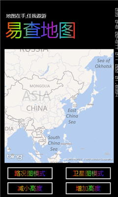
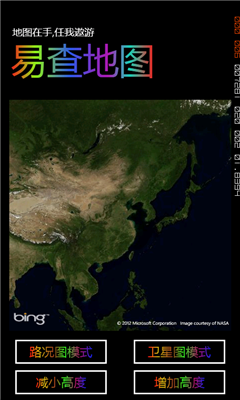
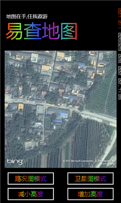
LR Maps LR Maps - This program is the Chinese version of the map program, the layer provided by the Google.Search functions are provided by Google Api and Baidu Api. Main functions are as follows: (1) through the GPS to locate and display the current location (2) Road name search with Chinese input: You can search for example, "Huaihai Road"
Other Software by developer «HaiTian_ZYK_NiDaKun»: