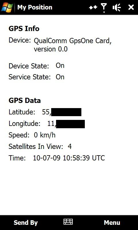
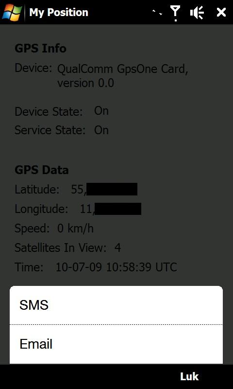
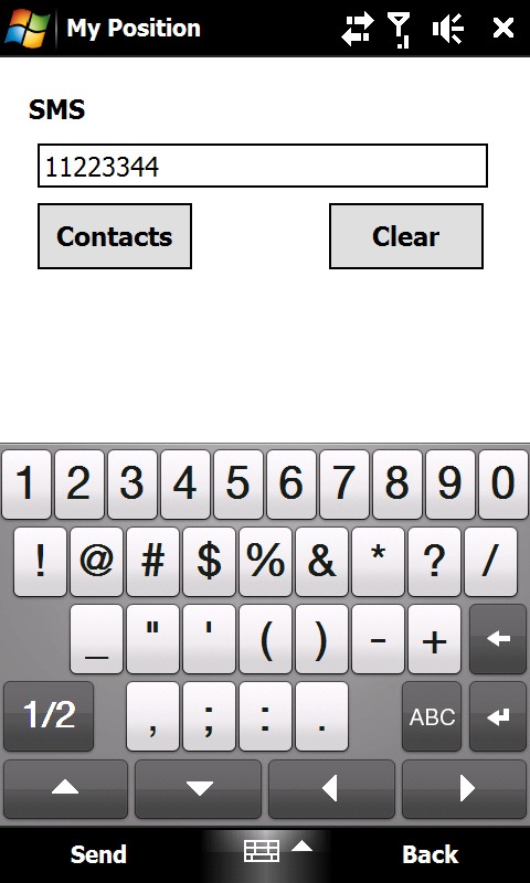
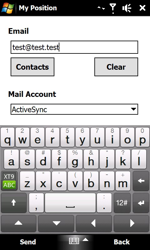
My Position - With My Position it is possible to see actual GPS information via the phone's built in GPS and send the position to others via sms or email.
When sending the position via sms or email it is possible to enter a telephone number or email address. It is also possible to select a contact from the contact list.
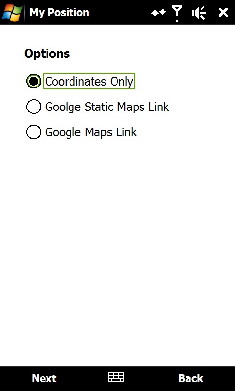
Sending the position is possible in three different ways:
1) As coordinates which can be inserted directly in Google Earth or Google Maps.
2) As a link to Google Static Maps. When the receiver opens the link the phones default web browser connects to the internet and shows the position on a map in 400x400 pixel resolution.
3) As a link to Google Maps. This option is mostly suitable when sending the position via email.
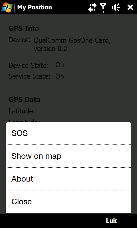
It is also possible to see ones own position on a map where Google Static Map is being used. The phones default web browser will open and connect to the internet and shows the position on a map in 400x400 pixel resolution.
This is a very good function when you are in a big city with many streets.
There is also a sos function which sends the position and a message of help. Again it is possible to send via sms or email.
Like it? Share with your friends!
If you got an error while installing Themes, Software or Games, please, read FAQ.
Supported operating systems:
Windows Mobile 6 Classic, Windows Mobile 6 Professional, Windows Mobile 6.1 Classic, Windows Mobile 6.1 Professional, Windows Mobile 6.5 Professional
Similar Software:
Kai's GPS Tracker.Net With the GPS Tracker you send your Position via 'SMS' or 'SMS to e-mail' to another person and tell him/her so your location. The recipient gets a SMS or e-mail with the location and a link to a map (on PC). Use it for your friends, family or in a company. Also suited to send holiday greetings from a foreign country
RaceChrono RaceChrono is a GPS based lap timing software for Windows Mobile. It can be used to measure lap times on almost any vehicle and track. It can be used to measure laptimes for example for motorbikes, bicycles, cars, water jets and quadbikes.
What's New in This Release:
· Much better looking user interface.
· Better and simplified touchscreen usage
GPS Tuner Essentials Full Version with Central Europe Basic Map Content GPS Tuner Essentials Full Version with Central Europe Basic Map Content is designed specifically for off-road use: its large buttons, selectable tool window size, multiple Compass views and the built-in Tele Atlas map makes it extremely user-friendly and reliable
MusicGoogler MusicGoogler uses the GPS on your PocketPC to find the 50 closest Music CD and Instrument stores sorted via GPS distance. Tap the button to start the GPS and when you get a lock tap on it to view the list of local stores. You can also dial the store. The GPS maps and store search service is provided by Google
FON Access Points for Madagascar FON Access Points for Madagascar - FON offers you a new Points of Interest service (POIs). This allows you to download FONspots directly to your navigation device.
What does that mean? You can download a Points of Interest file directly to your navigation device
Navigation BE-ON-ROAD Central Europe Q2/2011 Navigation BE-ON-ROAD Central Europe Q2/2011 - The new major version of be-on-road presents new features and is based on new platform which brings high level of reliability, portability and speed on almost any kind of device. The new be-on-road brings high value voice guided door-to-door navigation
Glympse Glympse is the easiest, most flexible way to safely share your location. Just a couple clicks, and you can decide who and for how long your friends can see your location on a map.
How it works:
Send a Glympse - Share your location from a mobile smartphone.
Receive a Glympse - View a shared location on either a computer or mobile smartphone
GPS4PPC GPS4PPC is an open source application, written with Basic4ppc that includes a set of tools for navigation and GPS data.
GPS4PPC supports:
- Converting coordinates between UTM and Lat / Lon.
- Converting coordinates in different datums.
- Calculating the distance and course between two coordinates.
- Show GPS data.
- Animated compass
Gpx2bin Gpx2bin - Gpx2bin is a GPS track converter software for Windows Mobile.
It can be used to convert .gpx, .mps, .plt and .nmea formats to the tracks.bin file used by Navitel Navigator to see the track as "blue line."
What's New in This Release:
· A problem with large files opening was fixed
FamilyUpdateds FamilyUpdateds - FamilyUpdateds can be used to get updates from family members using the PocketPC FamilyUpdaterer. You can group the URLs from each person into family groups. Tap on the name to view the current update.
This program requires that you have both the 'BeanDLL.dll' file ** and ** the runtime files for Visual Basic on your PocketPC computer
Other Software by developer «ULJ»:
Backlight Control A small and simple application to control the backlight