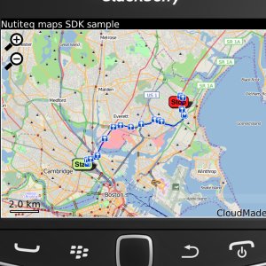
Nutiteq Maps - Nutiteq Mobile Mapping SDK demonstration application. It enables to view different map sources, including online (OpenStreetMap) and offline sources produced by TileMill (in MBTiles format) or Mobile Atlas Creator. Also online route finding is possible.
Like it? Share with your friends!
Supported operating systems:
RIM BlackBerry OS 4.6, RIM BlackBerry OS 4.7, RIM BlackBerry OS 5.0, RIM BlackBerry OS 6.0
Similar Software:
TrackMyJourney (BlackBerry) TrackMyJourney (BlackBerry) is a mobile application that uses GPS data to provide a number of functions, including navigation, location tracking, map display and route plotting. It receives its location coordinates by communicating via Bluetooth with a separate GPS receiver, or via the phones internal GPS if supported
apemap Outdoor navigation (only German version currently)
TUBE 2 New York City (Blackberry) TUBE 2 New York City (Blackberry)
Tube 2 New York City
Transform your Blackberry into a fully scrollable detailed map of the New York City MTA subway system.
Plan journeys on the New York City subway system, have the quickest routes to hand, with all the details you need including line changes, platform directions and accurate journey times
Super Duper Survey Super Duper Survey is an easy to use application to take and report surveys. It's designed as a self contained, offline application perfect for street surveys
Mundo Terpel Move around Colombia with this application
Open Street Map A simple viewer of Open Street Map using ESRI's ArcGIS API
Live Search for BlackBerry Live Search for BlackBerry - Turn your BlackBerry phone into a map, phone book, or city guide.
Find it.
Find local businesses, restaurants, and shopping in your neighborhood or where you travel.
Map it.
Get maps and detailed driving directions, and track your real-time location with optional GPS integration.
Plan it
GEOrendr GEOrendr is a great way to discover and use maps. Maps come to life in GEOrendr. Tap on the map or use your current location and discover information about what you see. Find community hosted maps from ArcGIS Online - ESRI’s online GIS. Alternatively you can use the authoring tools on ArcGIS.com to create your own maps that can be used in GEOrendr
Geo Mapper Geo Mapper is mapping app that lets you add and edit Locations, Tracks, and Areas. It displays them using online maps supplied by OpenStreet Maps and CloudMade Maps.
As you move around the map it will update keeping your current location in the center of the map. When you pan the map, location updates will be suspended
Other Software by developer «Nutiteq»:
Nutimap Mapping application based on Mobile Gmaps with some additional features localized for Estonia. Displays maps from an additional source (Regio), includes local POIs and can determine your approximate location based on the mobile network

")


")

")

")


