Orientation, Routing, Tracklogs, Waypoint and POI management.
Navigate with Spot:
Using Moving Map Navigation, the map centeres current position and will therefore move with you. This makes it easy for you to navigate visually in your environment. You can either do that with street level maps or in remote areas with maps composed of satellite photos.
You can as well use Spot's routing feature for navigation. It will guide you to a waypoint and gives you information on the distance, estimate time of arrival etc.
Routing
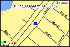
Streetlevel Map
Outdoor Activites:
Spot can be used for a wide range of outdoor activities. You can add waypoints/POIs (Point of Interest) to mark you favorite locations or download them from the internet. They will be visualized on the map of your device and simplifies orientation wherever you are.
A built-in tracklogger draws the distance you covered on the map. The Elevation screen will visualize the elevation profile of your track.
Tracklog
Position Info
Track Elevation
Satellite Info
Field Navigation:
Spot can perfectly be used for Field Naviation with your Blackberry, you do not need any additional hardware.
It can be easily integrated into your company GIS environment due to interoperable industry standard interfaces implemented in Spot. You can get field maps from your company GIS or from public map services. The waypoint management system allows you to add additional data in the field. For more information on how to integrate Spot with your company GIS or on how to use your company geodata with Spot, please write an e-mail to: info@skylab-mobilesystems.com.
Field Navigation
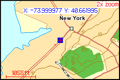
Map Navigation
The GPX waypoint format support assures an easy to use waypoint exchange and a trouble-free integration into other applications.
Our unique combination of GPS positioning and WMS map server access allows you to navigate on the map of your choice, available from the endless pool of free WMS servers.
Like it? Share with your friends!
Supported operating systems:
RIM BlackBerry OS 3.x, RIM BlackBerry OS 4.0, RIM BlackBerry OS 4.1, RIM BlackBerry OS 4.2
Similar Software:
Barcelona DK Eyewitness Top 10 Travel Guide & Map (BlackBerry) Barcelona DK Eyewitness Top 10 Travel Guide & Map (BlackBerry)- -From Gaudi''s mind-boggling buildings to the Gothic Quarter, your holiday to Barcelona starts the moment you open the guide, plus Barcelona maps and metro maps
Wayfinder Earth (BlackBerry) Wayfinder Earth (BlackBerry) - The world in your hand! Welcome to the ultimate experience of discovering the earth on your mobile device, for free.
How does it all work?
It's simple. Wayfinder Earth presents you with a 3D globe representing the planet earth, visible on the display of your mobile phone
e-Mobile Family Locator e-Mobile Family Locator-
Locate device and people
Locate device and people by sending a "locate" text message
Yelp Yelp is the fun and easy way to find reviews and talk about what's great and not so great in your area
Foursquare (BlackBerry) Foursquare (BlackBerry) helps you find new ways to explore your city. See where your friends are, learn about the places they frequent and unlock rewards as you travel through the city.
What's New in This Release:
· With version 3
J2ME OGC WMS Client J2ME OGC WMS Client is a program for accessing OGC Web map services from Java enabled mobile phone or PDAs.
It accesses the OGC WMS according to WMS 1.1.0 and 1.1.1 specifications and supports zooming and panning in the Map, WMS sublayers, and a bookmark management system for quick access.
Free for non-commercial use
Live Search for BlackBerry Live Search for BlackBerry - Turn your BlackBerry phone into a map, phone book, or city guide.
Find it.
Find local businesses, restaurants, and shopping in your neighborhood or where you travel.
Map it.
Get maps and detailed driving directions, and track your real-time location with optional GPS integration.
Plan it
Madrid DK Eyewitness Top 10 Travel Guide & Map (BlackBerry) Madrid DK Eyewitness Top 10 Travel Guide & Map (BlackBerry)- From the Palaciao Real to the green Retiro park - the 10 best of everything to see, buy, do, taste and avoid in Madrid, plus maps and Metro map
Metro Maps Metro Maps- Find you way through complicated metro in major cities. The developer is currently giving away 3 metro city maps from major cities. I'm sure more maps will be available as his work progresses with the development of the software. The software works great with my blackberry, so far I was able to test out the New York Metro Map
Llama (BlackBerry) Llama has hundreds of US mall directories, including current deals and a store finder for featured malls
Other Software by developer «Skylab Mobilesystems Ltd.»:
GPS Waypoint Manager - Free BETA GPS Waypoint Manager - Free BETA - The GPS Waypoint Manager for BlackBerry® Smartphones is a comprehensive tool for managing waypoints and points of interests (POI) right on your phone. By using the GPS in your device, your can accurately pin-point your location and map out other points as well. You also have the ability to import/export .kmz and
ContactMapper Geocodes your contacts from the address book and shows them on a satellite or topographic map. The 2-click-on-map-application!
Spot for BlackBerry Spot combines your BlackBerry and Bluetooth GPS receiver into the most powerful positioning tool
Spot Spot - Geocaching, hiking, biking, outdoor activities. Combine the power of GPS with worldwide maps and a flexible waypoint management. Orientation and routing enables you to find interesting places, store and share them with others
GPS SightFinder GPS SightFinder looks for sights, landmarks and other interesting places close to your current location. Descriptive search results with thumbnail images link to the corresponding Wikipedia articles for detailed up-to-date information.
GPS SightFinder is a Windows Mobile application for Smartphones and PocketPCs with built-in GPS or a connected Bluetooth GPS device
LocalWeather LocalWeather is an application for Windows Mobile Smartphones and PocketPCs providing location-based weather information. It retrieves the current location from a GPS receiver, looks up the nearest weather station and fetches information on the current weather conditions from the Internet
MobileTracker MobileTracker
The tracklog application for mobile devices!
Records a tracklog.
Elevation can be tracked.
Configurable timespan between positions.
Extensive statistical information
TopoExplorer for Touch Screen Devices ONLY TopoExplorer for Touch Screen Devices ONLY
Features | Free Download
With TopoExplorer you will discover your surroundings on topographic maps even in remote areas assisted by GPS and without the need of the wireless network connection
TopoExplorer for Non-Touch Screen Devices ONLY TopoExplorer for Non-Touch Screen Devices ONLY
Features | Free Download
With TopoExplorer you will discover your surroundings on topographic maps even in remote areas assisted by GPS and without the need of the wireless network connection


")
")


")
")


")


")

")


