Memory-Map Weather Radar is an application to display, live animated National Weather Service Doppler radar images from radars located throughout the United States. Radar is the most effective tool to detect precipitation, especially thunderstorms, and has been used by NWS forecasters since the 1940's
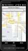
Metro helps you find your way in the public transport systems (subway, bus, trams, ...) in more than 400 cities around the world. FREE, FAST & ACCURATE. Simply enter you start and end stops, hit the "Go" button and the program finds the fastest route
MetrO (PPC 5.0) helps you find your way in the public transport systems (subway, bus, trams, ...) in more than 400 cities around the world. FREE, FAST & ACCURATE. Simply enter you start and end stops, hit the "Go" button and the program finds the fastest route
Metro helps you find your way in the public transport systems (subway, bus, trams, ...) in more than 4000 cities around the world. FREE, FAST & ACCURATE. Simply enter you start and end stops, hit the "Go" button and the program finds the fastest route
MetrO (PPC) helps you find your way in the public transport systems (subway, bus, trams, ...) in more than 4000 cities around the world. FREE, FAST & ACCURATE. Simply enter you start and end stops, hit the "Go" button and the program finds the fastest route
Metro Melbourne - Riding Melbourne's train system? Tired of having to carry around train timetable booklets in your pocket? Want to quickly find out arrival and departure time for any train in Melbourne? Metropolitan Melbourne has the answer for you.
Metropolitan Melbourne ("Metro Melbourne" for short) is an application for Windows Mobile phones
Metro finds your way in public transport systems in more than 350 cities around the world (Paris, New York, London, Tokyo, any city with a subway & many more!).
FREE, FAST & ACCURATE
Mobbyway - Based on both internet mobile technologies and GPS, Mobbyway allows you to know easily, at any time, your relatives’ exact position on a map if they have accepted it and if they are connected to the network.
Mobbyway is also a help on the road network with a local alert system of a dangerous zone which is carried out with the network of members
Mobile Altimeter -Altimeter for windows mobile devices. We have a background that symbolizes "altitude" which is appealing to end users. Plus it gives the program a lot of style and class
"Where I've been?" feature
Record track lines, points of interest(POI).
Different colors indicate different speed route.
Record text, picture and video style POI.
Record raw gps nmea data for reference and analysis.
Attach pictures to tags of geographical information