FlyBy Nav PPC - Flight planning is now as easy as tapping in your point of departure, arrival and winds!
In one screen, FlyBy Nav displays track, distance, ground speed, time enroute, ETA, and fuel burn.
Nearly all public airports and navigation aids in the U.S. are stored in its aviation database
FlyBy Nav Pro now creates multiple leg nav logs!
New: Purchase FlyBy Nav Pro PPC and receive FlyBy Nav Pro for Windows free!
Features:
Save up to 30 of your favorite routes with up to 11 waypoints per route.
Totally Flexible. Lets you change any navlog parameter on any leg or totals screen.
Stores up to 30 different aircraft
Sianix GPS Compass is an animated compass for your mobile device. It can show both realtime or simulated data if you want to test the application when inside a building. Displays onscreen data for heading, speed, altitude and acceleration in SI or Imperial units. The compass has three modes of operation, which can be switched easily using the Style button
Do you still use your GPS device for navigating only?
Turn your Pocket PC into a high precision metering machine using your GPS receiver! With MASPware GPSmeter you can measure short and long distances (beeline or routelength), altitude differences, timespans, average values and min-max-values using an internal or external GPS receiver
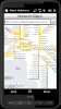
The Weather Channel - Weather can make or break your plans, whether it be business travel or a round of golf. With The Weather Channel for Windows Mobile, you'll have the latest weather information at your fingertips so you can plan more efficiently
Metro Melbourne - Riding Melbourne's train system? Tired of having to carry around train timetable booklets in your pocket? Want to quickly find out arrival and departure time for any train in Melbourne? Metropolitan Melbourne has the answer for you.
Metropolitan Melbourne ("Metro Melbourne" for short) is an application for Windows Mobile phones
European Travel Guides Collection - London, Paris, Rome, and many more- Indulge Yourself with a personal tour guide on Your PDA. Each Guide includes a phrasebook and is illustrated with maps and photographs. 25 guides for the price of 5. FREE General Information chapter, basic phrasebook, and map in each trial version
GPSed - Mapping Your Impressions
GPSed is a service for trip tracking from mobile. In real time tracks are traced on Google maps and stored in an online archive. With a simple geotagging feature it is possible to pin photos to a map precisely at a place they were taken

")