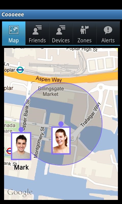
Tracker GPS - Find your friends and get directions to them. On-line tracking, detailed travel history Smart Energy Saving Auto restart after phone Panic Button
Like it? Share with your friends!
Supported operating systems:
Java ME, Java Nokia 240x320, Java SE 240x320
Similar Software:
GpsMid Midlands and Northern England GpsMid Midlands and Northern England is a free, fully offline, vector based map application for your mobile phone. It displays your current position on a zoomable map and can be used to search for and navigate to roads or points of interest of your liking
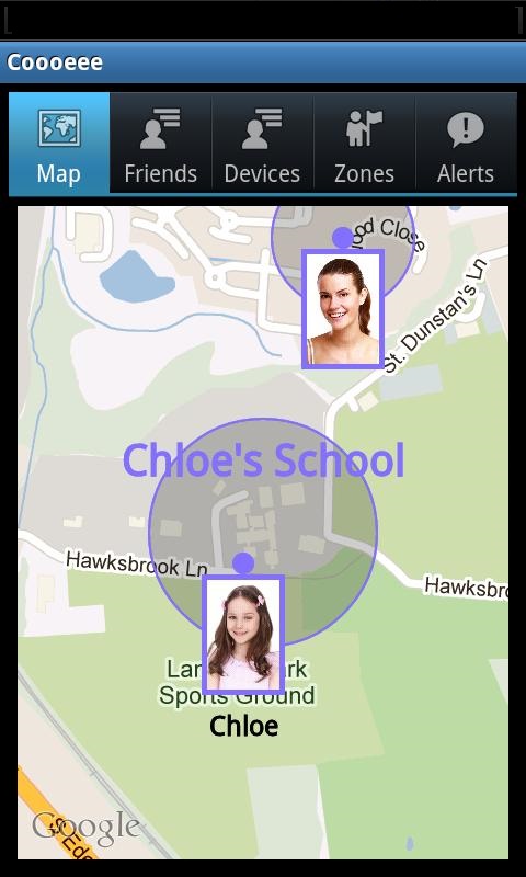
KidsLocator KidsLocator - Do you know where your children are? KidsLocator gives you peace of mind by letting you always know where your children are! KidsLocator is a mobile application using exceptionally reliable and intuitive technology to wirelessly keep track of your loved ones. The application's main features are: 1
FON Access Points for Turkey FON Access Points for Turkey - FON offers you a new Points of Interest service (POIs). This allows you to download FONspots directly to your navigation device.
What does that mean? You can download a Points of Interest file directly to your navigation device
new Phone Tracker The app allows you to track the location of others. Phone Tracker combines a full function GPS and Internet maps Features: Locate other users and learn about their movements during the previous 4 hours. You can allow or disallow other users to watch over you. GPS work in the background saves battery power
Maptales Mobile Maptales Mobile is a Java-based application for mobile devices that allows you to track your routes, add posts and tags and directly upload everything to Maptales.
Maptales Mobile has been created with ease of use in mind and provides a simple, straightforward interface for mobile storytelling
FON Access Points for Dominican Republic FON Access Points for Dominican Republic - FON offers you a new Points of Interest service (POIs). This allows you to download FONspots directly to your navigation device.
What does that mean? You can download a Points of Interest file directly to your navigation device
Nulaz (Nokia) Nulaz is a simple application for mobile phones and the Internet that enables you to see each others' location:
Know where you are, where your friends are and send them messages for free!
With Nulaz, friends can find each other in a crowded place, a mother can keep an eye on her kids, and you can see where all your friends are when you go clubbing
FON Access Points for India FON Access Points for India - FON offers you a new Points of Interest service (POIs). This allows you to download FONspots directly to your navigation device.
What does that mean? You can download a Points of Interest file directly to your navigation device
Nulaz (LG) Nulaz is a simple application for mobile devices and the Internet that enables you to see each others' location:
Know where you are, where your friends are and send them messages for free!
With Nulaz, friends can find each other in a crowded place, a mother can keep an eye on her kids, and you can see where all your friends are when you go clubbing
Comments on Tracker GPS:
Comments not found
If you noted an error or download link is broken, please, report it via this page or use comments.
Please, select device to check if Tracker GPS supports it


")

")