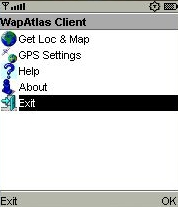
WapAtlas Client is a location aware Java application which runs on many mobile phones which have built in GPS. It uses the phone's GPS capabilities and the phone's WAP browser to quickly and easily open maps showing the current location.
It works in the following way:
* WapAtlas client uses the phone's GPS receiver to determine the current location
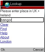
* It then uses phone's browser to open the WapAtlas.mobi web site, passing the latitude, longitude and other parameters to the site opening a map centered on the current location
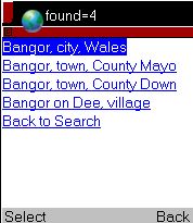
* WapAtlas client then closes automatically and control passes to the browser allowing the user to pan, zoom and search for another location
WapAtlas client does not contain any geographic data and as a result has a small footprint on the phone.
Like it? Share with your friends!
Requirements:· MIDP 2.0, CLDC 1.1
· Java Location API 1.0.1
Supported operating systems:
Java ME, Java Nokia 240x320, Java SE 240x320
Similar Software:
FON Access Points for Taiwan FON Access Points for Taiwan - FON offers you a new Points of Interest service (POIs). This allows you to download FONspots directly to your navigation device.
What does that mean? You can download a Points of Interest file directly to your navigation device
Nulaz (Samsung) Nulaz is a simple application for mobile devices and the Internet that enables you to see each others' location:
Know where you are, where your friends are and send them messages for free!
With Nulaz, friends can find each other in a crowded place, a mother can keep an eye on her kids, and you can see where all your friends are when you go clubbing
FON Access Points for Jamaica FON Access Points for Jamaica - FON offers you a new Points of Interest service (POIs). This allows you to download FONspots directly to your navigation device.
What does that mean? You can download a Points of Interest file directly to your navigation device
FON Access Points for Maldives FON Access Points for Maldives - FON offers you a new Points of Interest service (POIs). This allows you to download FONspots directly to your navigation device.
What does that mean? You can download a Points of Interest file directly to your navigation device
GPS Watch - Plus GPS Watch - Plus - GPS Watch is a powerful yet simple J2ME application that transforms your Mobile Phone and Bluetooth GPS into a professional Global Position Tracking System. GPS Watch integrates with www.trackut
TwitterGPS TwitterGPS is a location-aware Twitter client which runs on GPS-enabled devices.
TwitterGPS enables Twitter users to exchange twitter messages (tweets) which contain information about their locations and then view these on maps - either on the phone or on a PC browser.
This Java MIDlet is easy to download, install and use
FON Access Points for Andorra FON Access Points for Andorra - FON offers you a new Points of Interest service (POIs). This allows you to download FONspots directly to your navigation device.
What does that mean? You can download a Points of Interest file directly to your navigation device
GpsMid Seychelles GpsMid is a free, fully offline, vector based map application for your mobile phone. It displays your current position on a zoomable map and can be used to search for and navigate to roads or points of interest of your liking. As all data is stored in a compact binary format on your mobile phone you will incur no charges for extra data downloads
Redpin The aim of the Redpin project is to create an open source system that allows indoor positioning up to room-level description using mobile phones
Other Software by developer «Caversham Telecom»:
TwitterGPS TwitterGPS is a location-aware Twitter client which runs on GPS-enabled devices.
TwitterGPS enables Twitter users to exchange twitter messages (tweets) which contain information about their locations and then view these on maps - either on the phone or on a PC browser.
This Java MIDlet is easy to download, install and use


")


