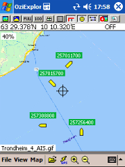
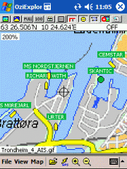
AIS2OZI - AIS2OZI tracks ship positions. It is a logger/decoder/plotter for PocketPC.
Ship positions are plotted directly in OziExplorer Download AIS2OZI (Make backup of Shiplist.txt when reinstalling.)
Decodes AIVDM sentences of types 1, 2, 3 and 5, i.e. position reports for class A shipborne equipment plus vessel information.
Like it? Share with your friends!
If you got an error while installing Themes, Software or Games, please, read FAQ.
Supported operating systems:
Windows Mobile 5.0, Windows Mobile 6 Classic, Windows Mobile 6 Professional, Windows Mobile 6.1 Classic, Windows Mobile 6.1 Professional, Windows Mobile 6.5 Professional
Similar Software:
GPS Tuner Essentials Full Version with Italy and Malta Basic Map Content GPS Tuner Essentials Full Version with Italy and Malta Basic Map Content is designed specifically for off-road use: its large buttons, selectable tool window size, multiple Compass views and the built-in Tele Atlas map makes it extremely user-friendly and reliable
Navigation BE-ON-ROAD USA Q2/2011 Navigation BE-ON-ROAD USA Q2/2011 - The new major version of be-on-road presents new features and is based on new platform which brings high level of reliability, portability and speed on almost any kind of device. The new be-on-road brings high value voice guided door-to-door navigation
PoliceGPSes PoliceGPSes - PoliceGPSes can be used to track suspects that you are using the PocketPC PoliceGPSer's locator on. You can make a file for each group of locators and view the current latitude/longitude/speed and altitude of each GPS locator on the Google.com maps site.
This program requires that you have both the 'BeanDLL
GPSWM65Voice GPSWM65Voice creates GPS stamped wave files and displays them in an easy to use explorer interface. When you get a GPS lock, the app will display the wave files in order of distance to your current location. To re-play the wave file simply tap on it. The map service is provided by Google
HandGPS HandGPS is provided for use with Windows PPC only. All versions of windows PPC are supported. Users are prompted to register product before use. License is valid for two years and may be extended. HandGPS is used to capture GPS coordinates to any open windows PPC application
FON Access Points for Afghanistan FON Access Points for Afghanistan - FON offers you a new Points of Interest service (POIs). This allows you to download FONspots directly to your navigation device.
What does that mean? You can download a Points of Interest file directly to your navigation device
DocumentGPSer DocumentGPSer - DocumentGPSer allows you to make Pocket Word files and attaches a GPS tag to the end of the file. You can also view the notes via GPS distance from your current GPS using "The Vincenty inverse formula for ellipsoids." (accuracy to within 0.5mm, or 0.000015")
This program requires that you have both the 'BeanDLL
FON Access Points for Equatorial Guinea FON Access Points for Equatorial Guinea - FON offers you a new Points of Interest service (POIs). This allows you to download FONspots directly to your navigation device.
What does that mean? You can download a Points of Interest file directly to your navigation device
GPSInfo GPSInfo is a simple tool for displaying all the data from your Windows Phone 7 GPS receiver. It allows you to see: actual coordinates (Latitude and Longtitude), GPS date and time, speed, current course (relative to North), horizontal and vertical accuracy