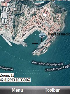
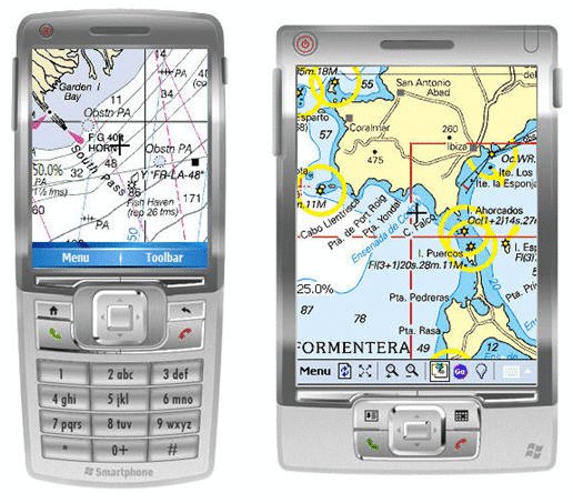
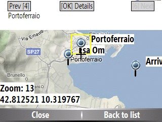
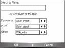
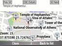
Bluemapia Mobile - View Maps, Search places and geotagged Wikipedia articles, GPS. Mobile Application for bluemapia, the new Web & Mobile Social Mapping for Boaters
- View Maps (OpenStreetMap and other web map servers)
- Support BSB/NOAA Charts and raster, calibrated charts
- Search places by name and bluemapia content from the web site
- View geotagged Wikipedia articles on the map
- Use a GPS to display your position on the map and set a terget destination
- Create tracks (gpx file)
- Shoot and upload photos and text to bluemapia for community sharing
Like it? Share with your friends!
If you got an error while installing Themes, Software or Games, please, read FAQ.
Supported operating systems:
Windows Mobile 2003, Windows Mobile 5.0, Windows Mobile 6 Classic, Windows Mobile 6 Professional, Windows Mobile 6.1 Classic, Windows Mobile 6.1 Professional, Windows Mobile 6.5 Professional
Similar Software:
Find My Car Find My Car - Did you ever park your car and not remember where it was parked? It can be hard to find your car again in this situation. With this application it allows navigate from your current location to your car. It is also possible to store the parking ticket expiry time with a countdown
SIGLOG SIGLOG - A Windows Mobile application that logs latitude, longitude, signal strength, mobile country code, mobile network code, location area code, CellID.
Written in Win32 C++ it's lean, mean, rather basic, but it does the job. It requires a phone with GPS, as it calls the Microsoft intermediate GPS driver
FON Access Points for El Salvador FON Access Points for El Salvador - FON offers you a new Points of Interest service (POIs). This allows you to download FONspots directly to your navigation device.
What does that mean? You can download a Points of Interest file directly to your navigation device
HandGPS HandGPS is provided for use with Windows PPC only. All versions of windows PPC are supported. Users are prompted to register product before use. License is valid for two years and may be extended. HandGPS is used to capture GPS coordinates to any open windows PPC application
TravelCompasses TravelCompasses - TravelCompasses uses the GPS on your PocketPC to find a "Home" position. Then the program displays a compass that rotates to your current GPS. The program also displays your current compass degrees.
This program requires that you have both the 'BeanDLL.dll' file ** and ** the runtime files for Visual Basic on your PocketPC computer
TrekBuddy Trekbuddy is a J2ME application to be used with a GPS receiver. It is designed to work with every Java-enabled device. It features capabilities such as: * GPS tracking and simple navigation * bitmap maps (without zoom, you can store bitmap maps with different resolution instead)
GPS Tracker Lite GPS Tracker Lite is an application that tracks your route while you move (walk, run, drive) and shows two main things: statistics of the route, and a map
PathAway GPS SE PathAway GPS SE - GPS Navigation using your own maps! Convert any digital map, for use on your Pocket PC. Then, attach a compatible GPS (via bluetooth, cable, snap-on, or card) to your handheld, and you have a powerful GPS Moving Map navigation system
StoreGoogler StoreGoogler uses the GPS on your PocketPC to find the 50 closest local business from 2,238 type of Yellow Pages entry sorted via GPS distance. Tap the button to start the GPS and when you get a lock tap on it to view the list of local businesses. The GPS maps and business search service is provided by Google
Other Software by developer «Bluemapia»:
not found
Comments on Bluemapia Mobile:
Comments not found
If you noted an error or download link is broken, please, report it via this page or use comments.
Please, select device to check if Bluemapia Mobile supports it