Map of South Africa - A map of South Africa, divided into 9 smaller territories for the ease of use.
NORTHERN
NORTH WEST
GAUTENG
MPUMALANGA
FREE STATE
KWAZULU-NATAL
EASTERN CAPE
NORTHERN CAPE
WESTERN CAPE
Good for intercity travels with SmartMap
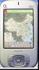
Map of Philippines - A map of Philippines. Good for intercity travels with SmartMap.
Layers include:
Towns
Settlements
Airports
Roads
Railroads
Rivers
Inland water
Administrative borders
International borders
Trees
Map scale is 1:1 million.
Good for use with any version of SmartMap
Tube London (2009 Edition) - Tube London
The ideal map for the traveller who needs to get around London using the underground system and would like to know just exactly where they are.
The map geographically locates all the central stations, making it much more informative than the official topological map
Map of Serbia - A map of Serbia good for intercity travels with SmartMap.
Layers include:
Towns
Settlements
Airports
Roads
Railroads
Rivers
Inland water
Administrative borders
International borders
Trees
Map scale is 1:1 million.
Good for use with any version of SmartMap. SmartMap can be purchased here
Map of Texas (US State) - A map of the Texas by VITO Technology. Good for intercity travels with SmartMap.
SmartMap is a mobile device application which uses vector and raster maps. It is compatible with any NMEA protocol GPS receiver (Compact Flash socket, serial port, BlueTooth or sleeve)
Map of Sweden - Set of 2 maps of Sweden accompanied by a short text description.
SWEDEN (NORTH)
SWEDEN (SOUTH)
Good for intercity travels with SmartMap
Menue
Pocket World gives you the whole world in your pocket. At any time, one click will bring you 133 facts from each of 272 countries. Facts such as currency, population growth, life expectancy, inflation rate, rate of exchange, international relations, political personalities, and more
Rough Guides Map Paris... These guides are a series of fantastic interactive maps.
Produced in conjunction with the premier travel publisher Rough Guides.
Discover and explore Paris using full colour interactive linked maps, in this simple to use PDA version of The Rough Guides Paris
Tube London City Streets
This Tube package consists of a fully scrollable detailed map of the London Underground system and 9 linked GPS enabled A-Z street maps.
Plan journeys on the London Underground system, list details of the quickest routes and see a superb animated display of your journey tracking around the system map