FlashWeather
is the perfect weather tool in your pocket: it's easy to use and with attractive animated graphics and the latest high-quality forecasts and observations it's the last weather application you're going to need. Using the Adobe's Flash Lite technology for mobile phones FlashWeather delivers loads of weather data packed to modest file sizes
With Nokia Location Tagger, you can automatically tag your location data to your pictures. As you take a picture, your GPS coordinates are saved to the EXIF header of the JPEG file. You can use this data later, for example, to locate your pictures on a map.
In the near future, we hope to make location tagging a seamlessly integrated part of your Nokia experience
Here and now - offers easy-to-use web services related to your current location. Check the local weather at a glance and get other topical information while on the move.
After installation, you can access Here and now directly from your web browser.
The initial release contains two services: the local weather and the local events - and there is more to come
Free text multi-language translator, Currency (online updates), World Clock & Map (550+ cities) & Sun Compass, Tip split, Unit/dress convertor, Pack List
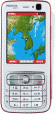
META friend locatorr is an online mobile map application with social features. META generates 5-10 times less data traffic than e.g. Google Maps - making it well suited for travelling. You get maps covering most of the world, GPS support and millions of user provided point-of-interest like restaurants and cafes
Altimeter Touch - Turn your Nokia Touch device into an analogue altimeter and check your altitude above sea level wherever you are. The altimeter displays altitude in 1 metre steps using the built-in GPS
Wayfinder Earth (S60 3rd Edition) - The world in your hand! Welcome to the ultimate experience of discovering the earth on your mobile phone, for free.
How does it all work?
It's simple. Wayfinder Earth presents you with a 3D globe representing the planet earth, visible on the display of your mobile phone
Symarctic ExtGPS allows you to use your phone's built-in GPS module externally on laptop via Bluetooth. It is mainly targeted for Nokia N95, E90, 6110 Navigator handsets, allowing you to use existing, more sophisticated GIS applications
AnchorAlert checks how far your vessel has drifted from its anchor point and sounds an alarm when the value exceeds the specified distance.
USAGE
Start the application, that will automatically connect to the predefined GPS (see Settings). You will see your latitude/longitude on the
main screen after GPS has a fix position
Hotel Park mX guide - Discover Hotel Park and city of Split, Dalmatia with mX guide! Practical, attractive and user-friendly, this guide shows everything that hotel and the city have to offer, in a palm of your hand