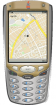
GPSbySMS (Java) - GPSbySMS reads data from the GPS receiver and sends it to the http://gps.ndd.ru site, or to other users using SMS messages. You can see your position on Yahoo Map. Auto send Mode available now.
Tested on: Sony Ericsson K6xx, K7xx, K8xx, W8xx series and Nokia 6151, 6288, 6300i
BuddyLocator - Locate your friends with your mobile phone! Using BuddyLocator you can see what your friends are up to. You can locate both them and yourself on the map. And you can see their status just like on any messenger.
What's New in This Release:
· Changed to special version of J2MEMap version 0.9.42
WPAverager - WPAverager helps you to create more exact landmarks / waypoints with your mobile device.
You just set how many coordinates it should record and how many of the best ones should be used to average the final location. Then you can save it to the landmarks store. That's it.
You should experiment with the values to get the best results
Wayfinder Active (Java) is a free GPS service for mobile phones with a unique combination of maps, GPS recording and statistics, all designed for active people. With this service on your mobile, you get access to a world wide map and terrain maps for selected countries.
You record your route or training trail with just a click
Maptales Mobile is a Java-based application for mobile devices that allows you to track your routes, add posts and tags and directly upload everything to Maptales.
Maptales Mobile has been created with ease of use in mind and provides a simple, straightforward interface for mobile storytelling
GPS/J is a console for Bluetooth-enabled GPS receivers. Version 2.7 released (trial available): PORTAL, GPS information screen, maps (POI databases) of the whole world, track&waypoint EXPORT/IMPORT, a compass with pointer and raster maps
GPS/J Lite is a console for Bluetooth-enabled GPS receivers. Version 2.7 released (trial available): PORTAL, GPS information screen, track&waypoint EXPORT/IMPORT, a compass with pointer and map displaying current position and track
navigami - A free noncommercial offline navigation for geocaching, tracking and other outdoor activities. It runs on common java mobile phones. Navigami uses offline vector maps from free public sources. Maps can be downloaded and stored in the phone