navigami - A free noncommercial offline navigation for geocaching, tracking and other outdoor activities. It runs on common java mobile phones. Navigami uses offline vector maps from free public sources. Maps can be downloaded and stored in the phone
Guidebee Map - For commerical version, please visit Nokia Ovi store find "Guidebee Navigator" under city guides & maps. Mobile Map, GPS Compass, MSN Messenger, IP Search, Find address, Get Direction download link http://www.guidebee.biz/forum/viewthread
GPSed: Track and Map your trips -
GPSed - Mapping Your Impressions
GPSed is a location-based service for trip tracking from mobile. In real time tracks are traced on Google maps and stored in an online archive. With a simple geotagging feature it is possible to pin photos to a map precisely at a place they were taken
HotSpot Navigator -Navigation software for your J2ME-enabled mobile phone with OpenStreetMap - based maps. It can connect to an internal GPS receiver to acquire current position and navigate to one of known hot spot from FON WiFi spots or from internal database. While navigation HotSpot Navigator shows map, current position, speed, course, and distance to landmark
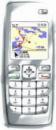
GpsMid is a free, fully offline, vector based map application for your mobile phone. It displays your current position on a zoomable map and can be used to search for and navigate to roads or points of interest of your liking. As all data is stored in a compact binary format on your mobile phone you will incur no charges for extra data downloads
GpsMid is a free, fully offline, vector based map application for your mobile phone. It displays your current position on a zoomable map and can be used to search for and navigate to roads or points of interest of your liking. As all data is stored in a compact binary format on your mobile phone you will incur no charges for extra data downloads
Moving GPS Map / InFlight - A Moving GPS Map and 3D GPS Logger for your handheld. It can use either an internal GPS (such as in the Nokia N95 or E90) or connect to an external Bluetooth GPS receiver or the HGE-100 from SonyEricsson. One can draw own vector-maps and -paths in Google-Earth and export them to the device. 3D GPS logs can be exported and viewed in Google-Earth